


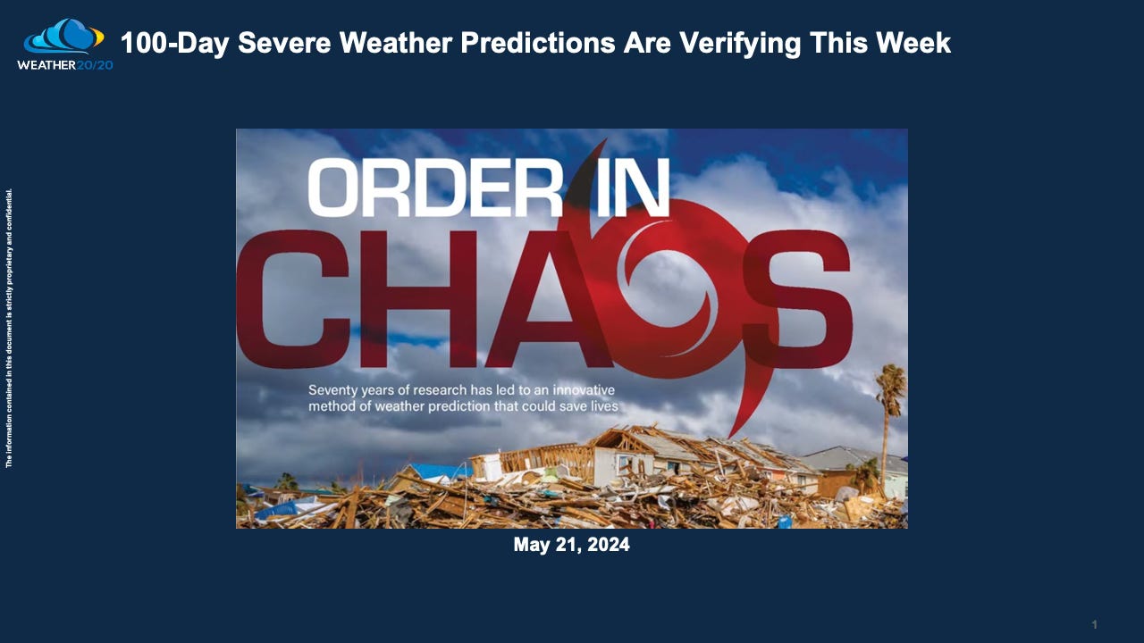
100-Day Severe Weather Predictions Are Verifying This Week
A wetter than average weather pattern will continue for the next month

Today, May 21, 2024, we find ourselves in the midst of significant severe weather activity—a scenario we had pinpointed as one of the most active severe weather risk periods over 100 days ago. In this edition, not only will we get into the specifics of this forecast's verification, but we'll also explore the accuracy and implications of our long-range predictions. As we review these predictions, we will extend our outlooks further into the future, providing insights and forecasts through next September. As you read through this and watch the video, we will uncover the patterns that continue to validate the revolutionary capabilities of the LRC, proving once again that advanced notice is not just possible—it's remarkably precise.
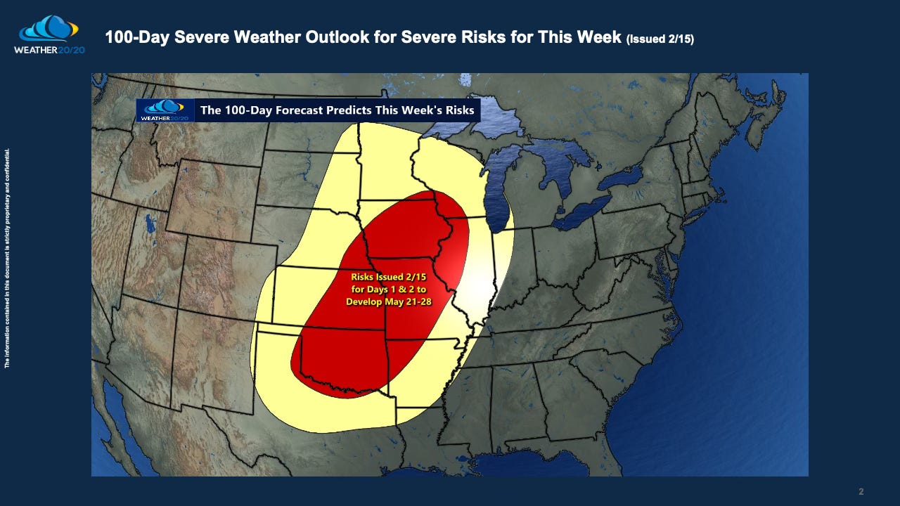
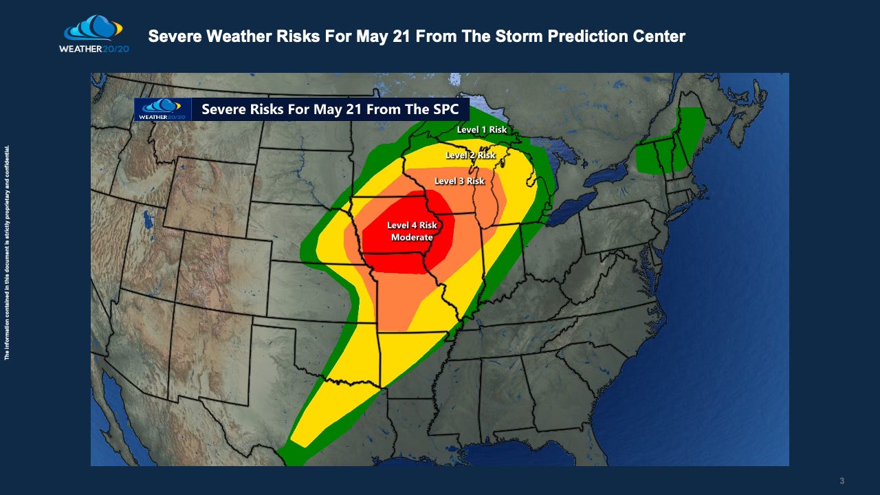
This slide above presents the forecast that Weather 20/20 issued nearly 100 days prior to this week. Below, we compare our 100-day risk assessment to the 1-day risk forecast by the Storm Prediction Center for May 21, 2024:
As you review the images, notice the remarkable similarity between the two predictions. Our long-range forecast, developed through the meticulous analysis of the LRC, not only anticipated the severity of the weather but also closely matched the areas highlighted by the SPC as a moderate, level 4 risk — all this nearly three months in advance. This comparison not only underscores the reliability of our forecasting method but also showcases its invaluable role in long-term planning and risk management.
The robust analysis of previous cycles from this year’s weather pattern, combined with a deep understanding of the Lezak Recurring Cycle (LRC), provides the foundation for these remarkably accurate predictions. For the second consecutive year, we have achieved nearly 90% accuracy in forecasting severe weather events weeks to months in advance.
Even in instances where our forecasts may initially appear off-mark, further scrutiny often reaffirms the reliability of the LRC. A case in point is last week's billion-dollar disaster in the Houston, TX region. Although our initial assessment did not specifically target Houston, a review of the first cycle of the LRC indicated potential severe weather risks for Texas that aligned with the events of last week. This retrospective analysis demonstrates the predictive power of the LRC, which continuously enhances our forecasting capabilities. We continue to learn with each year’s pattern.
In today's video, we conclude with a quick demonstration of the Weather 20/20 Vision Dashboard as we extend our forecasts through September. This tool not only visualizes our forecasts in a dynamic and user-friendly format but also provides actionable insights that are essential for preparing and responding to weather risks that may affect your farm or business. And, then we will finish this report with an outlook for the next 15-days.