


A Deep Dive into Arctic Air Trends via LRC Predictions
Cold Air Is About To Blast South

Welcome to the Weather 20/20 Intelligence Report:

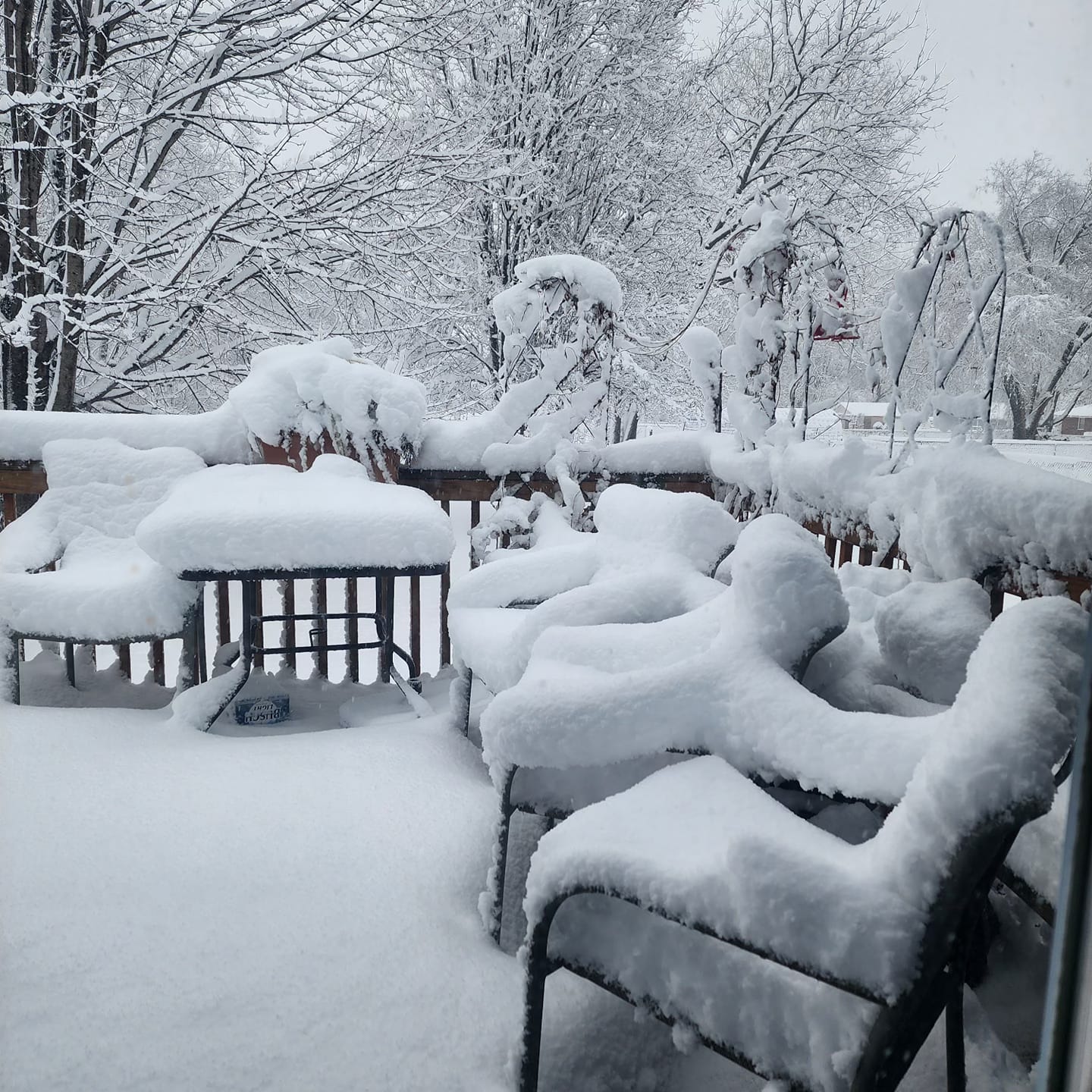
Kansas City awakened in the throes of its second significant winter weather event of the season. The initial occurrence materialized shortly after Thanksgiving, and then by applying the LRC methodology to a month ahead forecast, it foresaw the resurgence of this specific weather pattern. True to form, the pattern has resurfaced as anticipated, delivering the verification of a prediction made over a month ago. We'll unravel the details behind this accurate prediction, shedding light on how it proves beneficial for businesses with its long-range insights. Additionally, we'll take a sneak peek into the LRC model's predictions, stretching all the way through September.
Weather 20/20 customers have asked for a week-by-week prediction of what will happen during the winter snow season. We have been providing these forecasts with increasing accuracy over the past few years. Look at this forecast made a month ago and shared with our partners/customers:
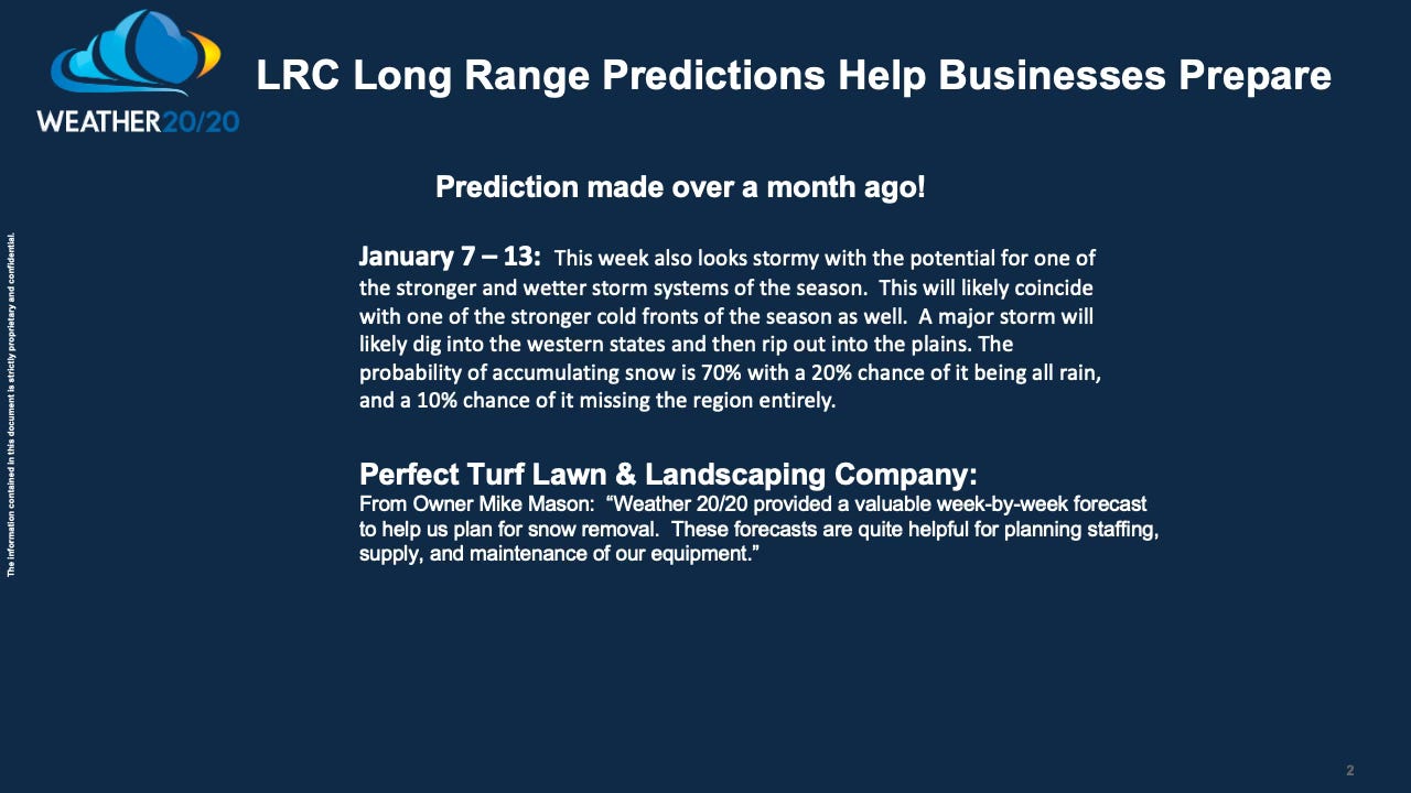
The owner of Perfect Turf Lawn & Landscaping is a tough grader. Last week he gave the LRC an A+. Now, this forecast above is this week, so I am hoping for a second A+ grade. Let’s dive into a little bit of the “how did they do that” concept using the LRC.
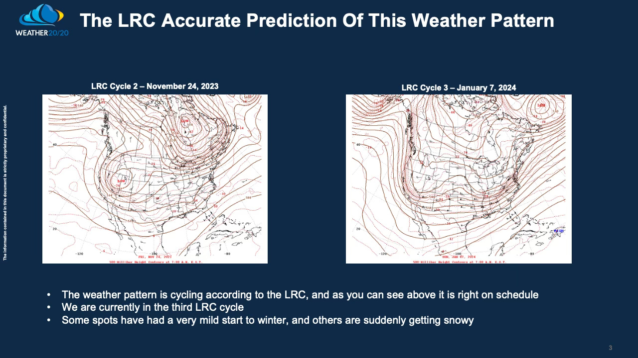
In the images provided above, you can see the weather patterns on November 24, 2023, and 44 days later on January 7, 2024. Notably, these patterns exhibit a striking resemblance. What's particularly noteworthy is that after experiencing the weather pattern in November, we had the foresight to prepare a forecast for the recurrence of this pattern in the current timeframe. In November, this cycle yielded 3-4 inches of snow in Kansas City. However, this time around, it has produced a substantial 4 to 10 inches.
Now, consider this intriguing concept: As the traditional computer models typically release their forecasts ten to fifteen days before a major storm, we gain valuable insights into when these models are accurate and when they fall short. This is done by “knowing” what the weather pattern is more likely to look like. As the storm approached within one day of its onset, these models consistently indicated a northward trajectory, contrary to what the LRC methodology was suggesting—a more southerly path. It was only in the final hours before the snowfall that the computer models abruptly and decisively shifted to a southern track. In response, Weather 20/20 made a swift adjustment, realigning the snowfall forecast to focus on the Kansas City region. I was telling our clients, “patience, I am still expecting the southern track”.
For a more detailed explanation, I encourage you to watch today's video, where I provide additional map-to-map comparisons and insights into what lies ahead, as another storm aligns precisely with our schedule. In the video's conclusion, I delve into the state-by-state LRC model predictions, extending from now through September.