
A Fascinating Mid-May Weather Pattern
How much rain is forecast in the next 15-days

Welcome To The Weather 20/20 Intelligence Report!
Good morning, this weather pattern is cycling right on schedule, and we will all experience moving into the 4th cycle of this very long 11-week cycle in the 2025-2026 season.
The benefits for fireworks companies — of which a few already use Weather 20/20 — are knowing where drought restrictions may develop as we approach July 4th, and much more as we move through each year. The benefits for those of you in agriculture are in planting timing, which type of seed to use, when to spray, how to plan for weather disruptions, and the advantages for other weather-sensitive industries are enormous. We are building something important that the world needs and already uses, and we appreciate all of you for being premium members.
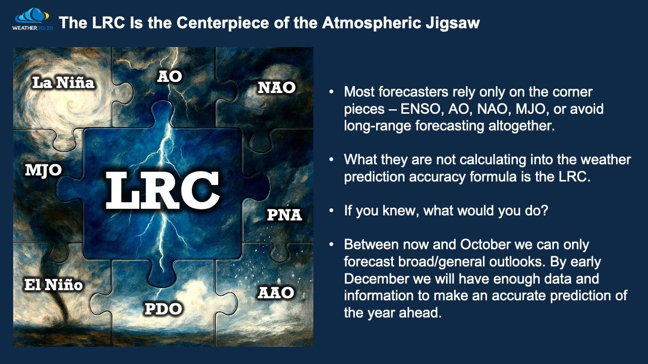
Weather 20/20 is in the process of improving the patent-pending LRC system, and we are glad you are along for the ride.
Speaking of rides, I am heading out on a trip of a lifetime road trip, and I am calling it Rainbow & Sunny’s Great Adventure - heading to California and back with the dogs experiencing life along the way with our first stop in Moab, UT later today. You can follow along on social media.
Let’s get started with today’s report.
A fascinating weather pattern continues to impact the world. The weather pattern across the Northern Hemisphere sets up every fall, a cycle develops, and then that pattern cycles regularly through the rest of fall, repeating through winter, spring, and summer before the entire process begins again the next fall. Every year is unique!
Right now, we are in the third cycle, and the areas receiving the most rain continue to get hit, while areas facing growing drought consistently get missed. May is often one of the wettest months in many areas east of the Rocky Mountains, making this current pattern especially important as rainfall trends, drought zones, and severe weather risks continue to evolve.
This is where pattern recognition becomes critical. Are current wet zones likely to stay wet? Will drought areas continue to miss out? And how may this evolving cycle shape the weeks ahead?
Let’s take a look at the trends — and a look ahead — in our Weather 20/20 Vision Dashboard.
Let’s begin with the latest El Niño update:
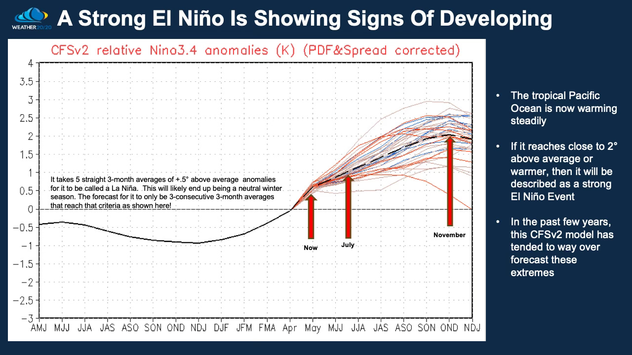
It will officially be classified as an El Niño event once we reach five consecutive 3-month averages of +0.5°C or higher over the tropical Pacific Ocean. The trend is moving strongly in that direction, and at this time it appears increasingly likely that this will evolve into a strong El Niño event.
El Niño is one important piece of the puzzle — but it is only one piece. While El Niño can help signal broader global tendencies, it does not determine specific regional outcomes on its own.
When we get to next fall, that is when the bigger picture begins to come into focus. As the new weather pattern sets up and the LRC develops, we will gain much greater insight into which specific regions are most likely to experience the strongest impacts — whether that means increased storminess, drought risk, colder patterns, or amplified heat.
In other words: El Niño helps set the stage, but the LRC helps reveal how the play unfolds.
These next two charts highlight the continuing trend in drought conditions across the lower 48 states.
The big story: Areas already receiving consistent storm tracks and rainfall continue to benefit, while many drought-stricken regions are still being missed. This pattern is not random — it reflects how the larger atmospheric cycle continues to favor certain corridors while bypassing others.
As we move deeper into this current cycle, the contrast is becoming more pronounced. Some regions are seeing meaningful drought relief, while others are watching deficits worsen as critical spring rainfall opportunities pass by.
This matters tremendously in May, one of the most important moisture months for large portions of the Plains, Midwest, and areas east of the Rockies. Where the rain falls now — and where it doesn’t — can shape agriculture, water supply, wildfire risk, and summer stress in the months ahead.
Watch these trends carefully: Persistent wet zones often continue to receive opportunities, while expanding drought areas can signal that the broader pattern is still working against meaningful recovery.