


A Look At What Just Happened & What Is Right On Schedule
The weather pattern is cycling right on schedule

Welcome to the Weather 20/20 Intelligence Report.
As we quietly transition into the sixth cycle of this year’s LRC, the atmosphere continues to follow its blueprint almost perfectly — and we are sharing this big scientific secret with all of you.
In today’s report, we’ll start by reviewing the impactful events of the past week and then take a forward-looking view using the LRC model — including an exclusive video showcasing the LRC model for a few states in a live forecast, and we will even look all the way into next January. Yes, the new LRC will be setting up in October, but it will be fun to look that far ahead using the patent pending model.
Let’s get started with a look at how the latest series of storm systems has been distributing precipitation.
Rainfall During The Past Week:
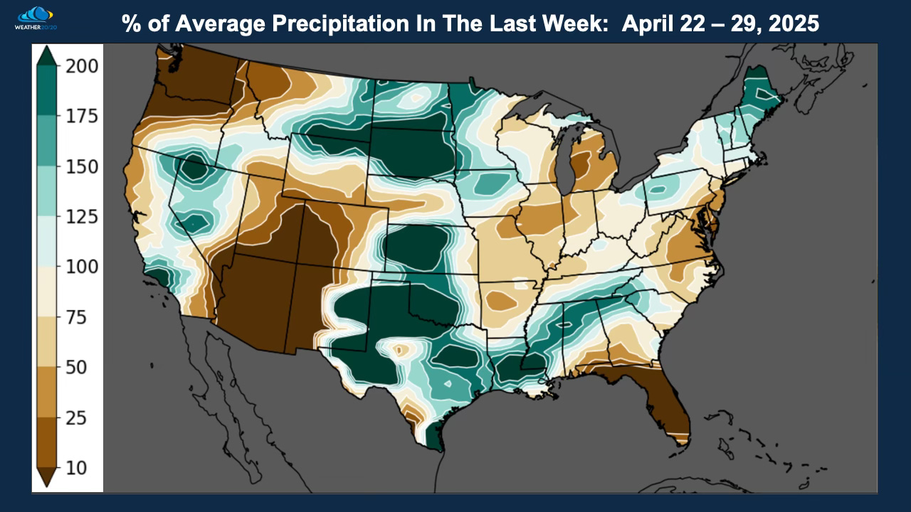
We begin by looking at what just happened in the 8-days from April 22-29, although the full rainfall data is not in this map yet. There was a very heavy rain event with tornado warnings, high winds, and hail across parts of Oklahoma and southern Missouri this morning.
Areas that have been drier than average in this years pattern got a pretty good drink of water across South Dakota, southern and eastern North Dakota, and from Kansas south into a very wet spot over Oklahoma and Texas.