


A Look Into March As The Pattern Continues To Cycle
This latest Arctic Blast will fade with a big warm up next week


This wild winter ride continues with a big warm-up and retreat of the Arctic air in the forecast. Welcome to the Weather 20/20 Intelligence Report. We will share an outlook for March and what is forecast next in this wild cycling weather pattern.
I would like to begin today with a showcase of something that we predicted would happen around February 18th and it did. In November, on November 30th, a rare early snowstorm targeted Kansas City and Jeff Penner and I called it “The needle in the haystack” part of the LRC. It returned and produced again in January, right on schedule, and then last night it returned again. Take a look at the Tweet with a reader image from Radarscope that I posted on November 30, 2024, and then another image snapped from last night’s radar as something “the same, but different”, as Gary England famously said 15 years ago.
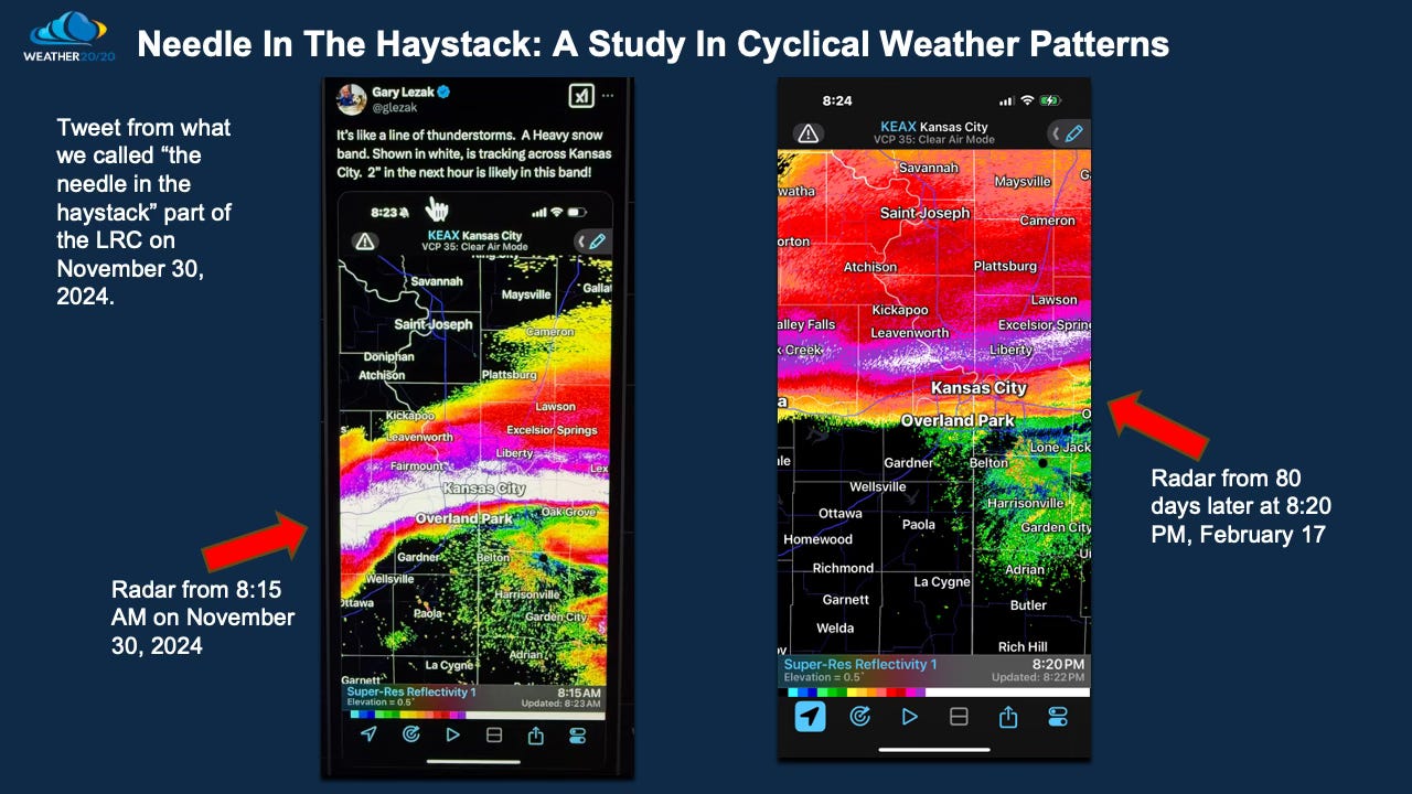
Let’s zoom in and take a closer look:
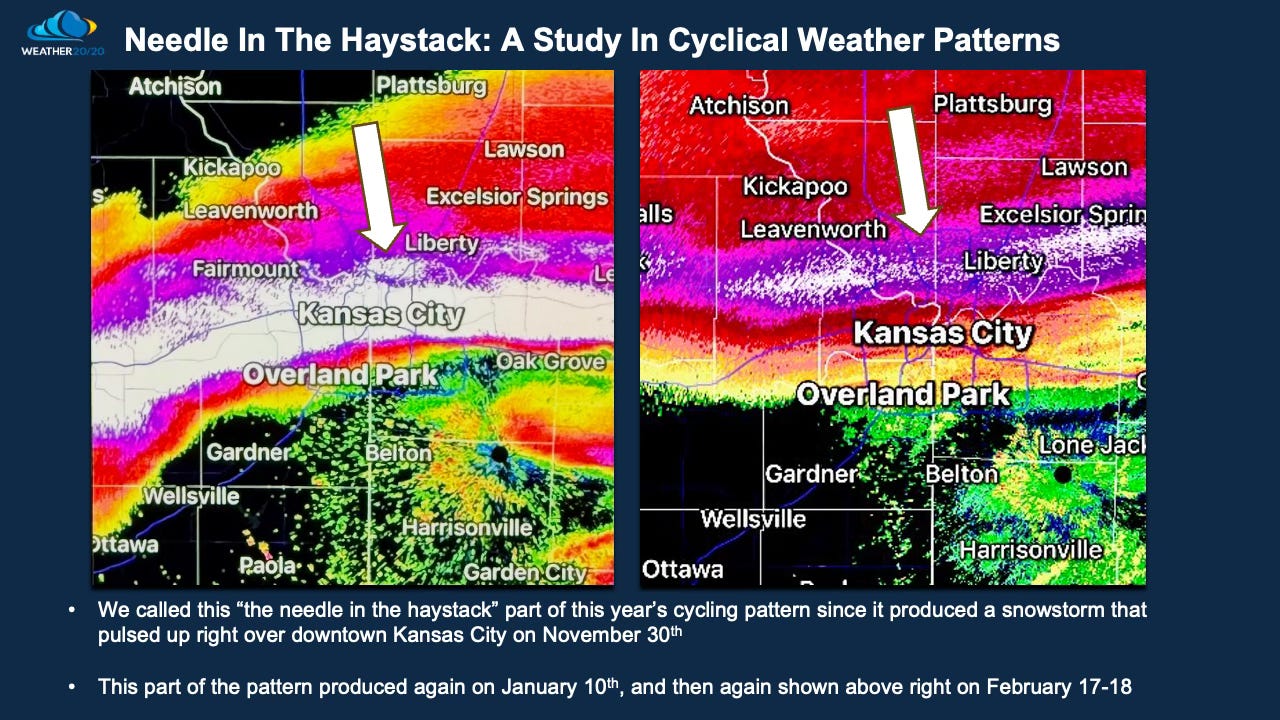
In the November cycle the band of snow was quite heavy right along I-70 and 3-5 inches of snow fell, and then on the image on the right, last night with Arctic air in place, the snow was also heavy, but a lot fluffier and drier. This is another one of those, “you can’t make this up”.
This storm is right on schedule, and this Arctic blast is powerful. Record lows will likely get shattered in many cities the next two morning.
What happens next should also be no shock. This slide below shows the 294 hour forecast, or 12 to 13 days from now: