A Massive Change Will Likely Lead Us Into A Wet Pattern In Spots
Severe weather risks, flooding, and wind will impact many areas


Welcome to this week's edition of the Weather 20/20 Intelligence Report. As we navigate through the early days of autumn, we're beginning to see the initial impacts of the evolving cycling weather pattern for 2024-2025. This unique pattern, which starts to take shape each year between early October and November, will establish a cycle that repeats through the coming year, giving us predictable and actionable insights into future weather conditions. For those of you with the Weather 20/20 Vision Dashboard that is in your forecasting tool chest, just know it will be updated in three weeks or so and then you can begin your planning for the year ahead.
In today's report, we'll dive deeper into how this year's pattern is forming and begin a discussion as to what it will mean in your location. We'll explore the potential for significant weather events and how these early pattern formations can guide our long-range forecasts. This is a critical time for understanding the foundational elements of the LRC, as these early weeks are when the pattern sets the stage for the weather we can expect until it resets again next year.
In this next week, as this massive change continues right above us, we are likely to see heavy snow in the ski areas, and potential flooding rains out over the plains.
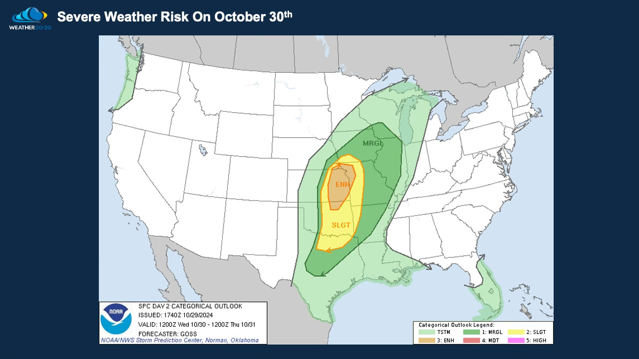
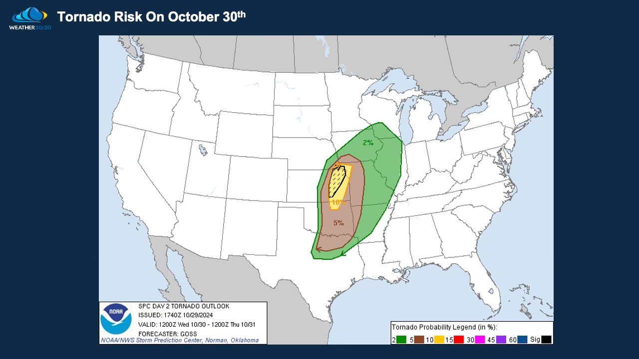
Let’s begin with a storm that is forming right now and already impacting the plains into the Great Lakes states with a high wind event. By Wednesday this lead storm will be sweeping across the plains with a severe weather risk, including a risk for tornadoes: