


A Powerful Storm Forms This Week
We are going to do a weather forecasting test in the next two reports


Welcome to the Weather 20/20 Intelligence Report!
As we brace for another major storm set to develop later this week, which we will explore in-depth, I want to extend a warm welcome to all our new premium customers. It’s thrilling to share with you what we affectionately call our "weather secret," providing you a significant advantage in planning your weather-sensitive activities.
This week, we also celebrate a standout testimonial from one of our valued winter clients, Mike Mason, owner of Perfect Turf Lawn & Landscaping. Mike reached out this morning to express his gratitude for the precise weather forecasts we provided over the past winter. Thanks to our advanced alerts, Mike’s team was prepared weeks in advance for the seasonal challenges, leading to a substantial positive impact on their operations.
Mike shared, “The forecasts, information, and updates from Weather 20/20, especially those predicting February’s winter storms six weeks in advance, allowed us to maximize profits significantly. It impacted our bottom line by 5 to 8 percent, translating to an increase of $62,500 to $100,000. Thank you so much to the LRC! As Gary always says, there is only one way to know.”
It's testimonials like Mike's that underscore the transformative impact of the Lezak Recurring Cycle (LRC) in real-world scenarios, validating the unique approach we take to long-range weather forecasting.

In this report we will begin with an in-depth look at the developing storm, and yes, this one was in our “Crystal Ball of Weather Forecasting” as much as 4-months ago. Let’s take a look:
Tracking the Current Storm System
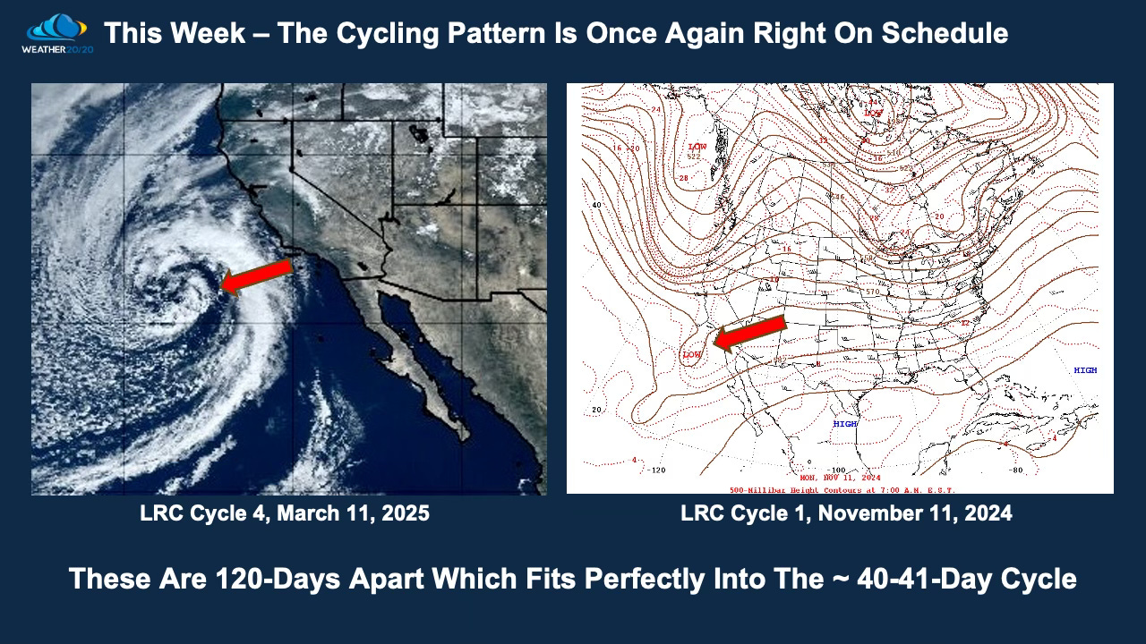
Today, a storm system is sweeping across the southwestern United States. Initially potent as it neared the Southern California coast, this system is expected to lose strength rapidly as it continues its eastward journey. Here is the vibrant imagery of this system as it approached the coast (left), side-by-side with a depiction of its energy at approximately 18,000 feet in the river of air above us (right), but from the first LRC cycle in November.
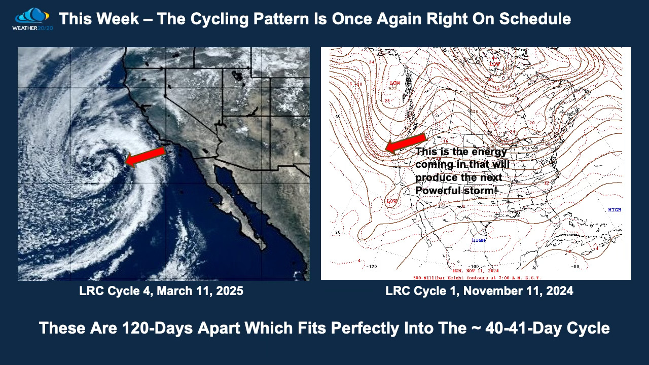
But why bring up November's weather now, in March? The reason is striking: the energy we observed on the west coast back in November is mirroring the dynamics of the storm forming right now. The upcoming slides will showcase this phenomenon in detail, illustrating the cyclical nature of these weather patterns and how past conditions can inform our current forecasts. This end of the week storm is worth spending some time, so let’s dive right in!
Here is today’s Video: