


A Summer Cold Front, The Tropics, & The September Outlook for Kansas/Nebraska
Let's discuss the weather pattern and what it means for the next few weeks

Welcome to the Weather 20/20 Intelligence Report! Cooler air is spreading in this week as the cycling weather pattern moves through the peak of summer.
The part of the weather pattern that just produced Hurricane Debby, which the LRC helped Weather 20/20 predict five months ago, is also producing these cooler surges. An “anticyclone” is the opposite of a storm system, or cyclone, and in the next few days these heat wave creating machines are shifting out over the Atlantic and Pacific Oceans.
This next slide below shows the big anticyclone over the western United States which has been producing relentless heat out west, and also transporting some monsoon moisture around it to produce thunderstorms over the Grand Canyon.
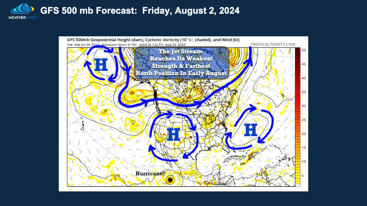
Look at what is forecast to happen by later this weekend:
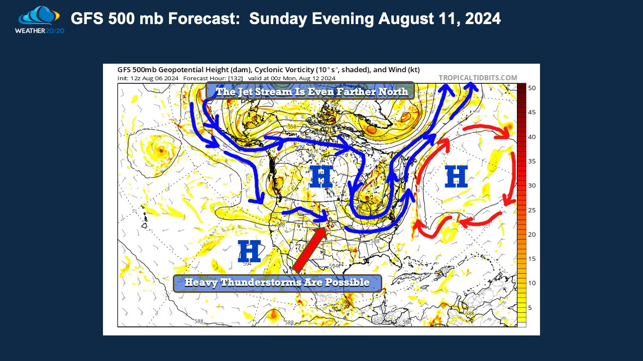
There is a disturbance forecast to track across the plains Sunday into Monday and a few spots will likely experience 2” of rain or more. There is a chance this will hit parts of the Kansas Nebraska region Sunday night into Monday morning
The jet stream shifts even farther north, with the exception of the area over the Great Lakes states.
This system is helping produce the late week cooler air surge, which we will all welcome to bring some heat relief.