A Tale of Two Storm Segments: The LRC’s Recurring Power
The January Blizzard & This Weeks Severe Weather Are Directly Related

Welcome to the Weather 20/20 Intelligence Report! As we enter the final days of spring, the atmosphere is right on schedule—returning to a powerful segment of the cycling weather pattern that first showed its hand in January. This report breaks down how the same energy that produced a blizzard and tornadoes earlier this year is now generating severe weather and much-needed rainfall across key agricultural regions. With summer officially beginning Friday, the timing couldn’t be better for farmers—and it’s another compelling example of how the Lezak Recurring Cycle (LRC) gives us the ability to look months ahead and see what’s coming.
The weather pattern we are in right now is not new—it’s a returning chapter of a story that’s been unfolding since October. What we’re seeing this week is directly tied to one key segment of the 2024–2025 LRC, which just followed the previous segment of the cycling pattern that produced tornadoes in all seven cycles of this year’s pattern.
Let’s investigate these two segments:
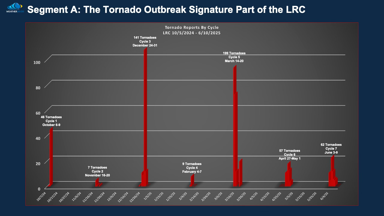
Segment A: The Deadly Tornado Outbreak Signature
This segment has produced tornadoes in all 7 cycles, spaced ~41 days apart. It’s where we saw some of the season’s worst outbreaks
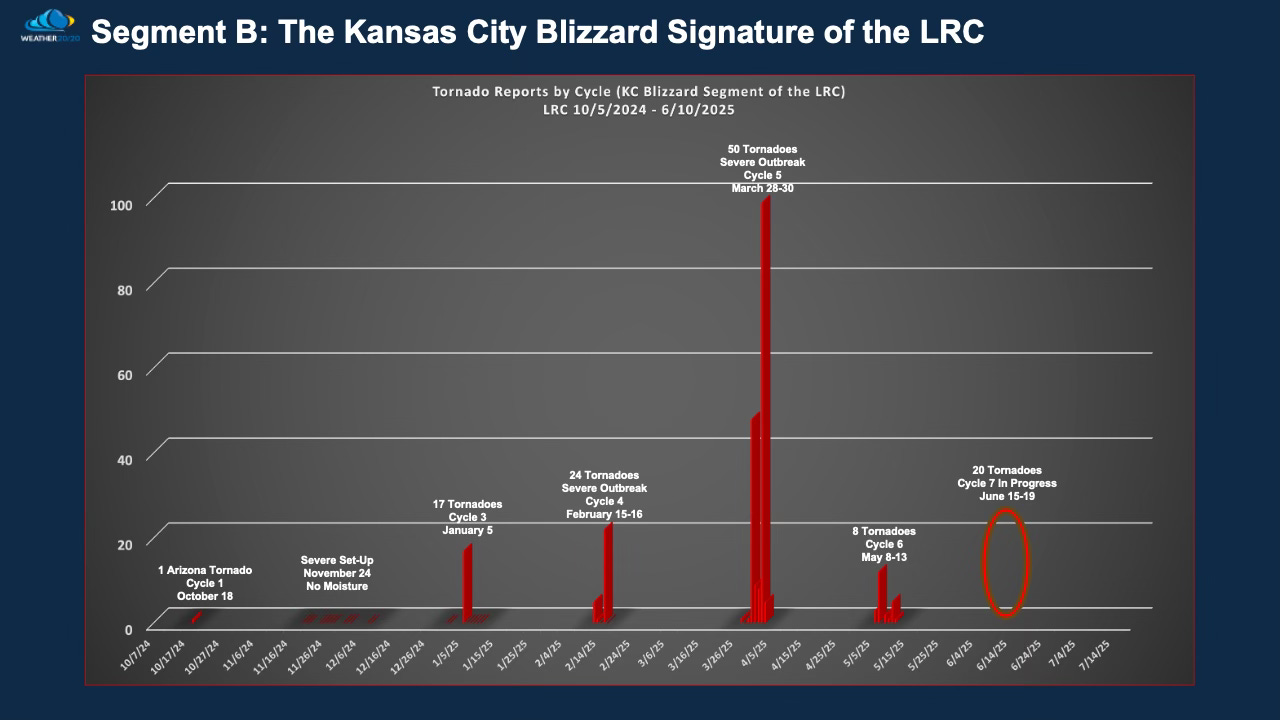
Segment B: The Kansas City Blizzard Segment of the LRC
Roughly 6–10 days later after the Deadly tornado outbreak segment of the cycling pattern came the Kanas City Blizzard Segment. This began with a blizzard and tornadoes on January 5, and has returned in every cycle—evolving with the season. the first two cycles had severe weather set ups, but low level moisture was missing.