


Another Major Spring/Winter Storm Intensifies
It was a deadly weekend of weather disasters & now another storm develops

Welcome to the Weather 20/20 Intelligence Report. The March Weather Madness continues as another intense storm system develops this week. This report goes in-depth into the dynamics of the upcoming system, expected to develop Tuesday night through Wednesday. Alongside, we'll explore the updated LRC model forecasts extending through May, crucial for your planting season preparations.
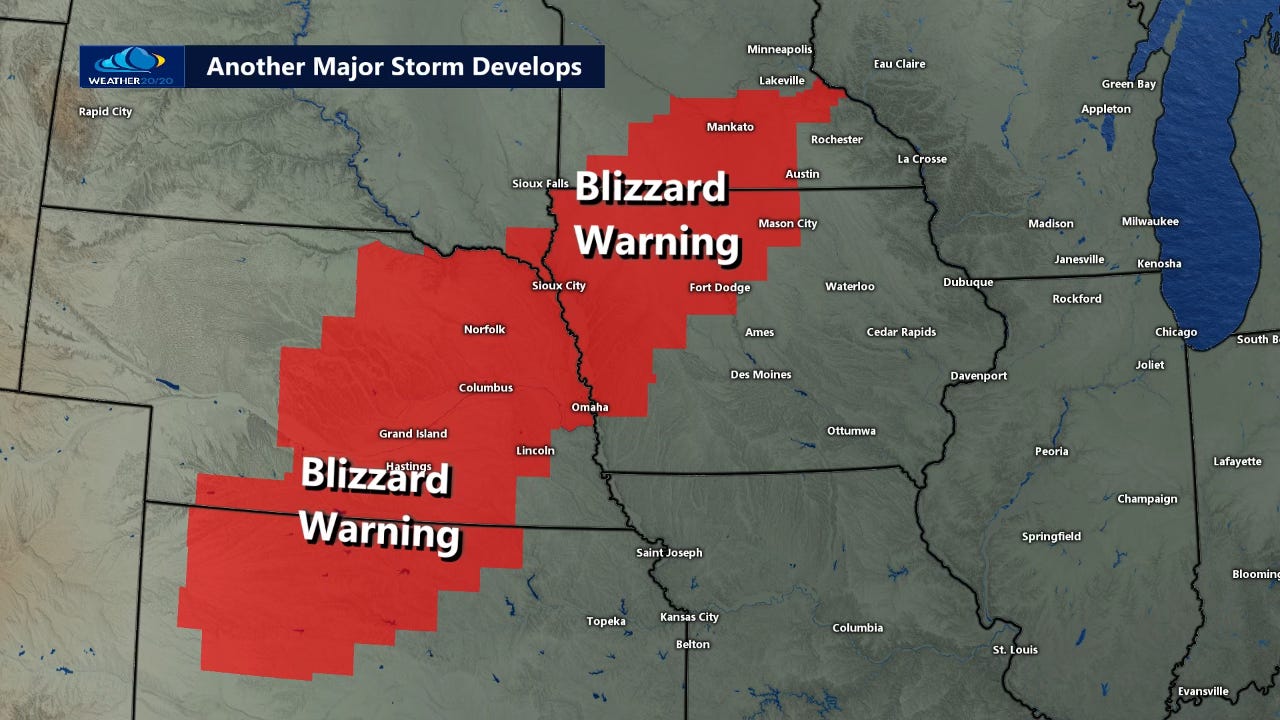
Another major storm is now forming as the energy comes over the Rocky Mountains, and we are here to break down the latest details in this week's report. Blizzard Warnings are in effect, stretching from northwest Kansas across Nebraska and northwest Iowa, reaching just south of Minneapolis. This region could receive nearly 1 inch of liquid precipitation, and resulting in significant snowfall, while surrounding areas remain markedly drier.
This new storm follows closely on the heels of last weekend's deadly double-barreled system, which claimed 40 lives, including eight tragic fatalities in a dust storm on I-70—precisely where the Blizzard Warning stands today. We'll examine the implications of this pattern and what it means for the affected regions as we move forward.
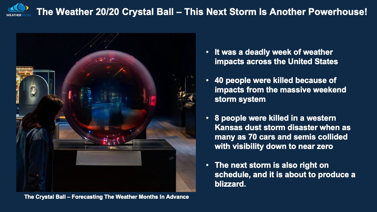
The Weather 20/20 Crystal Ball made another prediction using knowledge of the cycling pattern. This past storm was predicted by Weather 20/20 35-days ago in our Severe Weather Guide. Here is that prediction:


There are those on social media praising the Storm Prediction Center for their one and two day predictions, so keep in mind this forecast was made 35-days before this horrific severe weather outbreak, dust storms, and blizzards. Each dot on this map above shows a severe weather report, the damaging winds, large hail, flooding, and tornado reports. Our risk wasn’t perfect, but it was close. If the LRC was in wide use, then one benefit is in lives saved. If the region predicted to have a severe weather outbreak got the LRC warnings weeks to months in advance, then perhaps a few people would have planned differently and had been better prepared. Lives would have been saved through this advanced warning, and businesses could have been prepared for this event, at least with a plan in place without scrambling around at the last minute which is what usually happens with just a day to days notice.

Most of the devastating tornadoes also occurred in our forecast zone as you can see above. The weather pattern is cycling at close to every six weeks or so. That means this part of the pattern will cycle back through in late April. Here is the prediction also made and just updated for the late April timeframe:
Forecast For April From The February 8th report and updated after this storm hit. This will end up being nearly a 75-day accurate prediction. These forecasts from Weather 20/20 have been over 90% accurate the past two years, and we are already 3 for 3 this season. Here is the forecast for when this part of the pattern cycles back through:
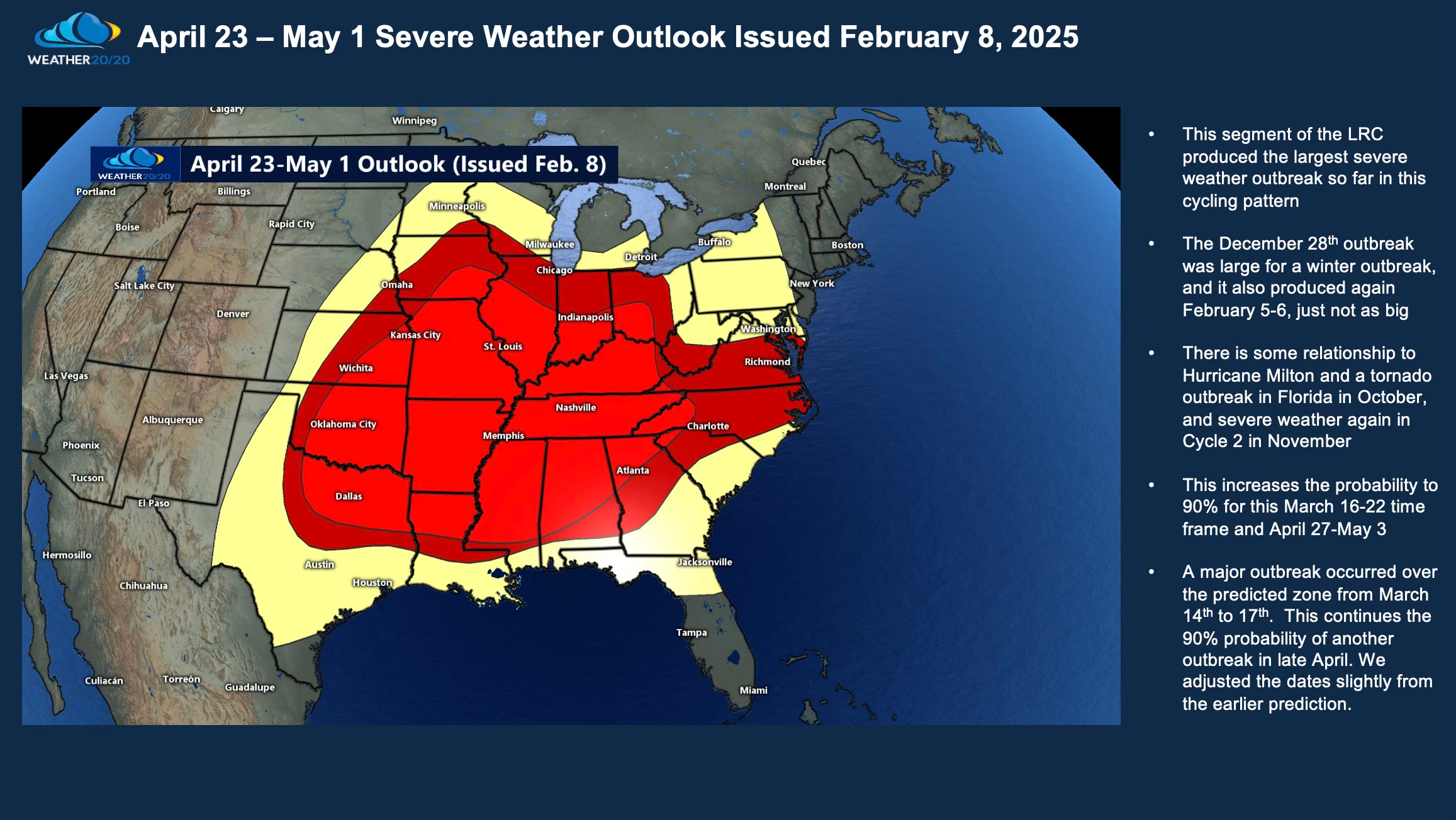
This part of the LRC has produced severe weathering all five cycles of this year’s pattern, including two major outbreaks, December 28-29 & March 14-17, in all five cycles. This continues the 90% probability of it producing again in late April. There are four or five other parts of the pattern that will also produce severe weather regularly as the pattern cycles into spring and summer, one of which is due later this month.