Arctic Air Is Showing Up - The First Cycle Of This Year's LRC Continues To Evolve
Another wet storm is moving out into the plains
Welcome to the Weather 20/20 Intelligence Report. As we get into the details of this evolving weather pattern, I'm writing to you from Colorado Springs, where I'm excited to represent Weather 20/20 at the International Association of Emergency Managers (IAEM) meeting. This event provides us with a fantastic opportunity to showcase our hurricane season results and introduce the unique capabilities of our LRC model to emergency management professionals including FEMA, NOAA, and many other organizations.
Over the past six weeks, we've witnessed incredible developments in the weather patterns that impact us all. We're here to share this critical information and data to help provide peace of mind, enhance decision-making confidence, and give your business a competitive advantage by knowing what's likely to happen from today up to nearly a year in advance.
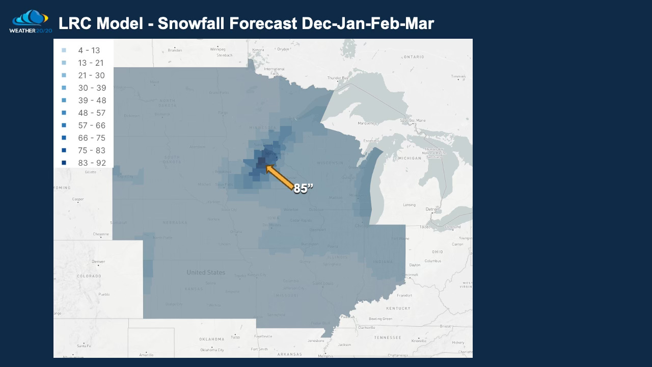
Weather 20/20 has just completed the first update from our patent-pending LRC model. As the first cycle of the pattern continues, we are constantly learning and adjusting our forecasts based on new data that comes in. Here's an example from our latest model update, which has been instrumental in accurately predicting the last four growing seasons for farmers globally. Take a look at this detailed forecast for upcoming snowfall over the next few months for the Corn Belt of the USA:

This model is scheduled for its next update this coming Saturday night. By December, we expect it to refine its accuracy to a level that businesses can reliably use for strategic planning and ensuring profitable outcomes.
Here is today’s Video. After the video we will discuss many aspects of this evolving and fascinating cycling weather pattern:


