


Happy Holidays! Thank you for sharing in this weather experience, and if you become a paid customer you will receive updated from our patent-pending LRC-model and much more in-depth information.
Join now for the holiday discount of $300/year or $50/month.
Look at what just happened. The LRC predicted this storm to track into the plains and upper midwest and Great Lakes 50-days before Christmas.
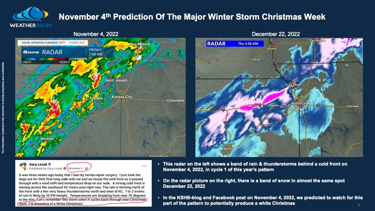
This morning, when I was monitoring the developing snow band, it reminded me of what happened in the first LRC cycle. As you can see on the upper left picture, a band of thunderstorms formed north of the front (shown on the surface map below), and then 48-days later on December 22, as this pattern cycled through LRC Cycle 2, a similar band of precipitation formed in almost the same spot. What? Yes! It is not a coincidence. It is what we were forecasting.

The front in November had temperatures drop from the 70s to the teens, 19° in Casper, WY. In the second cycle on December 22, 2022, the temperature drop happened again, and this time it was from the 40s to almost 40 below zero. Casper dipped to -38°F. Did you now that when the temperature reached -40°F it is the exact same temperature in °F as °C? Yes, -40°F = -40°C. Wow!
The next two maps show Christmas morning and New Year’s Day!
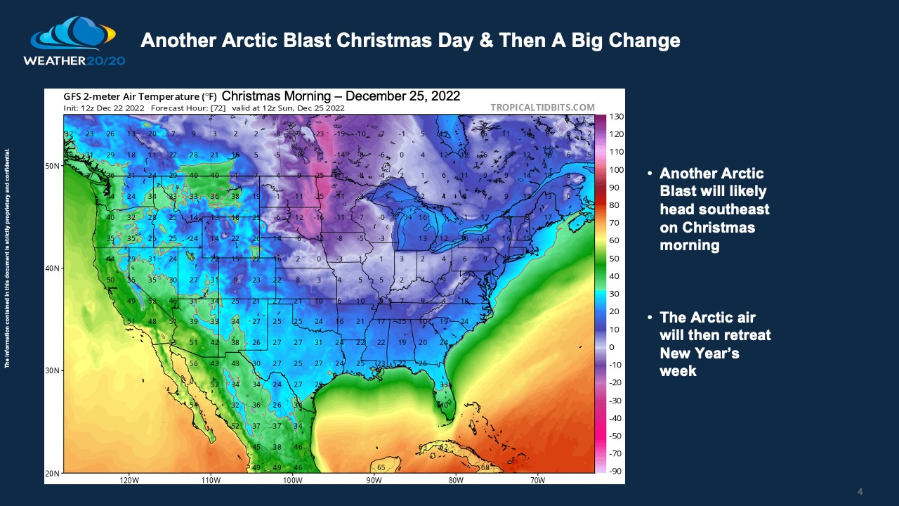
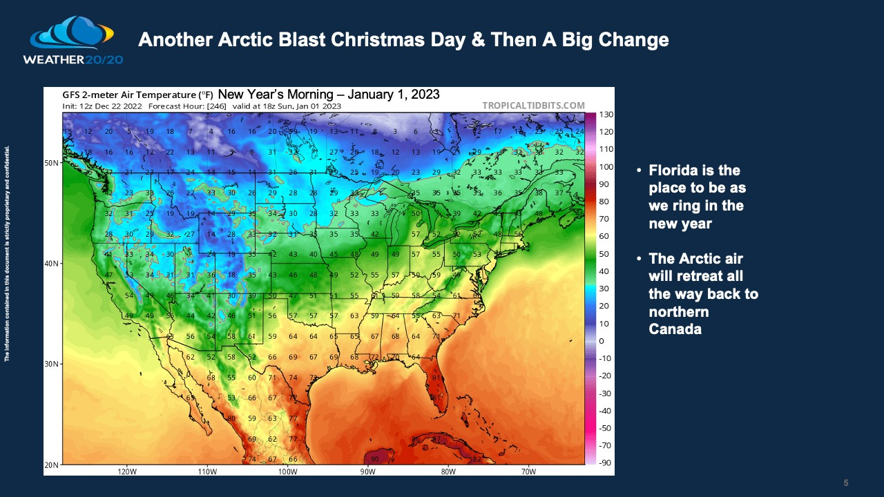
Another Arctic blast will arrive around Christmas weekend, and then there will be a major retreat of the Arctic air. Florida is the place to be as we ring in the new year.
For paid customers we will have a big update in the first week of 2023 as the LRC completely comes into focus.
Have a great holiday season! Bundle up!
Gary Lezak

Share this post