


As Summer Nears, the LRC Stays Locked In
What is next in line with the LRC - We will take a look!

Welcome to our latest Weather 20/20 Intelligence Report — and a special welcome to all of our new premium customers! We’re thrilled to have you join us. To our loyal subscribers who have been with us for years — some for decades — thank you for your continued trust in our forecasts and in the science behind the Lezak Recurring Cycle.
In this report, it may not surprise you to learn that the weather pattern is once again right on schedule. While most of the meteorological world still views long-range forecasting as guesswork, you're about to see what happens when you understand the big secret in weather prediction — the LRC.
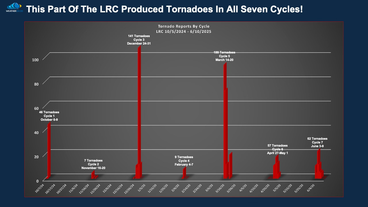
This unique cycling weather pattern, discovered and refined over nearly 40 years, is not only locked in once again but performing with remarkable consistency. We're now in Cycle 7, and this particular storm segment has produced tornadoes in all seven cycles. As the jet stream retreats and summer edges closer, the atmosphere is following the script — precisely.
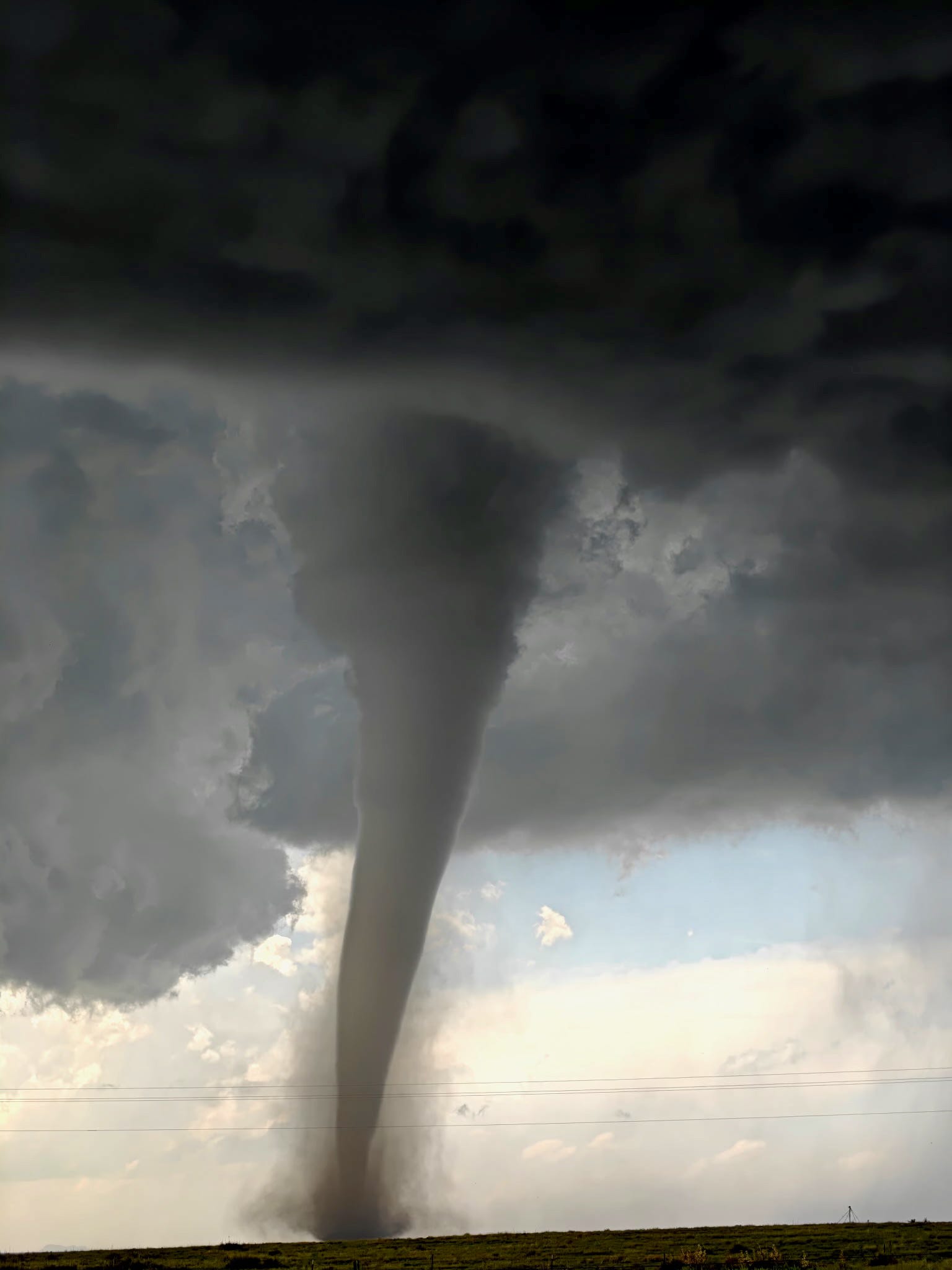
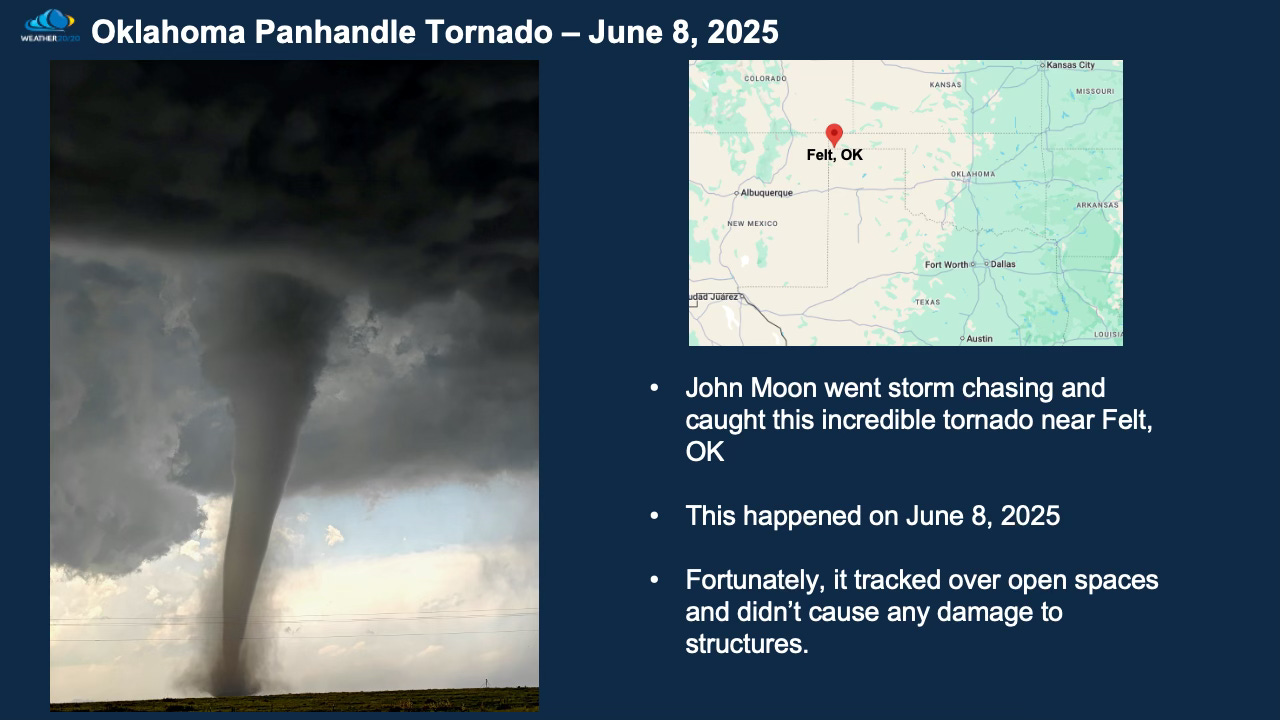
This breathtaking tornado in the Oklahoma Panhandle — captured with incredible precision by John Moon III near Felt, OK — shows the raw fury of nature. This isn’t just a random event. It’s part of a very specific, repeating segment of the LRC that has now cycled through for the seventh time. And each time it has passed through, it has produced tornadoes. Since this pattern began in October, this same segment has consistently generated severe weather — proof once again that the LRC remains locked in and highly accurate, even this late into the season.
I could show you all the compelling evidence — the matching 500 mb charts across each cycle, the surface reflections, the LRC Index, and more. But I’ll spare you the deep dive for now. Just know that behind the scenes, we are working diligently every day to analyze these patterns and deliver forecasts that don’t just tell you what’s coming — they help save lives and drive better decisions for your business.