


Countdown To The New LRC - Two Weeks
Fall begins this weekend & the pattern is still the same

Dear Weather Savvy Friends and Agriculture Enthusiasts,
The team at Weather 20/20 has been working tirelessly to refine our groundbreaking LRC technology, a tool that stands to redefine not just weather prediction, but how industries and individuals interact with the elemental forces that shape our world each day.
As we count down the days to unveil the new LRC, we invite you to share in the anticipation and excitement that is building up in our team. It’s not just about predicting the weather; it's about empowering each one of you with knowledge, a knowledge that is precise, scientifically grounded, and capable of steering Fortune 500 companies and hardworking farmers towards safe and informed decisions.
As we anticipate the new LRC, and hope for a weather pattern that will produce better conditions than this past year, let’s look at what has happened recently near the end of this year’s pattern

The tropics remain a hub of activity, with Hurricane Nigel being the latest entity to stir the waters. Nestled close to the equatorial belt where the sea temperatures are inching higher, this phenomenon aligns with the ongoing evolution of El Niño, promising to be a newsmaker soon. We have been tracking something intensifying in the tropics just about every day recently. Here is the latest satellite picture from this afternoon on September 18, 2023:
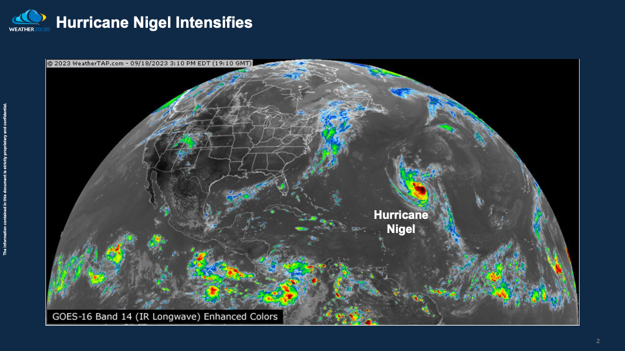
Hurricane Nigel is the latest named storm. Look near the bottom of the satellite picture. There is a band of disturbances stretching across the lower part of this map. This is called the ITCZ, or Intertropical Convergence Zone. Hurricanes usually form north of this zone. This zone is closer to the equator and this is where the ocean temperatures have been warming. Yes, El Niño is continuing to evolve and it will be making headlines soon.