


Developing Hurricane Helene & Signs Of A New Weather Pattern
We are nearing the end of this year's weather pattern

I hope everyone is doing well. As we near the conclusion of this year’s LRC cycle, there's much anticipation about the new weather pattern that will soon unfold. Welcome to another edition of the Weather 20/20 Intelligence Report.
Today, we're tracking a developing hurricane in the Caribbean Sea that is about to move over the warm waters of the Gulf of Mexico, and is expected to intensify Wednesday and Thursday. Following that, we’ll explore the emerging weather patterns over the next two weeks. Is there a possibility of rain halting completely?
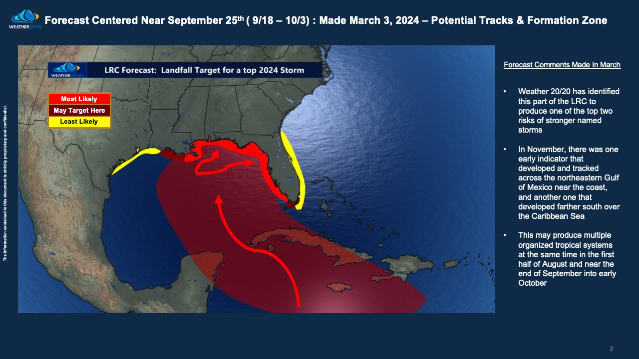
The slide above shows the prediction Weather 20/20 made in early March, and you can see the comments I wrote in there in March as well.
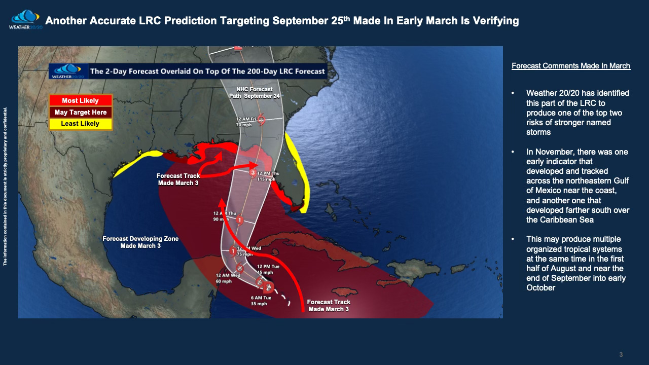
This next slide below presents the National Hurricane Center's forecast for the coming days overlaid on top of our 200-day prediction, where Helene is anticipated to intensify into a major hurricane before making landfall. This situation truly underscores the saying, “you can’t make this up.” Despite skepticism—some may claim that hurricanes like this are typical for late September—our precise forecasting demonstrates that this is not merely a routine occurrence but a scientifically predictable event based on our unique LRC methodology.
Thank you for following along with our slides. Now, I invite you to watch this detailed video discussing the developing hurricane and a description of this developing weather pattern: