


Everything Is Cycling Right On Schedule - Does It Mean Wet Or Dry?
A fascinating weather pattern continues to amaze us as we move into the sixth cycle - we will go in-depth!

🌎 Welcome to This Week’s Weather 20/20 Intelligence Report
We’d like to start by extending a warm welcome to all of our new premium members — and a big thank you to our returning subscribers. You’re not just receiving forecasts here — you’re getting access to a deeper level of insight into how the atmosphere actually works.
And this week, we’re sharing what most in the weather world still believe is impossible - but we’ve proven it over and over again. The weather isn’t random. It’s cycling. And it’s right on schedule.
While most traditional forecasters are reacting to what’s two or three days ahead, we’re tracking the pattern that has been building for months — and projecting its return into the weeks and months ahead.
In this report, we’ll start with an analysis of the current weather pattern:
What has happened
What traditional models are now showing
And what the LRC model already told us would happen
Then, we’ll take it further — using two compelling examples (which you may recognize) to showcasing this year’s cycling pattern.
Finally, we’ll finish with an exclusive forecast powered by the LRC model — with forward-looking insights for key regions from North Dakota to Indiana.
Let’s get started by showing a little bit of what has been happening. The 7-Day Rainfall totals are shown on the next two slides, which included the Easter weekend storm system:
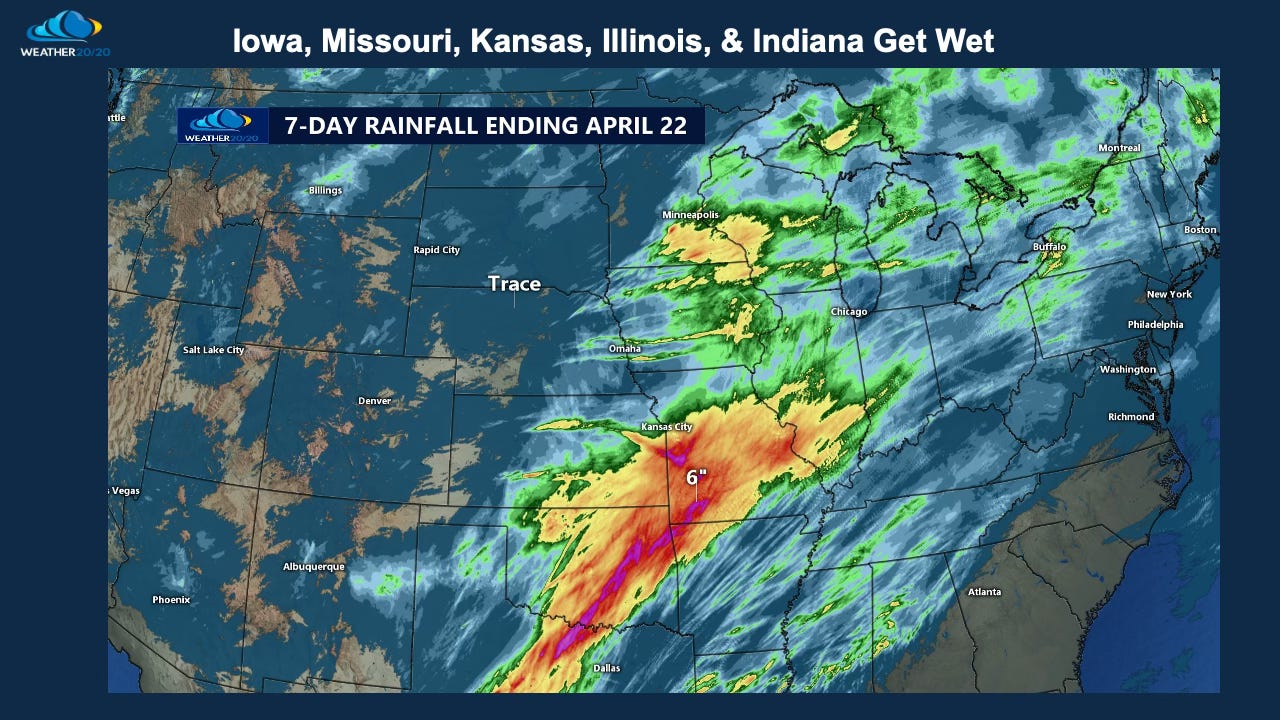
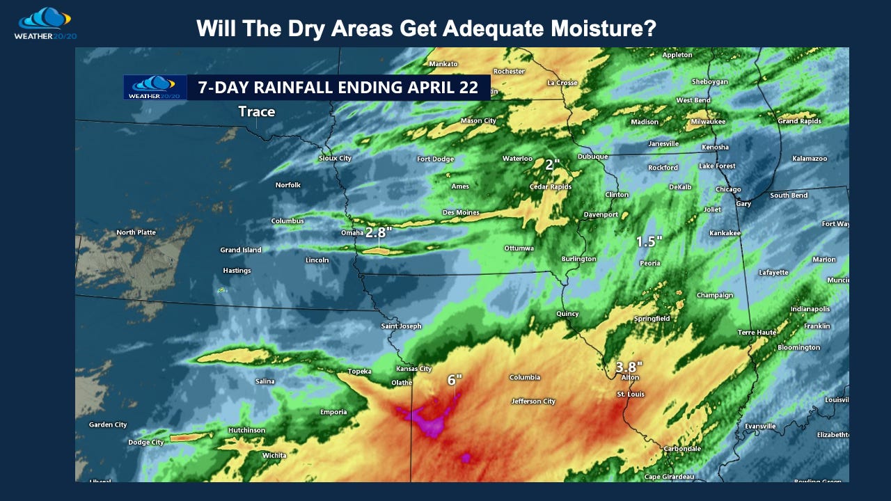
Just look at the Kansas City region. Areas just southeast and south of KC had pond filling rains, while others are very dry, like northwest Missouri where only a few drops have fallen. We have heard from a few farmers around the plains and upper midwest that have had little to no rain and with planting going on now, it would be nice to get a drink of water, even one inch of rain, and this is in the forecast as you will see as our discussion continues.