


Heat, Hurricanes, and the LRC: What is Going On With This Summer Weather?
Let's look at what Beryl just did and a look at the rest of summer


Welcome To The Weather 20/20 Intelligence Report!
Today, we are thrilled to announce the launch of our Global Predictor app, now available for download on Google Play, the iTunes store for iOS devices, and directly through our website at Weather2020.com. The Global Predictor stands alone as the only tool in the world offering detailed six-month weather forecasts. Whether you're planning a wedding, organizing an event, or simply curious about the weather for Christmas Day, the Global Predictor provides unparalleled foresight into future weather conditions. Join us as we share how this innovative app can enhance your planning and bring a new level of excitement to checking the weather. Just go to the App Store and search for Global Predictor.
While the app is powered by our patent-pending LRC model, let's go in-depth into the current weather pattern and how it is related to the very beginning of this year’s LRC. It blows my mind, and I am the one who discovered this 37 years ago. This analysis will not only enhance your understanding but also showcase the predictive power and precision of the LRC model in real-time applications, and I hope it will increase your confidence in using our weather predictions and data for your business in the years ahead.
The Earliest Category 5 Hurricane Ever Recorded In The Atlantic Basin
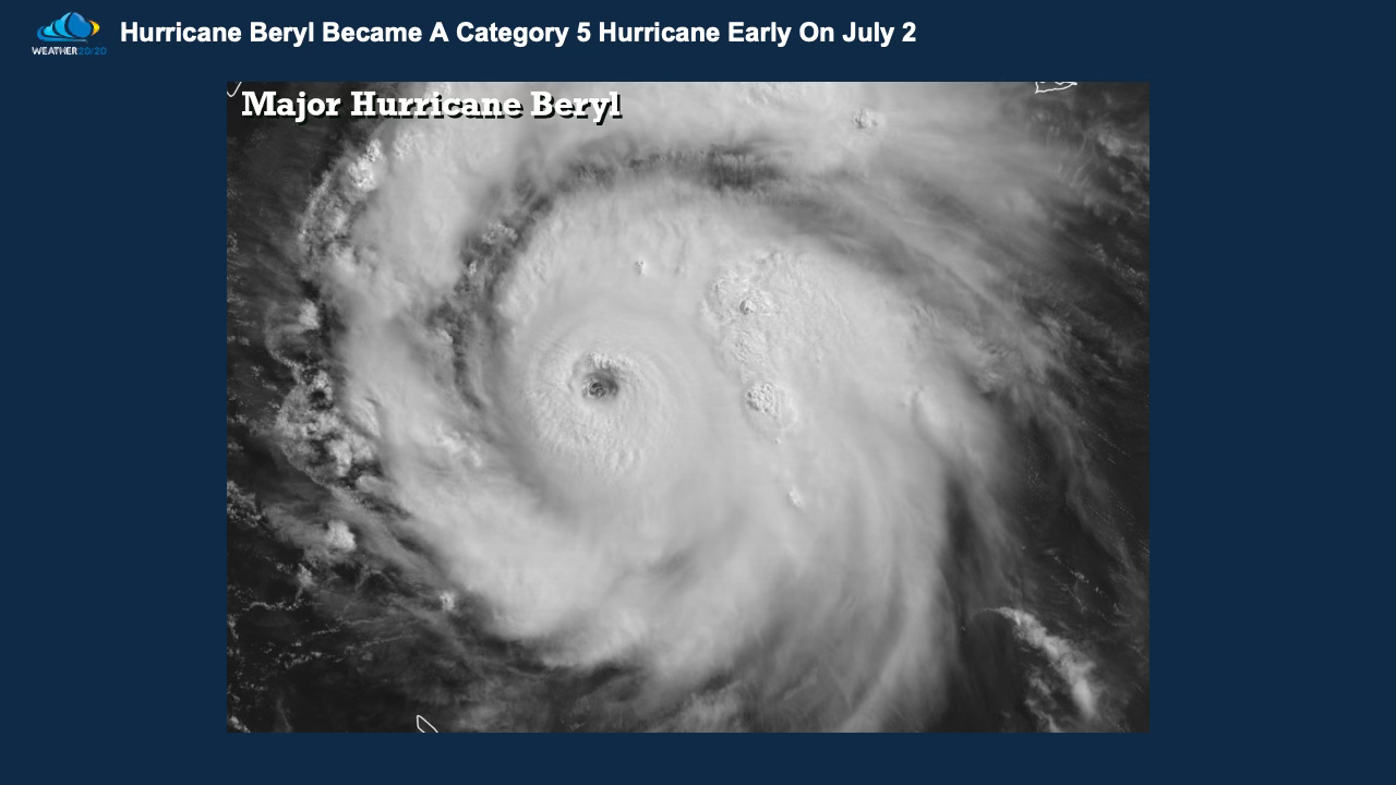
Major Hurricane Beryl intensified into a CAT 5 hurricane a week ago and it had wind gusts over 200 mph near the ocean floor. Fortunately almost all of those extreme winds were likely over the open water.
For a hurricane to maintain strength and intensify it must have 80° water temperatures or higher as a source; the eye, or center of the circulation must be over these warm waters, or it will quickly fall apart, as it did as it crossed over the Yucatan Peninsula on July 5th:
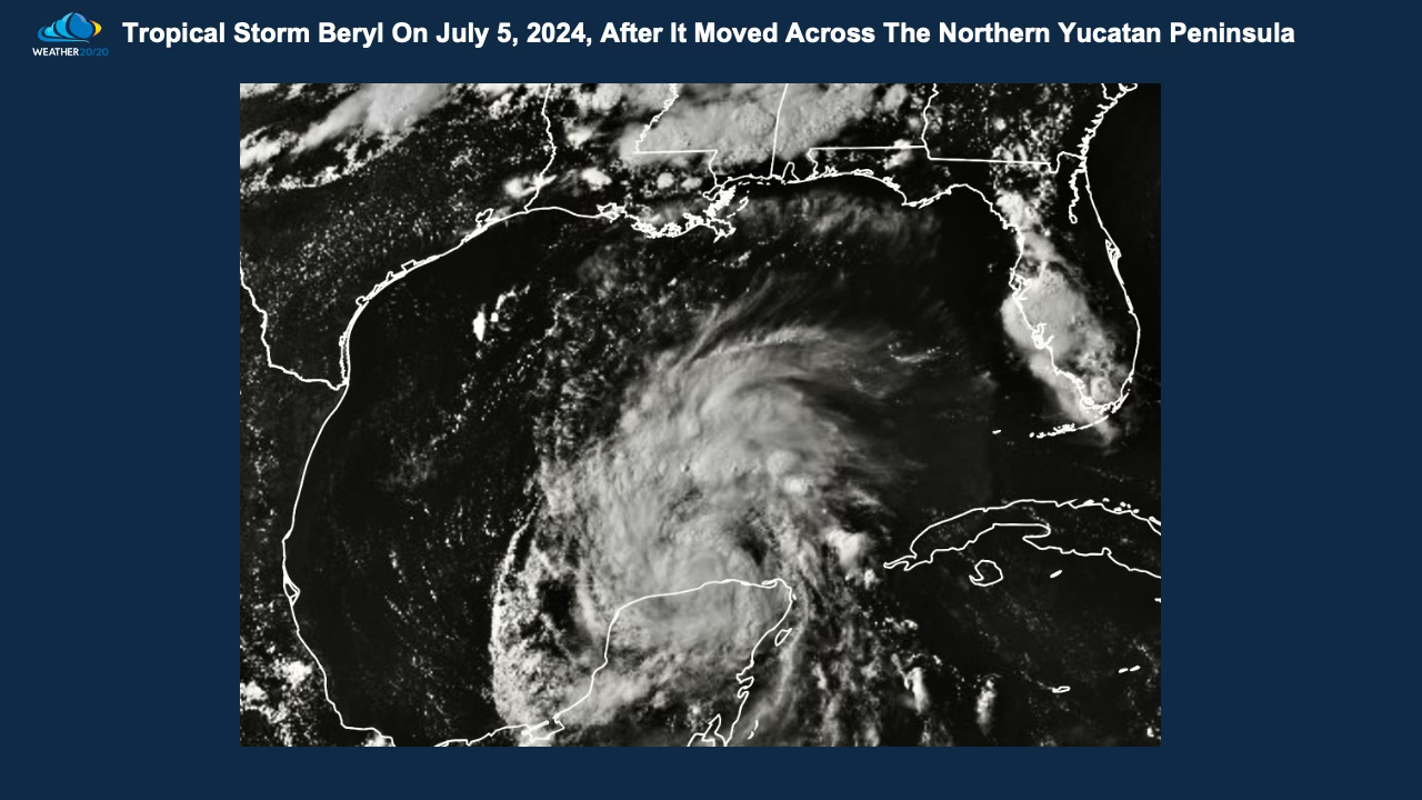
Beryl, then weakening to Tropical Storm Strength, struggled to get reorganized until it reached the Gulf Coast south of Houston:
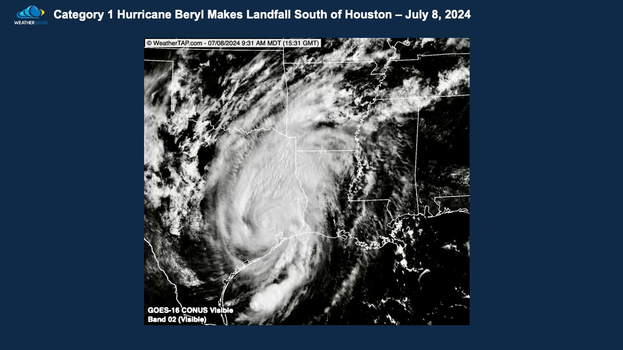
Beryl certainly made its presence felt with flooding, power outages, and wind damage, yet it stopped short of escalating into a major disaster. As it moved inland it was hyped up as a major tornado producer, but what actually happened were over 100 tornado warnings and around 15 small tornadoes occurred. So, it was significant, but a bit overhyped.