
Hurricane Gabrielle Developing & Fall’s First Storm Potential
Tropical Update

Welcome to the Weather 20/20 Intelligence Report – Tropical Update.
Something remarkable happens on Monday: the sun will set at the North Pole, marking the beginning of the countdown to the new LRC that develops in early October. Until then, the atmosphere is still being governed by last year’s recurring pattern. Within this old cycle, a strange and potentially wet storm is emerging that could impact Kansas City, the Rocky Mountains, and surrounding areas. We’ll dive deeper into what this means in our full report Tuesday.
Developing Hurricane Gabrielle
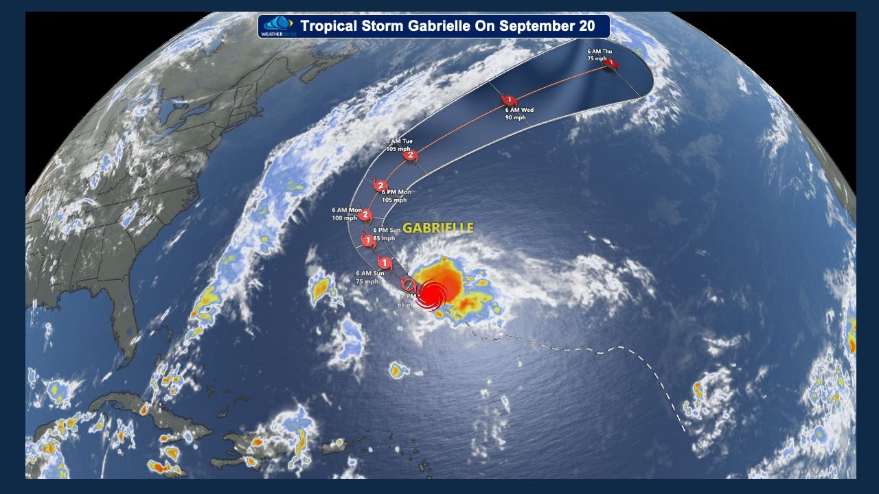
Tropical Storm Gabrielle is expected to strengthen into a hurricane by Sunday. Fortunately, impacts will be minimal as the system tracks harmlessly over the open Atlantic. Incredibly, Gabrielle is just the seventh named storm of the season—and only the second to reach hurricane strength.
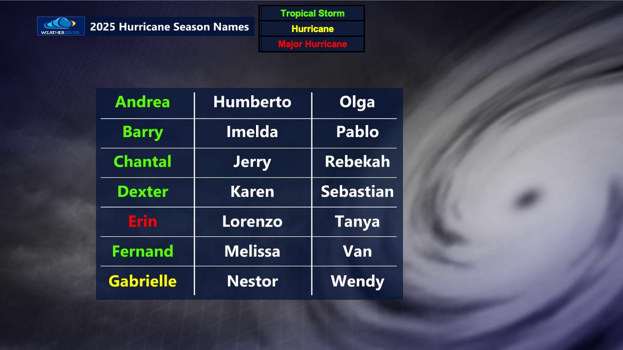
After October 20th—about a month from now—the Atlantic typically averages only two additional named storms. That means we may never reach Karen or Lorenzo on this year’s list.
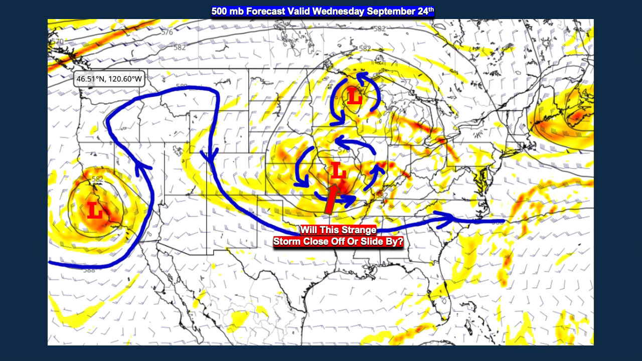
While the tropics remain relatively calm, the seasons themselves are about to change. Let’s shift focus to the developing weather pattern. The map below shows the flow at 500 mb, roughly 18,000 feet up in the troposphere. Notice how the jet stream remains displaced far to the north over Canada, with a split flow developing across southwest Canada into the western United States. A storm system is caught in this split and is forecast to dive south into Wyoming and Colorado Monday into Tuesday.
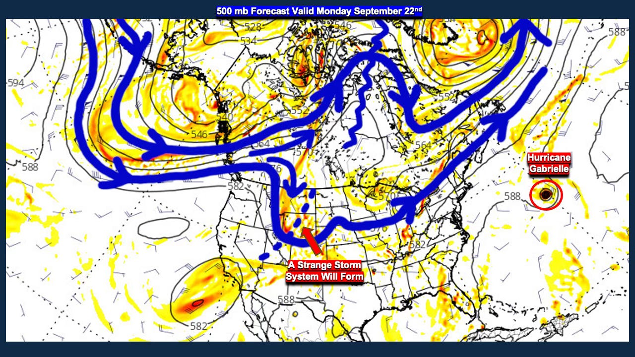
Snow levels with this system will remain high, above 10,000 feet. The bigger question is whether the storm organizes enough to deliver rain to Kansas and Missouri. The GFS (American Model) closes off the upper low, which would spin showers and thunderstorms into Kansas City by mid-week. But will it actually happen—or will it fall just short, like the August system that left Kansas City high and dry? Other models aren’t as strong, not that this is a strong storm, but just a little organization and rain would be more widespread. This next map is valid on Wednesday:
Take a look at the rainfall forecast from the morning GFS run on Sunday showing pockets of 3” rainfall amounts:
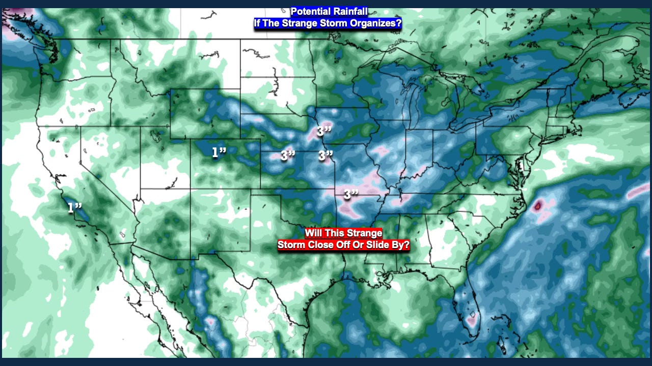
There is also a system off the California coast that could bring rain to parts of Southern and Central California.
👉 [Click here for today’s in-depth video]
In conclusion, the weather pattern is beginning its slow transition. The sunset at the North Pole marks a critical turning point, likely accelerating this change over the next two to three weeks. We’ll have a full update in Tuesday’s report, by which time this storm will have come into clearer focus.
Have a great few days,
Gary Lezak