


Intensifying Hurricane Francine Tops The Weather News
This will be a combined tropical and agriculture outlook

Welcome to the Weather 20/20 Intelligence Report. We will go over the trends in the rainfall forecast for the Corn Belt in just a second. We will lead this report with the intensifying, what will become Hurricane Francine later today.
New Orleans will have some impacts from Francine and it will depend on the track and strength of this storm. The morning data, on this September 10th, showed an eastward trend. Here is the American (GFS) model:
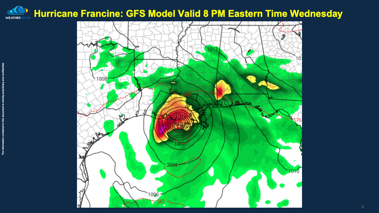
It will likely still track a bit left or a bit right of this GFS model track. Just know the trend has been for it to track a bit farther east as shown below on the updated path prediction:
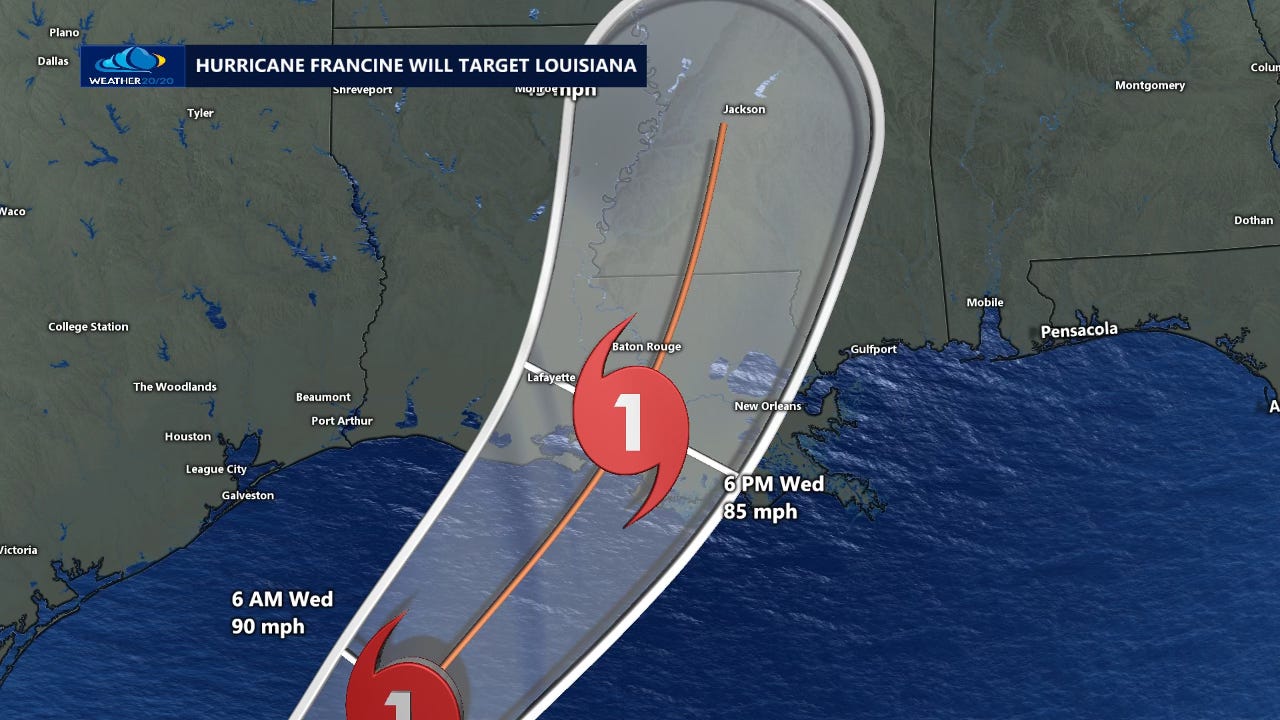
The biggest impacts will be flooding, some wind damage, and storm surge issues for areas on the coast line. Let’s see how strong the hurricane becomes as it makes landfall.
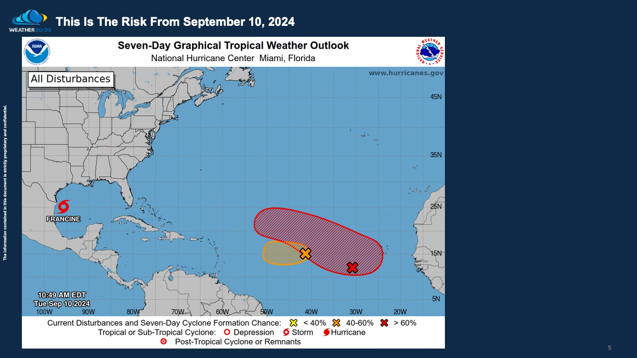
There is another one developing over the Atlantic, in fact, the National Hurricane Center is tracking two systems over the Atlantic right now. One of these is likely to become Tropical Storm Gordon in the next week.
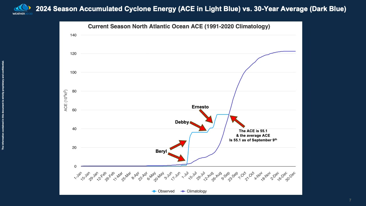
Here is an interesting chart showing the energy for this 2024 Hurricane Season. After a booming start from Major Hurricane Beryl, the ACE has drifted all the way back to near average, which was expected by us at Weather 20/20.
While all the other organizations, that predict these seasonal outlooks, had forecasts of it being a hyperactive hurricane season, Weather 20/20 stands out once again as the only source to predict a near to slightly above average season as tracked by the Barcelona Supercomputing Center shown here:
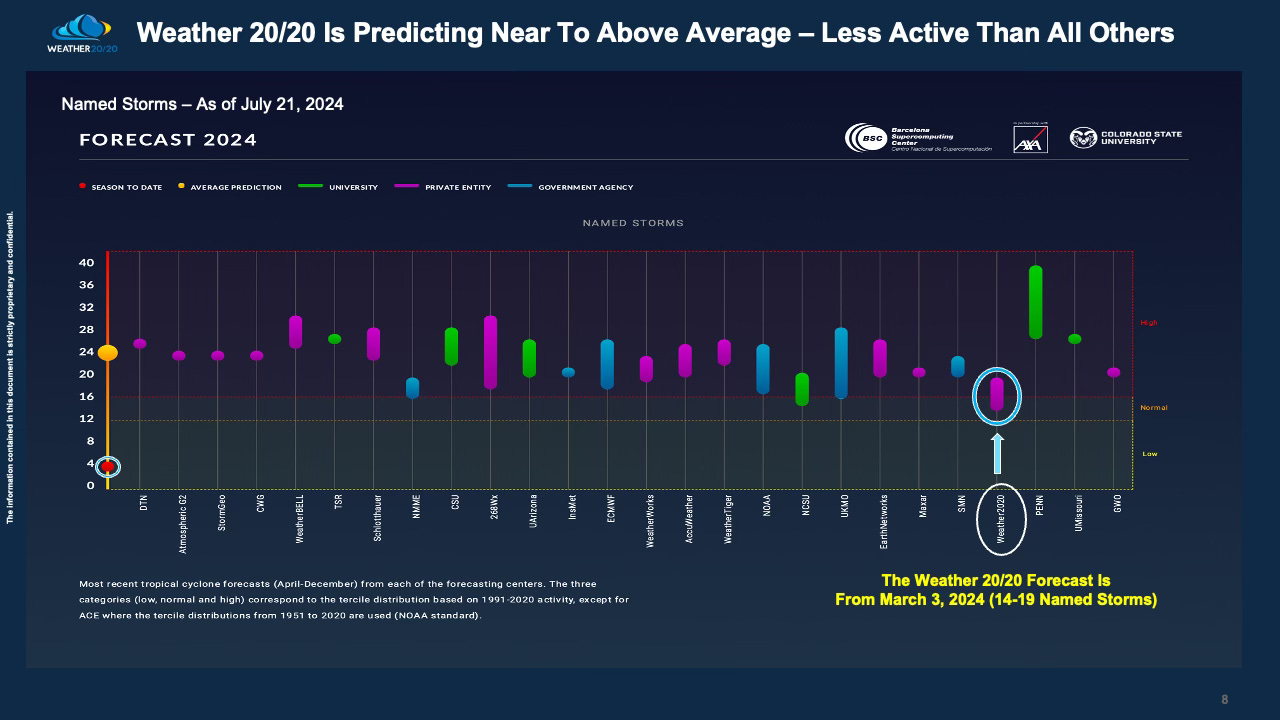
I have seen excuses, reasons as to why their forecasts were off, but just know one fact: They do not use the LRC. So, we are about to be the most accurate for the third year in a row as tracked by this site. There have only been 6 named storms so far this season.
Will It Get Wet In The Next Two Weeks as Harvest begins?
The weather pattern that set up last fall is continuing to cycle today. We are actually in the 8th cycle of this year’s weather pattern, and this is the final cycle. By the time the 9th cycle would begin, the new LRC will be setting up in 3 to 4 weeks. This is a rather exciting time of the year to track the evolving pattern, but I ask for patience as we are not there yet.
Here is today’s video where I show some additional maps and explain what is going on with this 8th cycle of the LRC: