


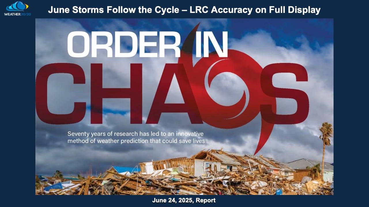
June Storms Follow the Cycle — LRC Accuracy on Full Display
Deadly storms blast the USA from Lake Tahoe to New York! What is next in line?

Welcome to This Week’s Weather 20/20 Intelligence Report!
To our loyal customers — some of you have been with us for decades — and to all of our new followers, welcome. I’m grateful you’ve joined us at a time when the weather story across North America has been nothing short of extraordinary — and once again, right on schedule.
This week, we’ll show how the LRC accurately anticipated a string of extreme events:
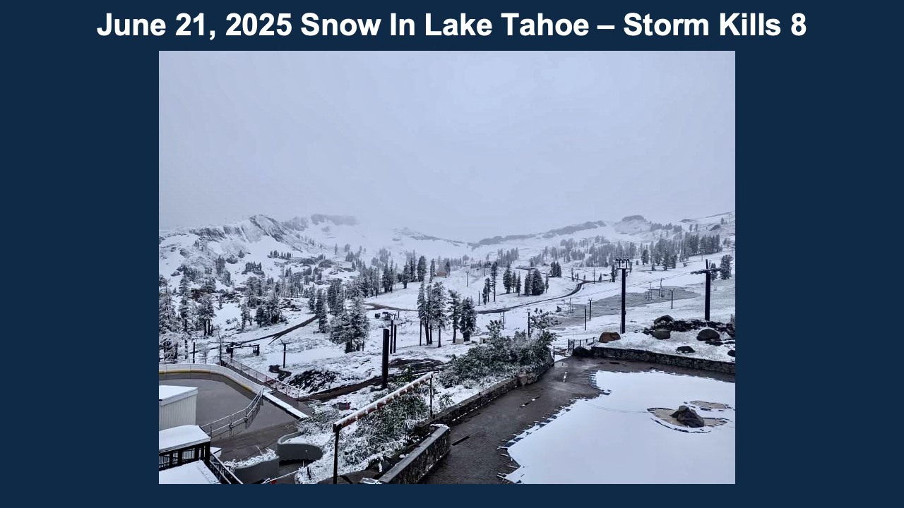
A tragic boating disaster on Lake Tahoe during a high-impact windstorm
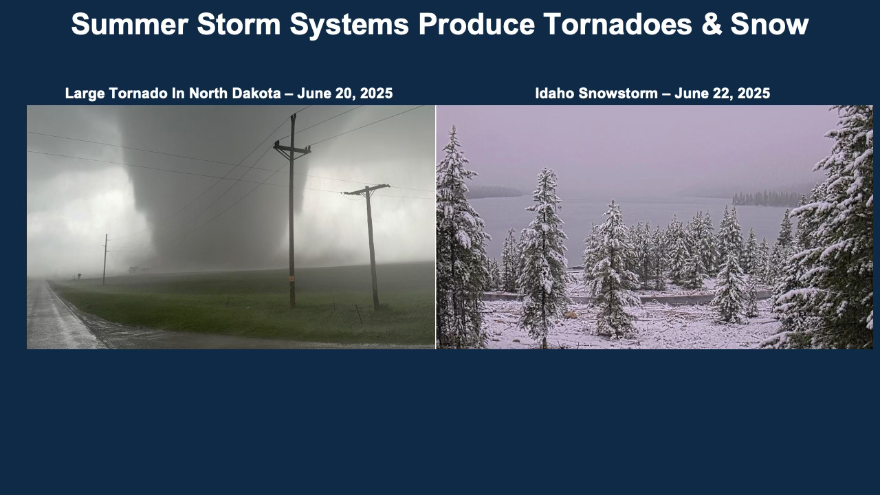
A deadly tornado and derecho outbreak in North Dakota
Snowfall in Idaho — in late June, no less
All of these events, while seemingly random to others, were precisely aligned with the cycling pattern we've been tracking for months.
Whether you've been with Weather 20/20 since the beginning or are just discovering the power of the LRC, this report will show why our technology continues to lead the way in long-range weather forecasting.
A Summer Storm Turns Deadly — From Sierra Snow to North Dakota Tornadoes
The snow may look picturesque at Palisades Ski Resort near Lake Tahoe, but behind the beauty was a deadly storm. On June 21, as this powerful system swept through the Sierra Nevada, winds gusted to 45 mph and temperatures plunged more than 25 degrees. Lake Tahoe turned violent, generating massive swells that tragically capsized a boat carrying ten people — eight lost their lives, with only two survivors. It was a heartbreaking reminder of just how quickly weather can turn dangerous.
This storm was no isolated event — it was part of the same segment of the LRC that returned right on schedule. Just one day earlier, it had carved a path across the northern Plains, unleashing large tornadoes and a deadly derecho in North Dakota. And as it pushed into the Intermountain West, it delivered rare June snowfall in Idaho — a dramatic end to the first weekend of summer.
The pattern — locked in since last October — continues to deliver on its forecasted rhythm.
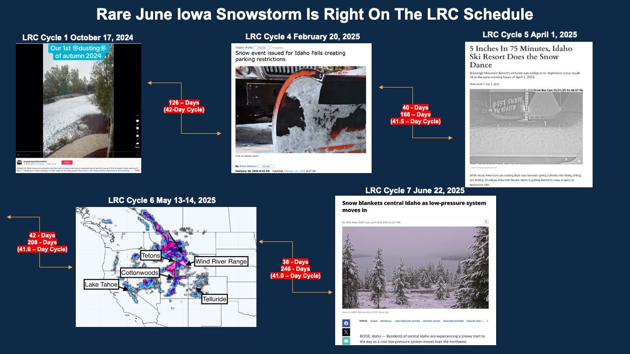
This segment of the cycling weather pattern has now completed its 7th full cycle, and remarkably, it has produced snow across Idaho in five of those seven cycles. Below, you’ll see each of those snow events lined up in time — all occurring within the boundaries of this year’s established 38- to 44-day cycle length across the Northern Hemisphere.
These aren’t coincidences. This is structure in the atmosphere — and it’s been there all year long. It falls into the category of “you can’t make this up”.
Whether it's a blizzard in early January or unexpected snow in late June, the LRC continues to provide clarity in what others often see as chaos. The precise return of this storm segment proves once again that timing isn’t just luck — it’s part of the pattern.
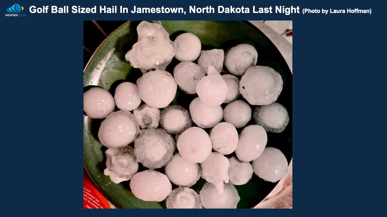
Here is a bowl of hailstones from Jamestown, North Dakota from Friday’s storm:
Two Rounds of Big Thunderstorms — Right on Schedule
That powerful storm system that tore across North Dakota was actually the second major storm of the week in this segment of the LRC. Both systems lined up with precision — part of similar atmospheric energy returning on schedule for the seventh time this season.
Below are radar images from June 16th and June 20th, capturing both waves of this impactful setup:
June 16th: The first complex delivered widespread rainfall and hail across the Plains.
June 20th: The second wave intensified into a destructive derecho and tornado outbreak in North Dakota.
These two rounds were no accident. They were part of the same recurring pattern that we first identified back in the fall:
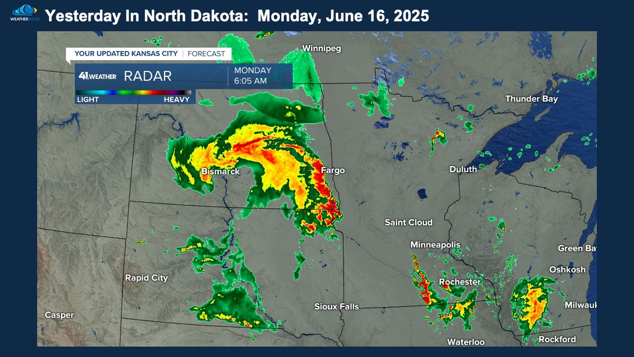
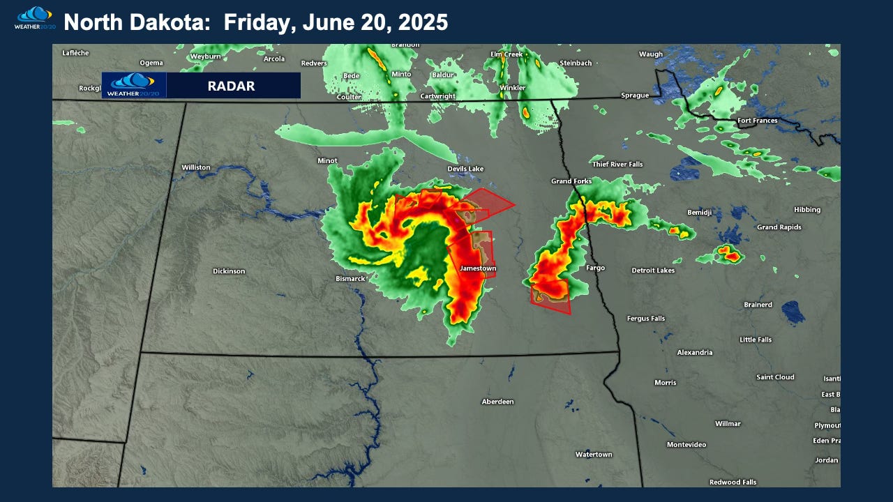
One of the most remarkable aspects of the LRC is not just when storms return — but where. The two radar snapshots from June 16th and June 20th look strikingly similar and occurred in nearly the exact same region. This segment of the LRC just produced with impressive results.
Just a couple of weeks ago on WDAY Radio, a listener asked,
“Gary, is the tornado and derecho threat you talked about for later this summer still in the forecast?”
I answered: Yes. That part of the pattern is cycling back through next week.
And, here we are a week later and, well — it already produced. Right on time, right on target, just one cycle earlier.
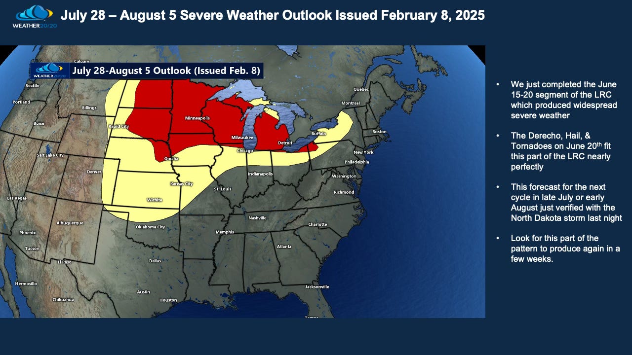
This segment is part of the same LRC cycle that brought the Kansas City Blizzard on January 5th, and the sililar atmospheric energy now brought a deadly outbreak to North Dakota in June. And yes — it’s still not done. Expect this segment to return again in late July or early August with another potential threat.
Below is the original prediction from our Severe Weather Guide — issued February 8th — for this exact stretch of the summer. The LRC is once again proving its unmatched long-range value.
We will get to a lot more including our LRC Model predictions through December. First, here is today’s video describing this report: