


Rain Is In The Forecast - How Much?
We will analyze the Easter weekend storm and the next few months!

Welcome to this Week’s Weather 20/20 Intelligence Report!
The planting season is underway, and as every grower knows — timing is everything. The placement and consistency of rainfall over the next few weeks will be critical to establishing early crop success and setting the tone for the season ahead.
We are now transitioning back into Phase 1 of this year’s LRC, a familiar segment of the pattern that has produced rain in previous cycles, and yet it has not hit all locations. For weeks, our long-range forecast has highlighted this upcoming window as an opportunity for the mid-April to early-May and the late-May into the middle of June, in the fifth and sixth cycles for adequate rainfall across key agricultural regions.
So the question now is: Will It Verify? The latest model data is looking bullish as we kick off this report. Let’s start with the latest rainfall forecast from the GFS (American) model and see how it lines up with our LRC-based expectations:
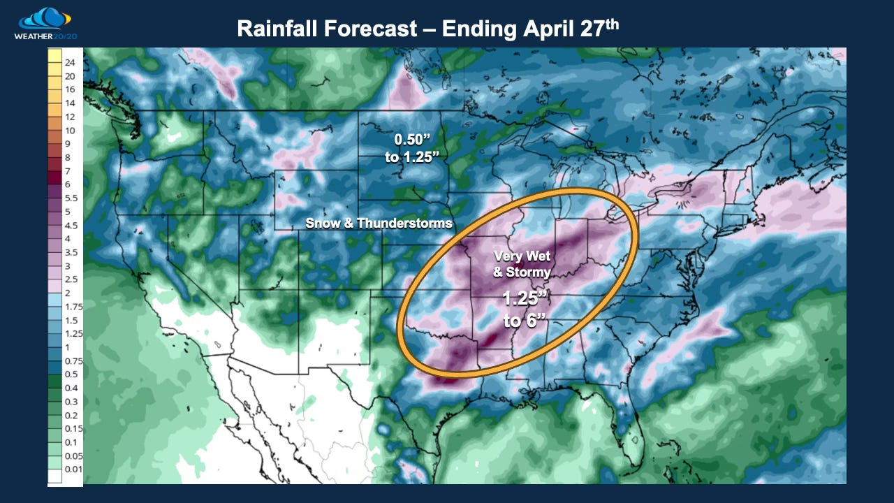
If you look closely at the forecast, shown above, there are still spots that may struggle to get over 1/2” of rain in the next ten days, while others may end up getting too much, and there will be a few severe weather risks.
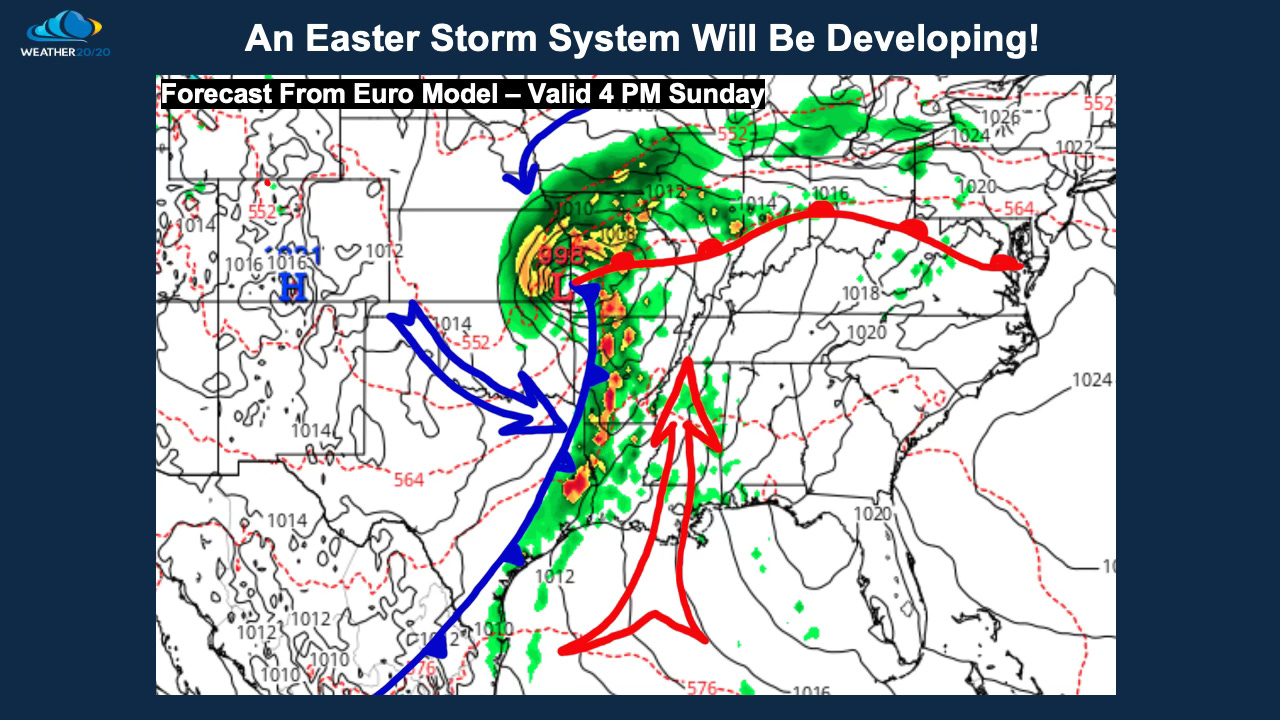
This next developing storm system is timed for Easter weekend. The evolution of this storm system is fascinating to watch unfold, as it is another great exhibit showcasing the cycling weather pattern, which I will get into in just a minute. Here is a forecast from the European Model run, from the overnight data, that shows the storm organizing on Sunday. A line of intense thunderstorms is being modeled from Missouri south into eastern Texas while a comma head of rain and thunderstorms is near Kansas City. Not shown on this map is a likely snowstorm over the Rocky Mountains extending east to near Denver, CO in the next 72 hours:
We will go in-depth into this evolving and cycling pattern in just a second. Here is today’s video where I show two strong examples of the LRC:
Here is Today’s Video: