


Rainfall Forecast & A Look Into The Tropics
Summer isn't here yet - A look into the rainfall patterns, the tropics, & severe weather

Welcome To The Weather 20/20 Intelligence Report!
To our premium subscribers—welcome back. You’re already ahead of the curve. And if you’re new here or considering upgrading, this is your gateway to a forecasting method that doesn't guess—it knows, weeks to months in advance.
Over the past 30 days, much of the central U.S. has benefited from well-timed, meaningful rainfall. Key agricultural zones have seen moisture return just when needed most. But not every region is on the winning side of this cycle—pockets of persistent dryness remain, particularly across parts of Missouri, where the pattern has also been consistent, consistently missing with heavy rainfall, and yet still perhaps getting just enough.
These rainfall patterns are not random. As we’ve tracked since October, the current LRC cycle—now repeating for the 6th time—has returned key systems on schedule, bringing precipitation to many of the same regions that benefited in prior cycles, or even have had too much rain over parts of southern Missouri, Oklahoma, and Arkansas.
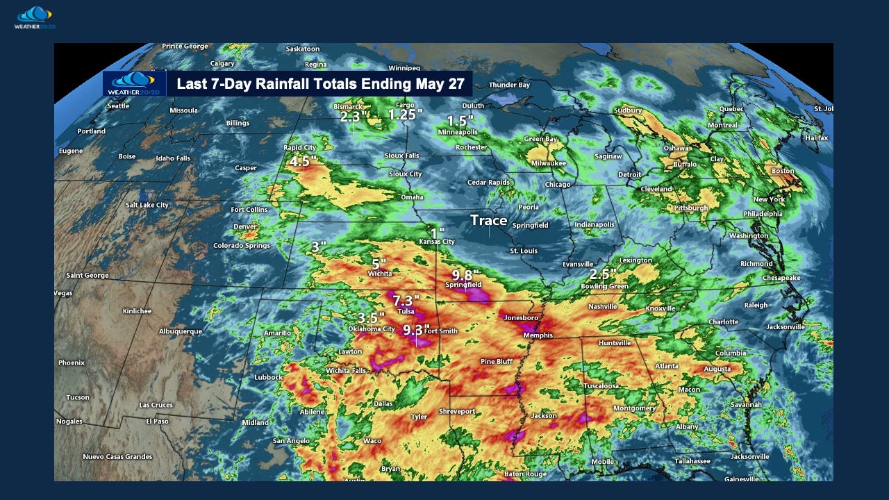
As we’ve seen time and time again this year, the LRC doesn’t just bring storms on schedule—it brings them back to the same regions, again and again.
Certain zones—especially across parts of Oklahoma, southern Missouri, and the Mid-South—continue to get hit with round after round of rain. Meanwhile, just a few counties away, it's been a frustrating weather pattern to experience with so many near misses and lingering dryness. This sharp gradient is no accident. It's the fingerprint of a powerful, structured pattern at work. It is personally driving my weather mind a bit crazy, even though I know it is this year’s LRC causing it.
But there’s some good news.