Severe Weather Season, Hurricane Season, & The LRC Outlook Through September
Summer is now just six weeks away
Welcome to the Weather 20/20 Intelligence Report! The weather pattern is right on schedule, cycling regularly, and we will look at the 80-day prediction of the current severe weather risks, another look at the Hurricane Season forecast, and we will post the LRC model predictions for the northern plains today.
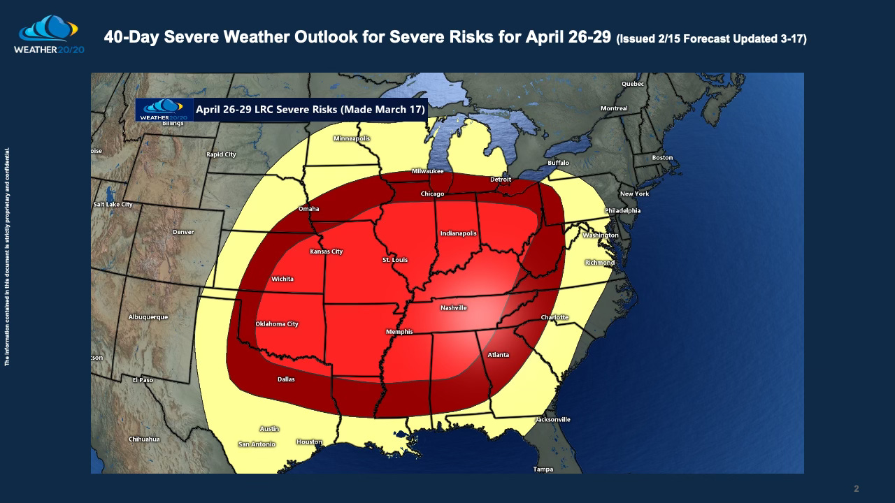
Severe weather season has been a lot more active during the past month. Last week we shared with you this forecast (the yellow, dark red, and bright red shades show the prediction made 70-days before and updated 40-days before this part of the pattern cycled through:
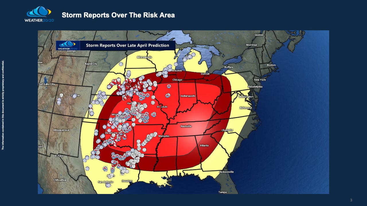
This segment of the cycling weather pattern has now produced three of the largest severe weather outbreaks since October, when the 2023-2024 LRC began. Three people were killed in the mid-March version, and this is why I extended the risk into Ohio. As you can see below, the severe weather happened over the western half of the risk area:
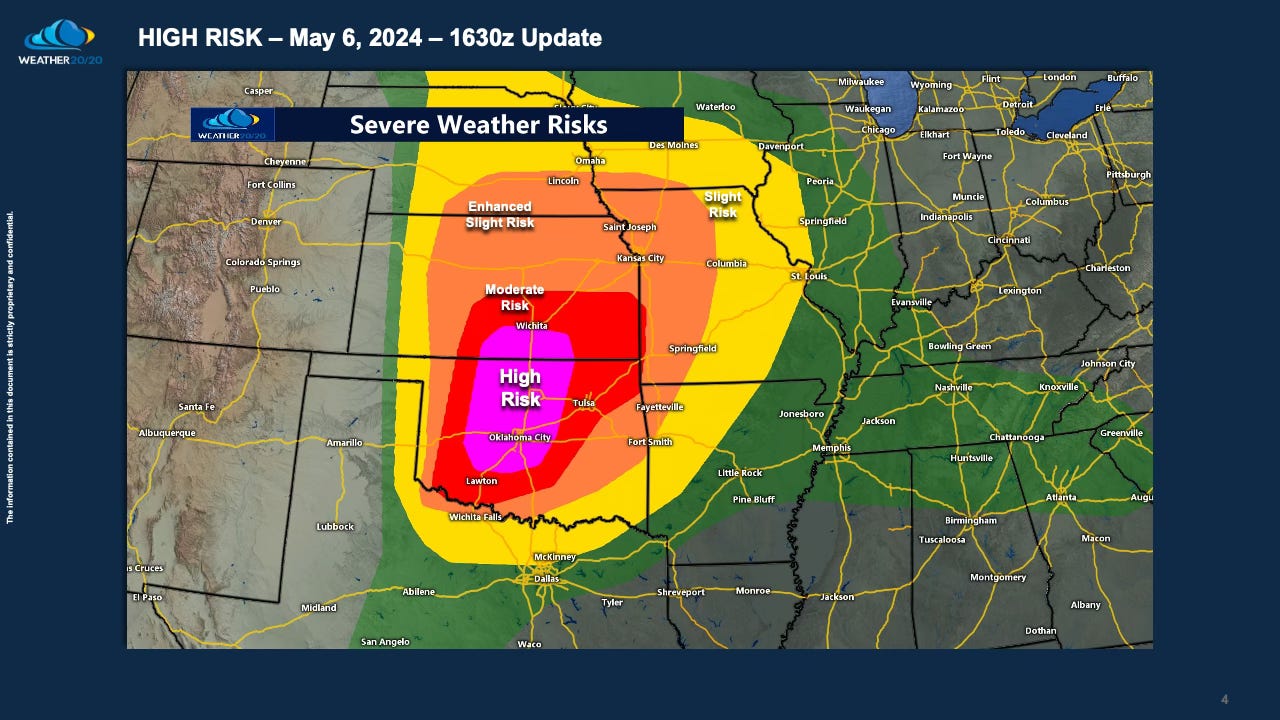
The late April version may not have produced in the eastern half of the outlook from 40 days earlier, but compare that to the high risk from yesterday’s outlook from the Storm Prediction Center. The worst tornado formed east of the High Risk outlook. When you compare it to the LRC-based prediction from Weather 20/20, it shows the 80-day outlook may have been a bit more accurate than the 1-day SPC outlook:
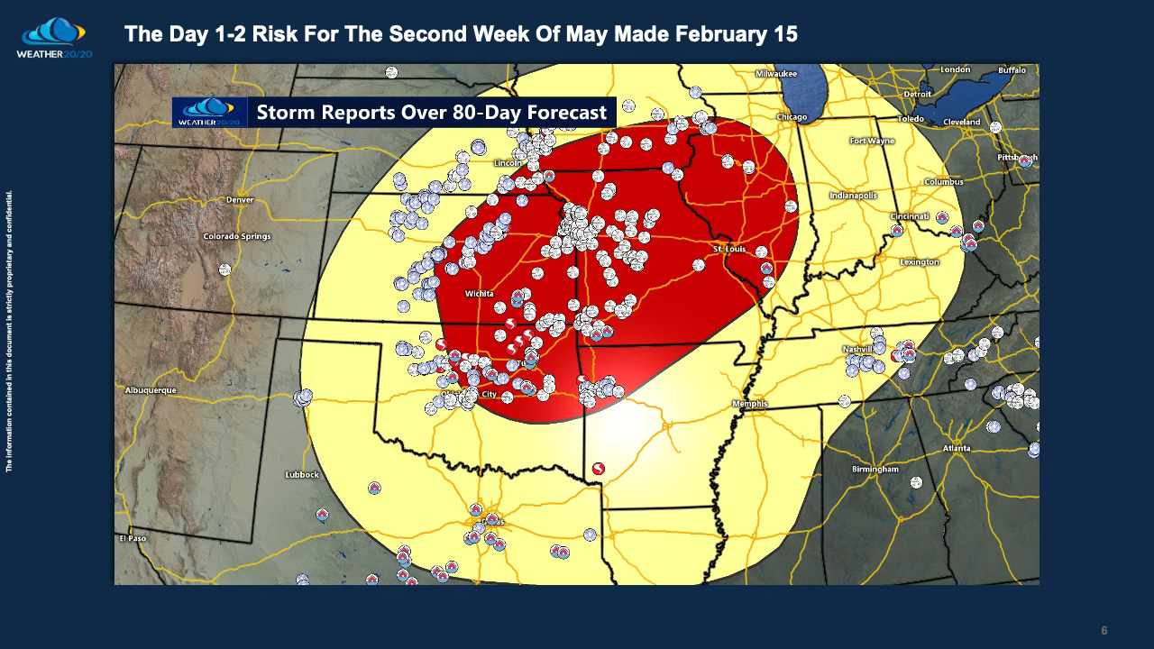
This high risk was likely a bit overhyped as there apparently was only one long track tornado reported and experienced. This next slide shows the 80-day prediction made by using the LRC methodology valid this week:
Here is the verification showing how the worst of the severe weather occurred right over the Weather 20/20 prediction made 80 days earlier:
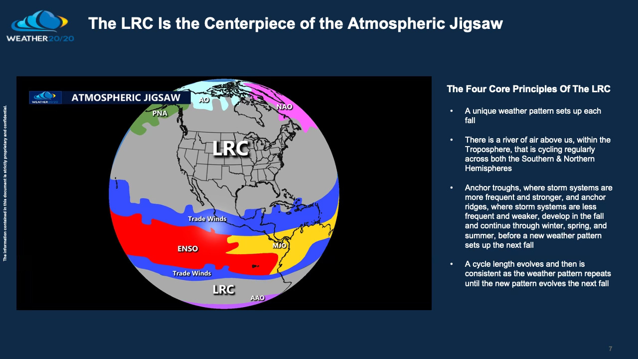
There is only one way known in meteorology to make an accurate prediction like these showcased in the past few slides. There is deep scientific analysis and also a lot of art from instincts that weather forecasters achieve through years of practicing weather forecasting. Science and art combine to create the centerpiece of the big atmospheric Jigsaw:
As we approach the onset of summer, which is just six weeks away, significant changes in the strength of the winds aloft will be taking place. The jet stream, a key player in shaping weather systems, will gradually weaken and shift northward as temperature contrasts across the Northern Hemisphere diminish. While severe weather risks persist into the summer months, the likelihood of tornadoes decreases significantly, with the risk plummeting by around the first day of summer.
Why does this transition occur? As the jet stream weakens and shifts northward, the winds aloft lose their strength. This reduction in wind shear diminishes the formation of supercells, which are often associated with tornadoes. Despite the increasing heat and humidity—both prime ingredients for thunderstorm development—the weaker upper-level winds dampen the tornado threat by mid to late June and throughout the summer months.
While a few tornadoes do still occur throughout the summer months, the number is always lower during the summer, but some segments of the cycling weather pattern will still produce, particularly those predicted through the Lezak Recurring Cycle (LRC).
Well, this isn’t summer; this is today! I went up to near the Eisenhower Tunnel, just 45 minutes from where I live. I-70 was closed, and I was able to turn around and go to the previous exit to capture this winter scene. This is Sunny & Rainbow The Weather Dogs in the snow:
In Today’s Video I will end with another look at the Hurricane Season Forecast. Here is today’s video:


