


Snowstorms, Rainstorms, Thunderstorms, Ice Storms, & Another Cold Outbreak
Let's showcase how the LRC predicted just about everything that is happening in the weather right now!

Welcome to the Weather 20/20 Intelligence Report. In this discussion today we are going to showcase a few strong “You Can’t Make This Up” examples of the Lezak Recurring Cycle (LRC). I’d like to welcome all of our new customers and thank our premium customers for being along for this ride of scientific discovery. We are all sharing in this experience together.
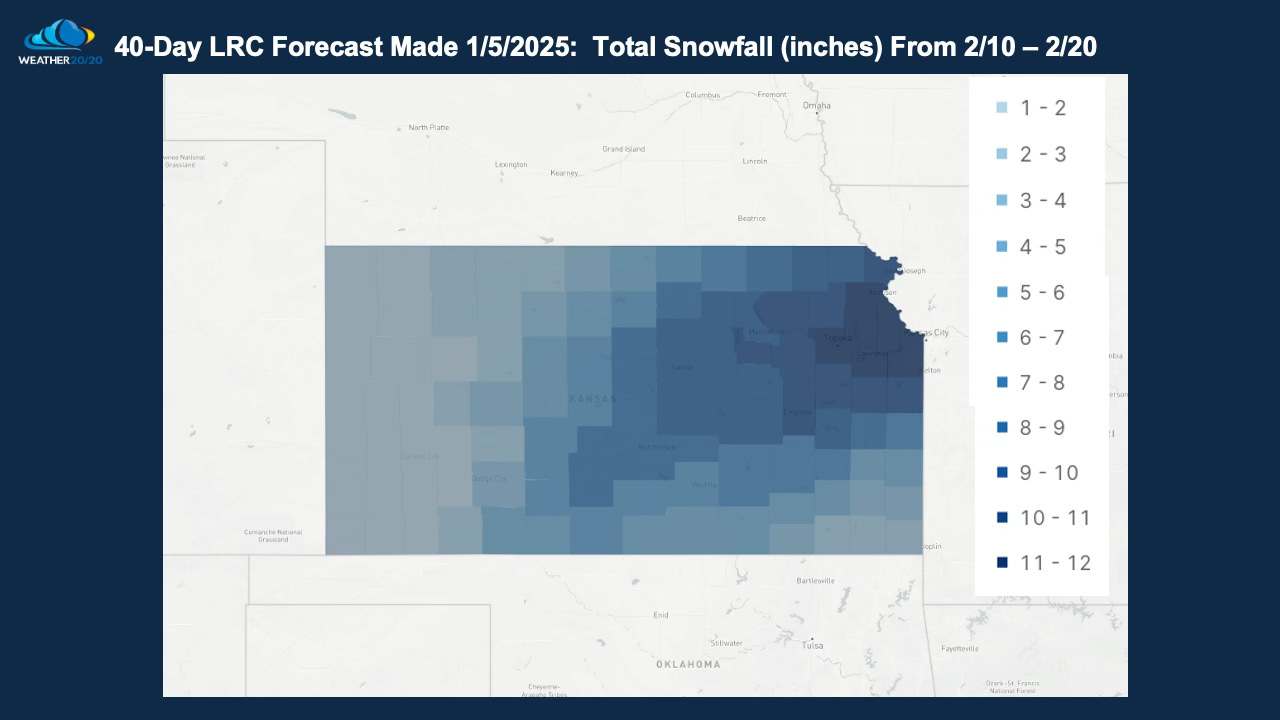
This next ten day stretch, that we are in right now, was forecast to be a snowy one for areas around Kansas City, and this forecast was made by the LRC model 40 days ago. Let’s begin with a look at the set up for snow on Wednesday, February 12th:
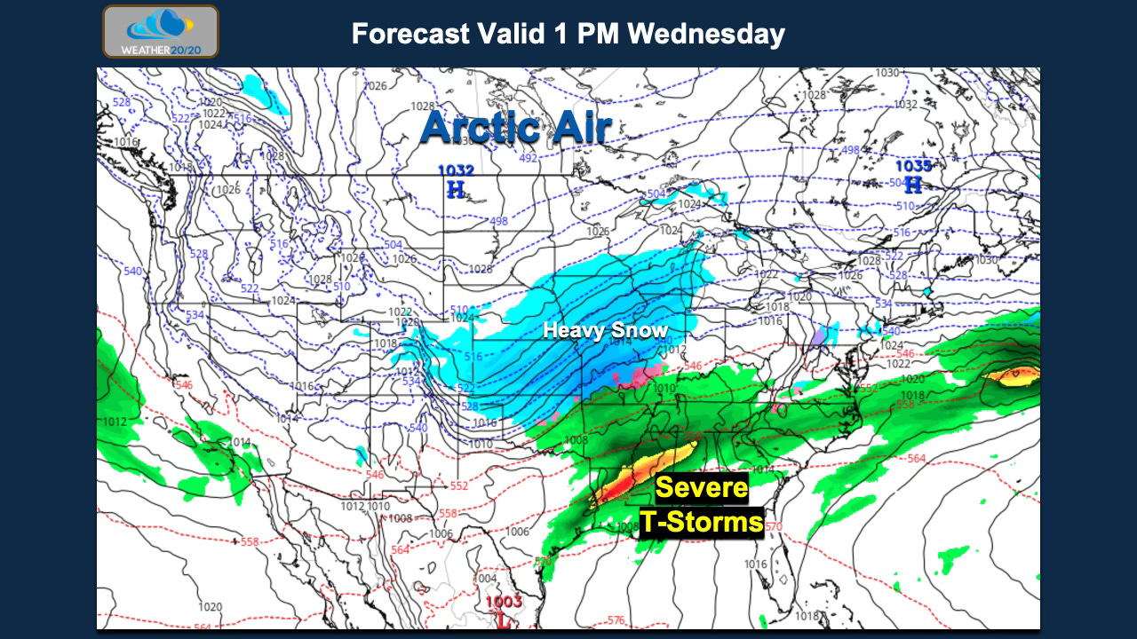
This large area of snow is being caused by a series of waves that are in a negatively tilted trough moving out over the plains and southern Rocky Mountains. Snow will extend from Nebraska and Iowa, where there hasn’t been that much snow this winter, up to this point, and then south over Kansas and Missouri into northern Oklahoma.
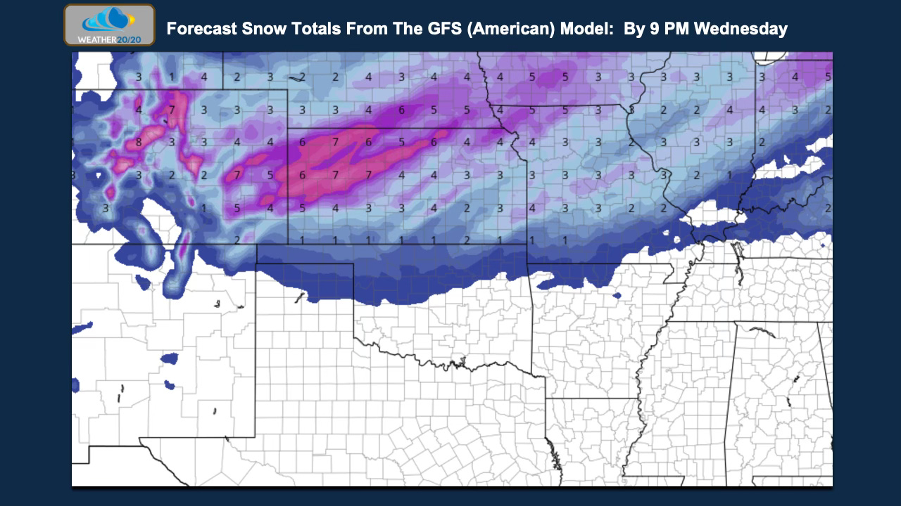
The latest snowfall forecast from the American Model (GFS) shows the widespread snowfall accumulations of 3” or higher extending northeast to Chicago.
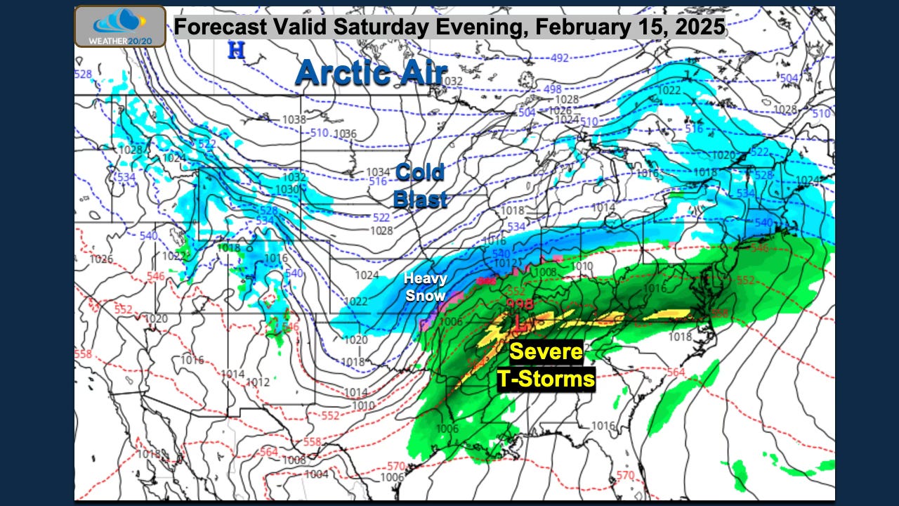
Do you remember the blizzard that hit parts of the plains including Kansas City on January 5th? The segment of the LRC that produced that storm and others is cycling through now, and as many of you know the patten has been cycling every six weeks or so. We are now in the fourth cycle of this year’s pattern. The latest GFS model shows the winter storm this weekend:

Severe thunderstorms are also possible, if not likely over the southern states. Here is the first “You can’t make this up” moment of today’s report. The severe weather risk on day 5 from the Storm Prediction Center today is shown on the left side of this next slide, and on the right is what happened while KC was having a blizzard on January 5th:
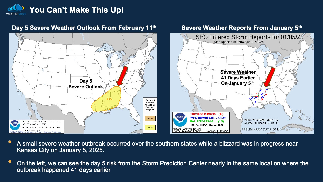
You can’t make this up! The risk is almost in the same spot as the area that got hit in the last cycle. Yes, this part of the pattern is likely going to produce some big severe weather in the next few cycles and our severe weather forecast guide will be coming out in just one week.
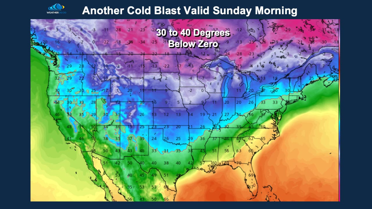
After this storm goes by, cold air will blast in two or three more times. One of these cold blasts arrives this weekend as shown below.
Here is today’s video:
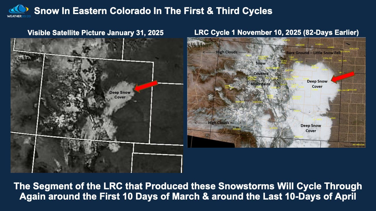
Okay, here are some more “You can’t make this up” moments that have recently occurred. No matter where you live, these things are happening on cycle all of the time. This next one shows the snow storm comparison from Colorado:
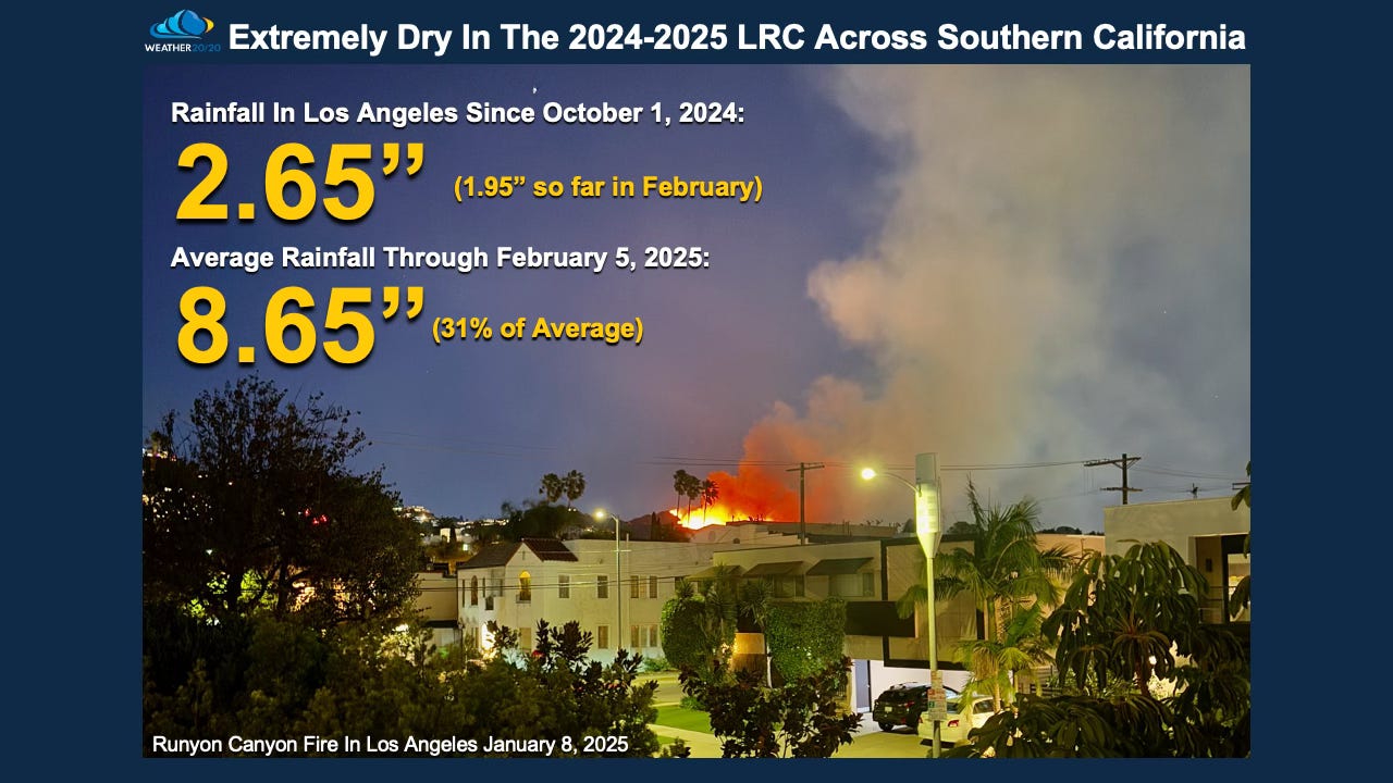
Southern California is about to get hit by a storm. They are finally catching up on some much needed rainfall, but still way below average for the season. The rains that have fallen have also been right on the LRC schedule:
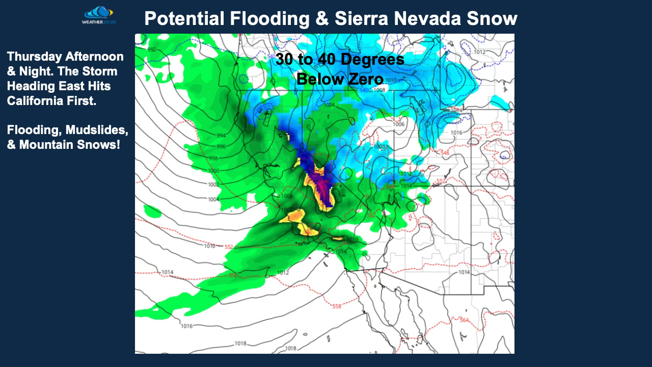
The storm heading towards the Rocky’s and Plains will hit California first! And, yes, this one is also on schedule!
The part of the pattern that produced the New Orleans storm is likely not going to produce snow again when it cycles through in two to three weeks, but it will likely produce a cold front and some thunderstorms.
What is causing this crazy weather? There is a lot in motion right now that is rather significant and actually somewhat rare happening now within the troposphere, the lowest layer of the atmosphere where 99.9% of weather happens. There is a big atmospheric jigsaw and the LRC is the centerpiece of this big puzzle. There are other influences. These other influences explain some of the why it has been so cold, but the LRC provides the when and where significant events will happen around the world:

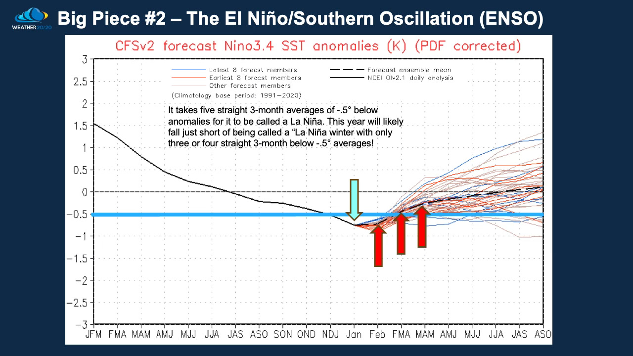
Two of the biggest influences are shown in the El Niño Southern Oscillation (ENSO) Index. We are likely going to end up calling this an ENSO neutral winter as it takes five consecutive 3-month averages of -.5° below average or lower to be called a full La Niña winter. As you can see above, if this prediction of ENSO is correct, the temperatures over the tropical Pacific Ocean are forecast to rise above that critical threshold in the next month to six weeks ahead of us. What will this mean? I believe it means that precipitation patterns will shift west a bit over the corn belt to begin producing a wet spring ahead in many locations.
Another influence, a big one, is called the Arctic Oscillation (AO). The AO is forecast to dip to near -5 in the next few days, just as Saturday’s storm develops. This is rare territory, and it just happens to be right on cycle with this year’s LRC, as you can see the other big dip negative happened around January 5th when the blizzard formed and nearly a foot of snow fell in KC.
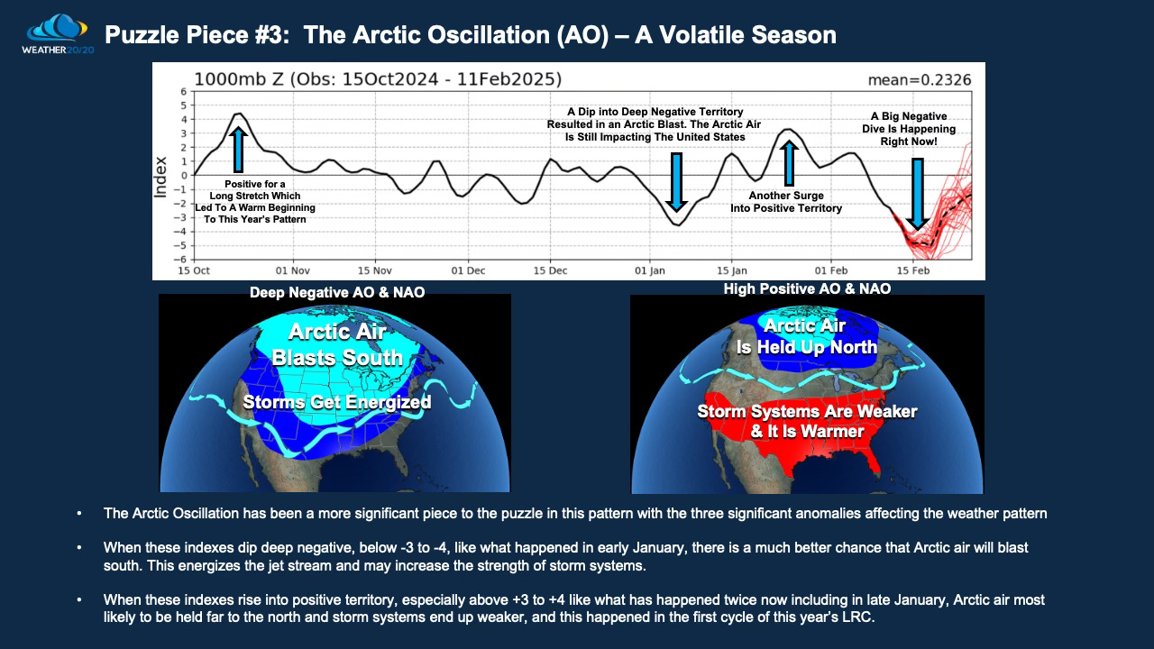
The LRC begin with an AO+ influence which likely led to the warm beginning to this year’s pattern. So as much as the LRC helps us tremendously to know when and where just about everything we experience weather wise on earth will happen, it still only provides strong hints on when it will turn cold and influence the storm systems. This big AO dip to deep negative happening now is leading to these cold blasts! Are these predictable? Yes, and the LRC is the most important factor with these other influences also added in to the weather forecasting accuracy equation.
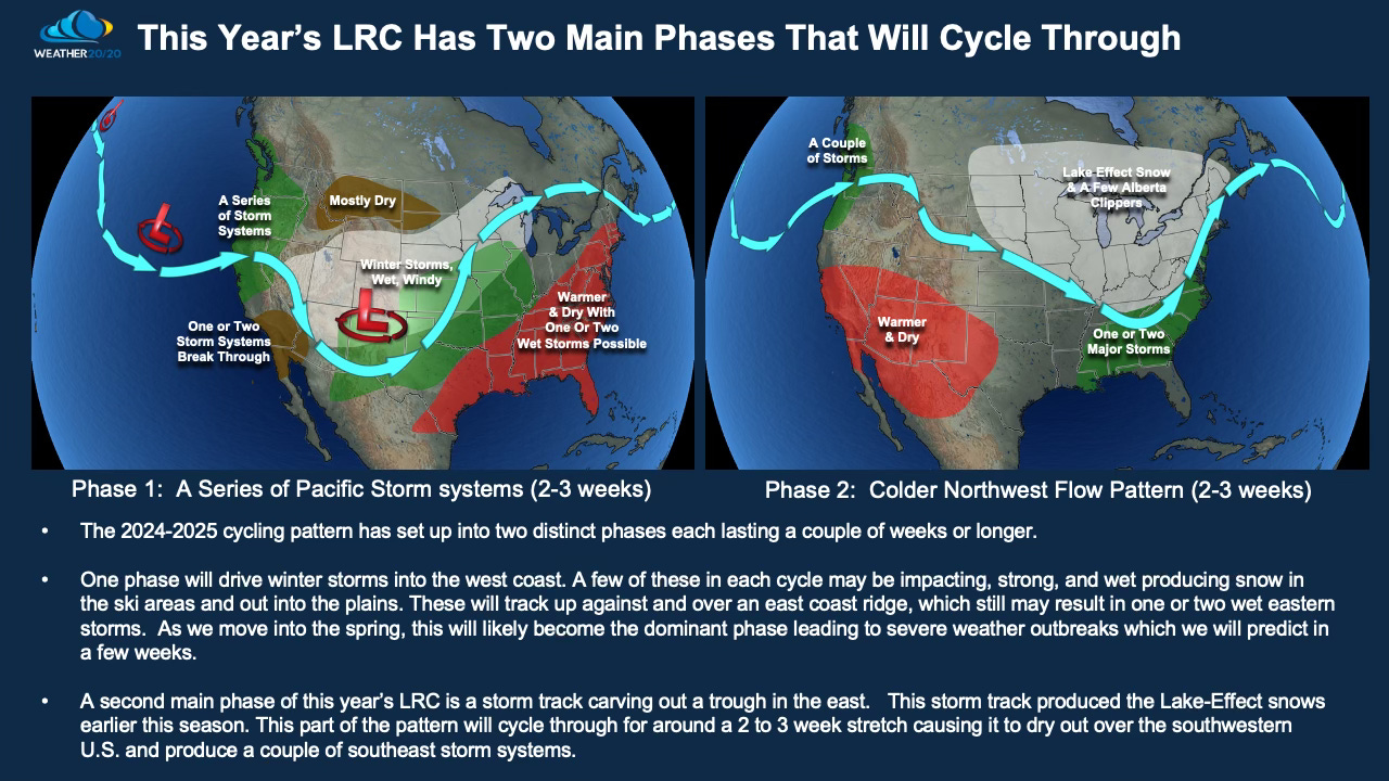
We are currently in phase 1 of the LRC this season with Phase 2 beginning late next week. Before this phase change happens there are three more storm systems to track. This next one coming up this weekend looks so similar to how it has looked in all three previous LRC cycles. Let’s look at the 500 mb level in all four cycles in this part of the LRC beginning with what happened right before the KC January blizzard:
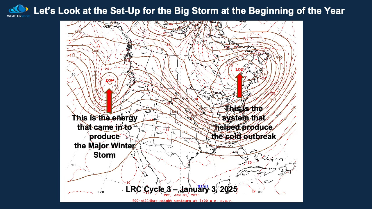
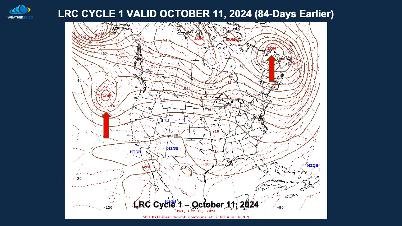
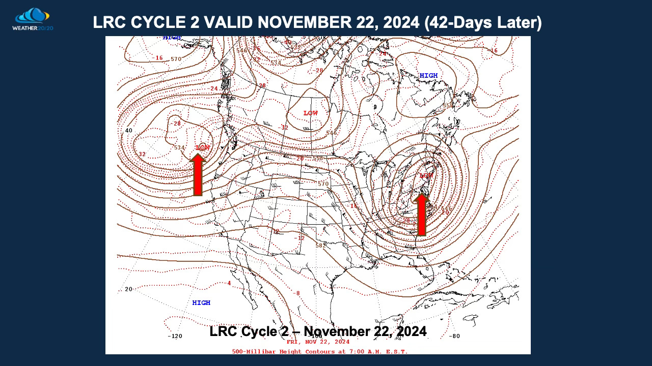

The three previous cycles are shown above, and the current forecast valid two days before Saturday’s storm is shown below:
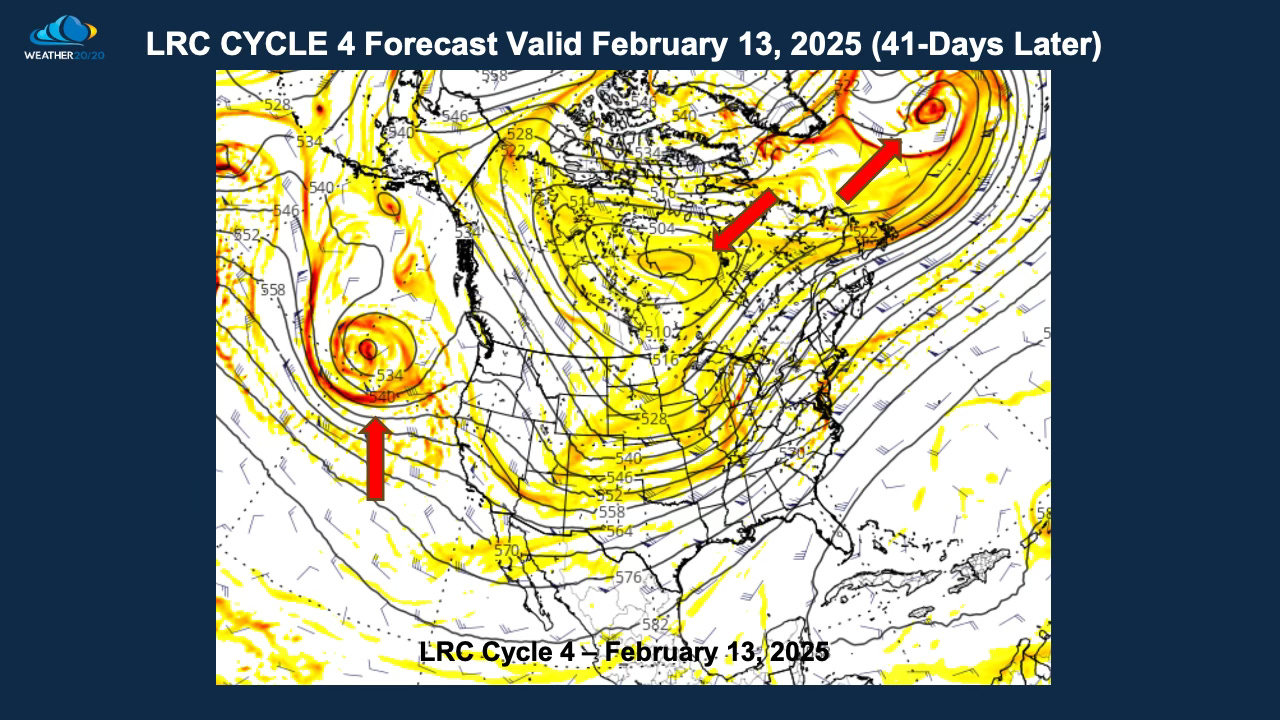
As. you can see, the patterns are rather similar in each cycle just before it snowed in Kansas City in November and January. The October version was influenced by a developing AO+ and this first cycle didn’t produce a snowstorm.
The latest GFS model is getting some support from other models. Let’s see how Saturday sets up in the coming days.
The LRC model picked out this snowy ten day stretch 40 days ago as you can see here:
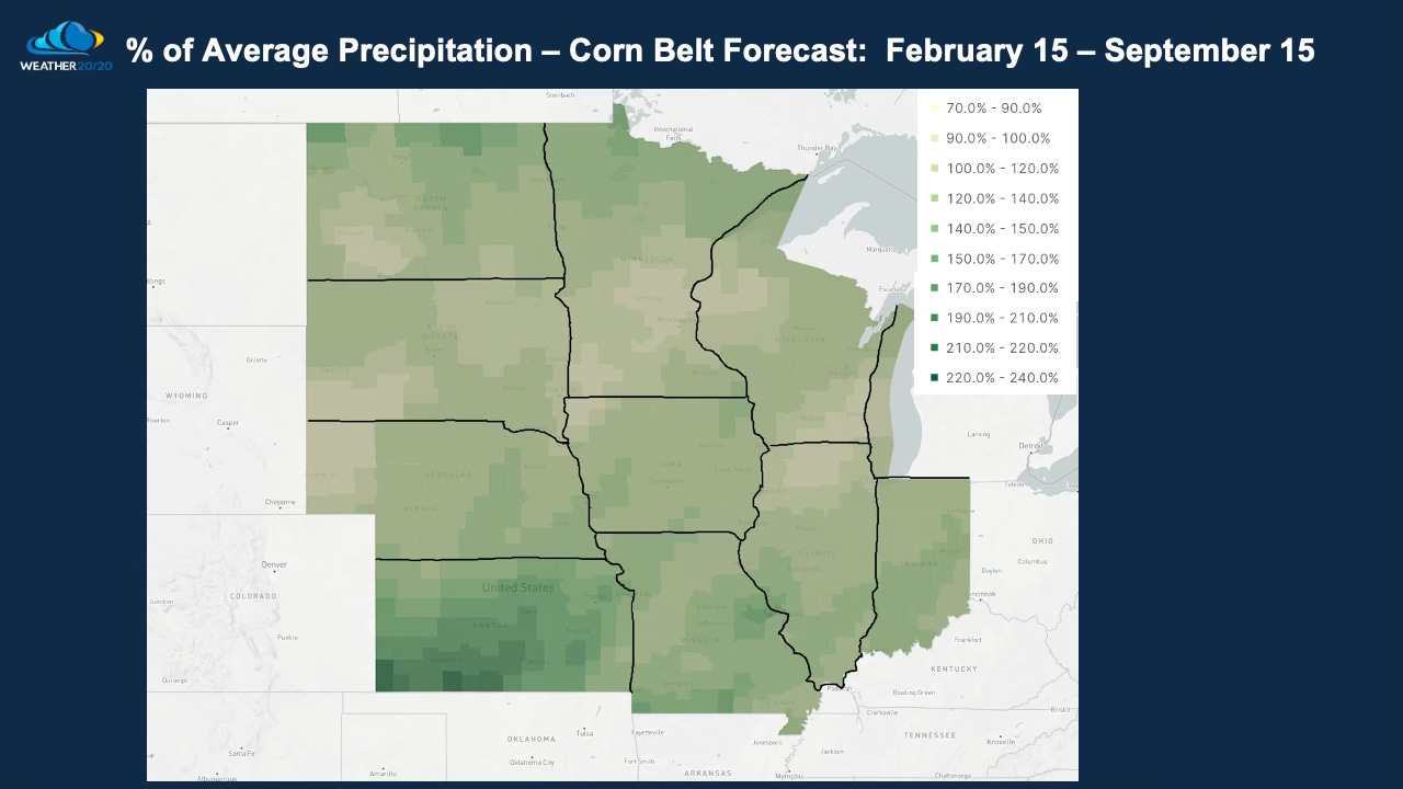
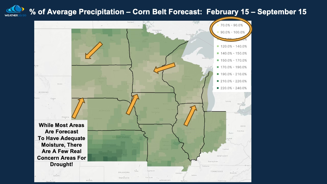
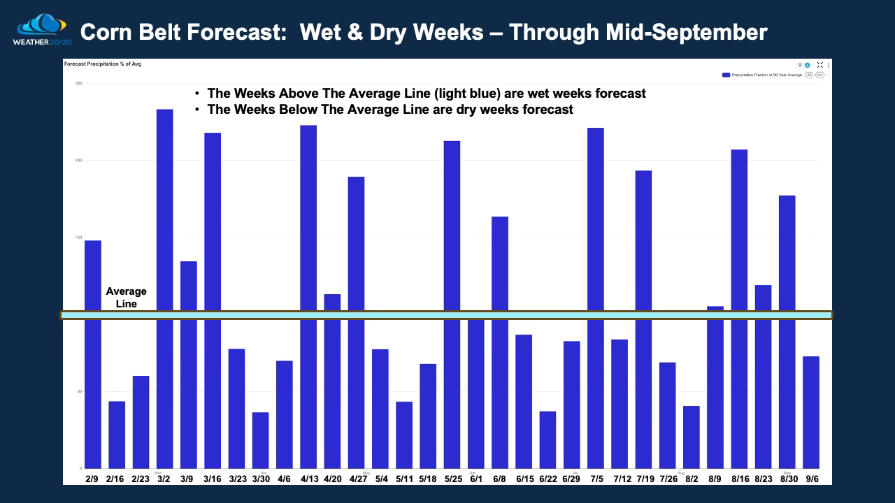
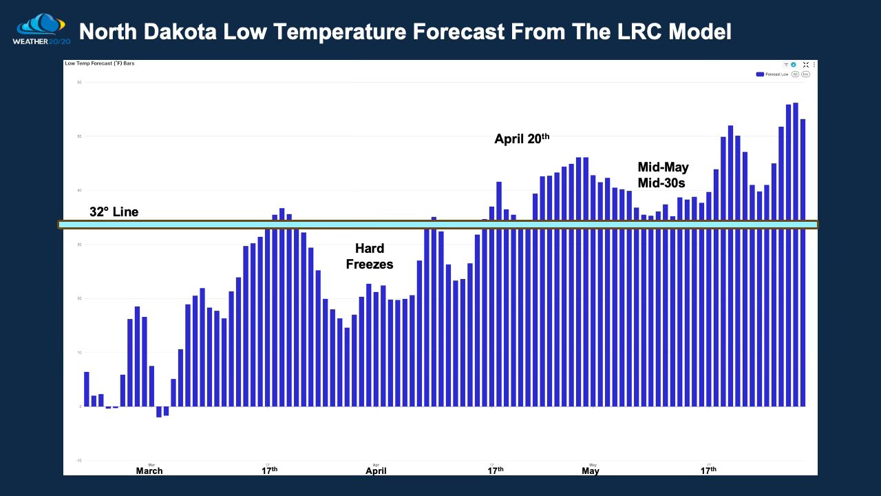
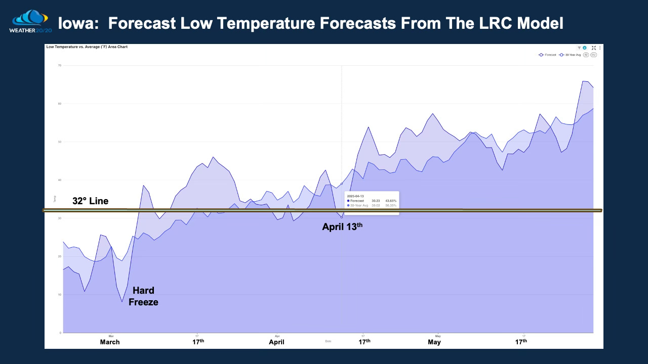
Here is a look at the latest LRC model predictions for rainfall and for potential late freeze dates. We will keep track of this and discuss further in the weeks ahead. With La Niña not quite fully developing and weakening, we are forecasting drought areas to shrink and not expand. There are a few concern areas.
I am sure there are questions, so let me know what is on your mind. let’s have a discussion. Have a great day!
Gary
We will be cycling back into Phase 1 of this year's LRC at that time. Let's see where the Arctic Oscillation trends in the next couple weeks.
I see where the weeks of March 9 and March 16 are supposed to be well above average on precipitation across the cornbelt region. Would you be able to tell me if there would be any concern for winter weather between March 13 and 16th in South Bend Indiana where Notre Dame is at. My daughter’s hockey team is supposed to travel up there for a tournament and just wondering if there could be any winter precipitation on those days. Thanks Rodney