


Spring Is Just A Bit Over A Month Away
Let's Look At The LRC As We Cycle Into Mid-February

Welcome to the Weather 20/20 Intelligence Report. Thank you for being premium customers of this report as we share with you the LRC. In this report we will go in-depth into the patent pending LRC Model as spring rapidly approaches.

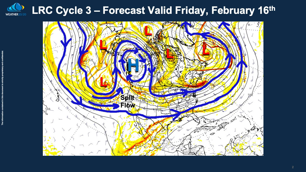
This map above shows the weather pattern at around 18,000 feet above us, which is around half way up in the atmosphere in weight. One big feature showing up on this forecast valid on Friday, February 16th, is the big upper level high over northwest Canada, just southeast of Alaska. The flow of air crosses the Pacific Ocean and then splits apart near the west coast of the United States. This split flow has been a dominant feature that has returned over and over again in the past few months.
Storm systems have gotten caught in this split flow, and they have turned towards California and blasted the Golden state: