


Spring Is Throwing Us Some Curveballs
Everything is right on schedule as we move into the sixth LRC cycle

Welcome To The Weather 20/20 Intelligence Report!
Let’s begin by examining the current storm system — and I’ll show you how it’s right on schedule. Remember, we’re sharing with you what we believe is one of the biggest scientific secrets in meteorology. We truly appreciate your trust in us as we provide insights we believe are invaluable to your operations.
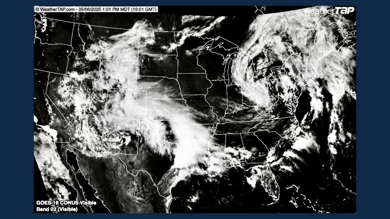
This storm, now weakening as it moves out over the southern Plains, has already produced significant rain and snow across New Mexico and Colorado, then rain through the Texas Panhandle and Oklahoma. It’s now finally spreading some rain toward Kansas City.
As you know, we’ve discussed this part of the cycling weather pattern many times. We’ve been calling it the “Kansas City Blizzard Segment of the LRC” ever since the 11-inch snowstorm hit KC on January 5th.
Now, let’s look back at May 4th and January 4th — the day before this current storm and the day before that blizzard.
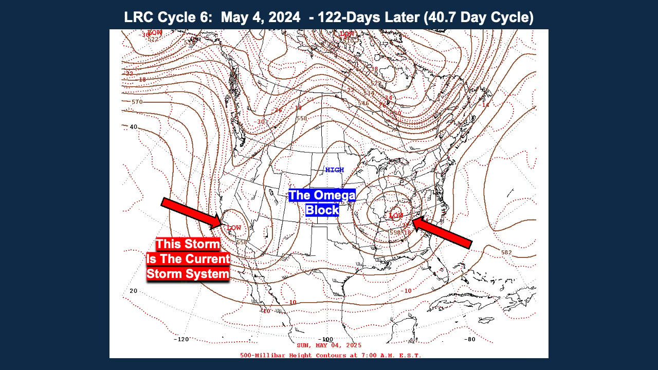
The 500 mb level is half way up in the atmosphere in weight and a great level of the atmosphere to see the LRC, experience the cycling weather pattern. It is around 18,000 feet up and unaffected by surface friction. Look at the map above and compare to the map below. In the video I will try to make it come “alive” for you, as you can’t make this up.