Storm Systems Tracking Across The USA
An analysis of the cycling pattern and some impacts that are showing up

Welcome to the Weather 20/20 Intelligence Report!
To our long-time premium members and to the many new customers joining us — thank you for being part of this breakthrough in long-range forecasting. The purpose of this report is not only to inform you, but to help you act on long-range weather predictions that can improve planning, reduce risk, and create opportunity in the months ahead.
We begin today with an analysis of this week’s series of storm systems, followed by an updated look at the evolving seasonal pattern and what it means for your region.
This wild and highly active weather pattern is cycling right on schedule according to the Lezak Recurring Cycle (LRC). The key question now is: What does this mean for your region in the weeks and months ahead?
Let’s begin with a long range freeze outlook for Kansas and Missouri, and then discuss the evolving pattern this week:
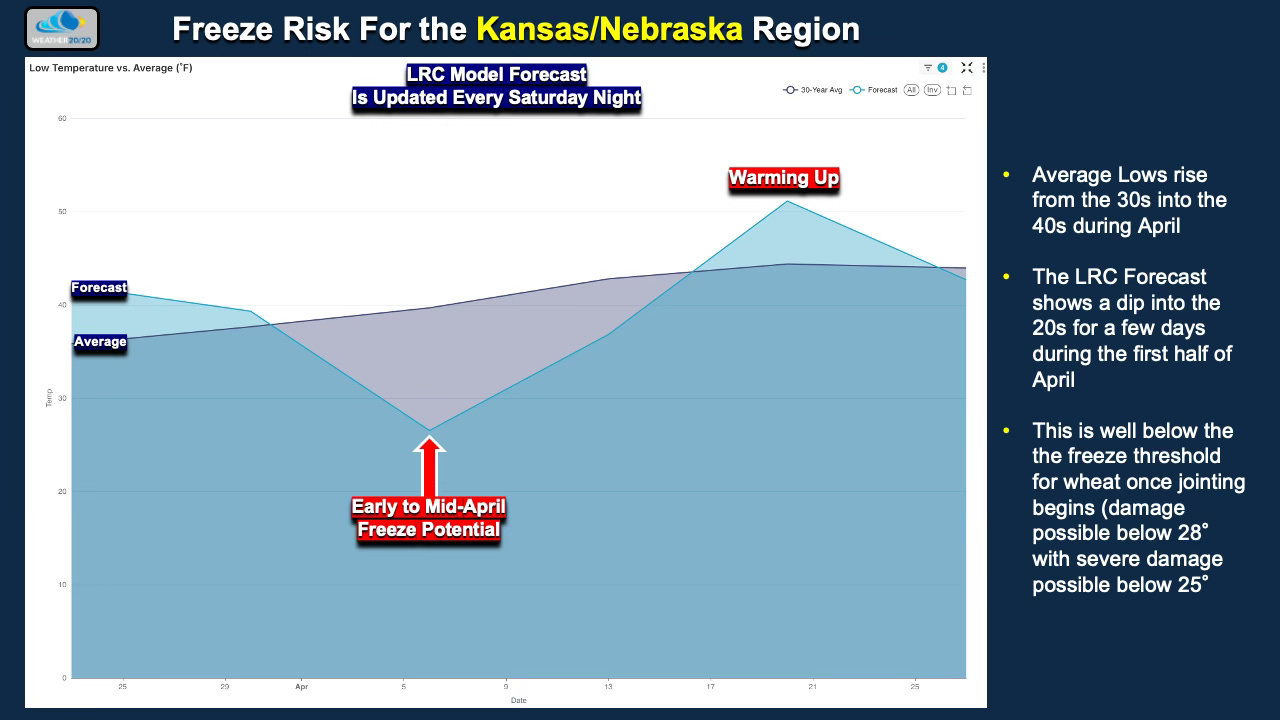
As winter wheat begins to emerge across the Central Plains — particularly Kansas and southern Nebraska — attention is turning to late-season freeze risk. The Weather 20/20 LRC model indicates a potential cold snap in the first half of April timeframe, when overnight temperatures could fall into the mid-20s or lower across portions of the winter wheat belt. If the crop has reached the jointing stage by that time, localized freeze stress could develop, making this an important monitoring period for producers. This forecast is valid in just 6 to 7 weeks from now.
This Week’s Outlook:
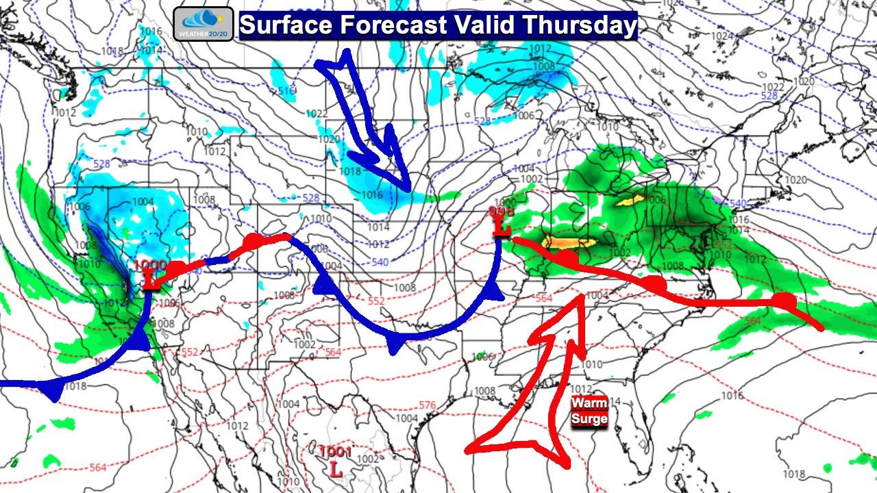
An active storm track is in place across the United States this week, with the overall pattern moving somewhat faster as a series of systems races from west to east.
The first forecast map shows the surface pattern valid Thursday. A fast-moving system will spread light snow across parts of Nebraska — a region that has been quite dry — but precipitation totals will be limited and will not provide much drought relief. Farther east, precipitation becomes more widespread from Indiana into the Mid-Atlantic, where a surge of warmer air will turn most of the precipitation into rain.
However, stay alert: as we will show in a moment, another significant winter storm could be developing for the Northeast in less than a week.
Meanwhile, another storm system is moving into central and northern California on Thursday, the latest in a continuing series of Pacific storms affecting the West.