


Summer LRC Produces Historic Flooding Disaster – What Is In The Forecast?
The Pattern Continues To Cycle Right On Schedule

Welcome To The Weather 20/20 Intelligence Report:
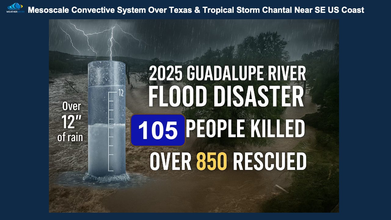
The tragic flooding disaster that unfolded along the Guadalupe River in Texas is one of the deadliest weather events in recent memory. With at least 105 lives lost, families shattered, and amazing stories of survival, this has become a defining moment in what has already been a volatile summer. Our hearts go out to everyone affected — the magnitude of this tragedy is immeasurable.
At Weather 20/20, we are committed to showing that there is order within the chaos. This horrific event was not completely random. It had a level of being predictable. The LRC — the Lezak Recurring Cycle — once again revealed its hand, and in this report, we will take you inside the pattern that contributed to this disaster. We will show you how it was rooted in a weather seed from last fall, tied to Tropical Storm Nadine, and how this segment of the cycling pattern returned right on schedule.
As we move deeper into July, we’ll share with you exactly where we are in the cycle right now, using the power of the LRC and our proprietary Weather 20/20 Vision Dashboard. And to help you plan ahead, we’ll highlight one small example of an outlook for next winter — even though we will showcase how the weather pattern will change, evolve into the new LRC by around October 5, now less than three months away.
This is not just about science. It’s about saving lives, protecting businesses, and helping decision-makers act with confidence.
Let’s look at an LRC connection to the disaster and how moisture from Tropical Storm Barry may very well have put this flooding event over the top.
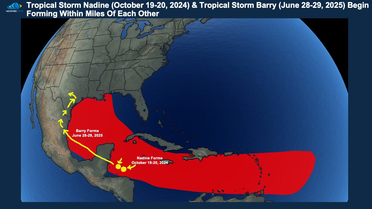
A unique weather pattern sets up each fall, and Day 1 of the new LRC pattern is identified each year around October 5–7. Any tropical system that forms on or after this key window becomes what we call a “weather seed.” These seeds are embedded within the newly established pattern and may grow into organized, named tropical storms during the next hurricane season. In the case of this year’s disaster, Tropical Storm Nadine — which developed just a couple weeks after Day 1 in October — planted the seed that Tropical Storm Barry would follow months later, almost on the exact same track toward Texas. Nadine fell apart over the Yucatan Peninsula, and then over 8-months later Tropical Storm Barry forms and becomes a problem, a big problem for Texas.
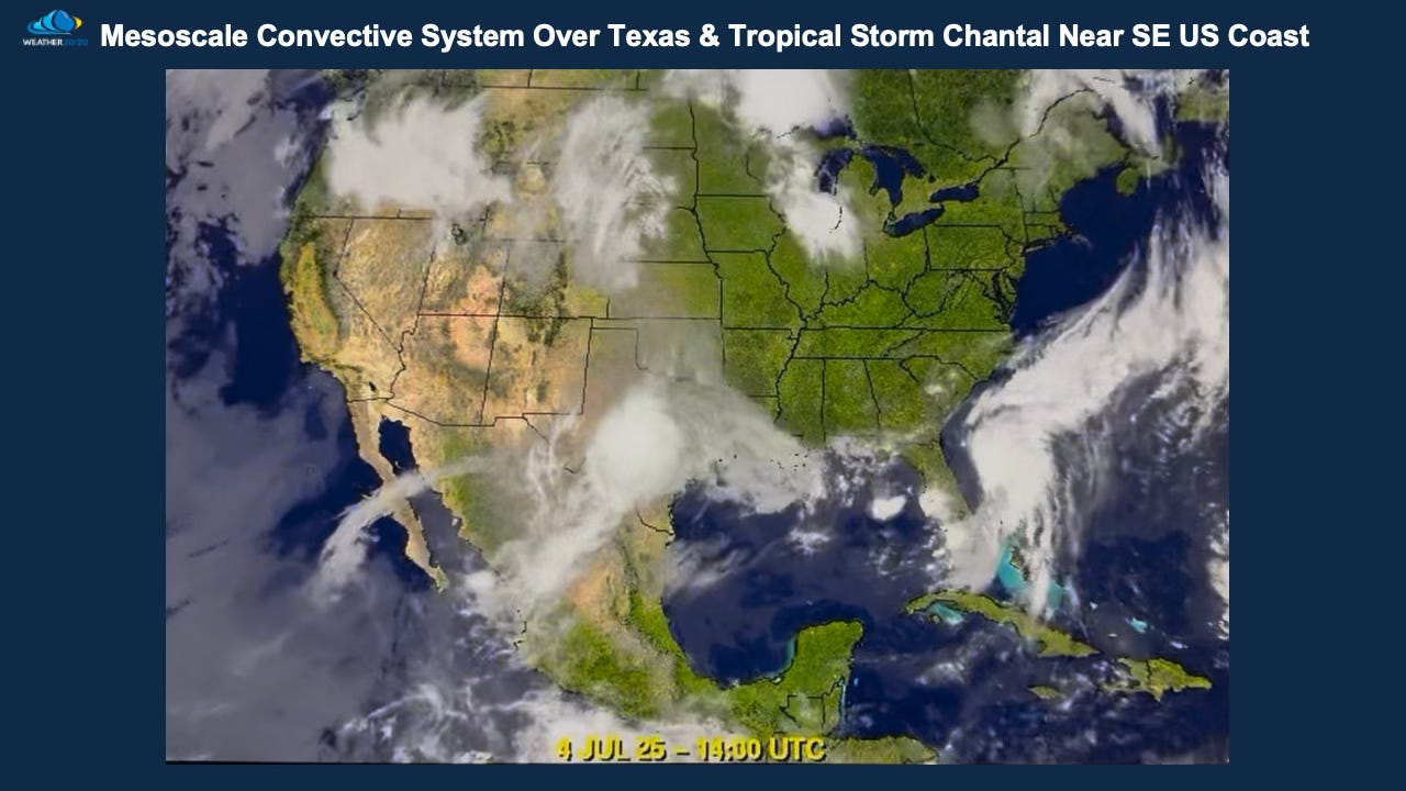
Watch this video and look carefully at Barry coming into Mexico then gradually moving into Texas a few days later, then the moisture gets pulled into the complex of thunderstorms that produced the flood, and then in the second, main video, I describe the predictability and relationship through the LRC: