


Texas Weather Disaster & Tropical Update
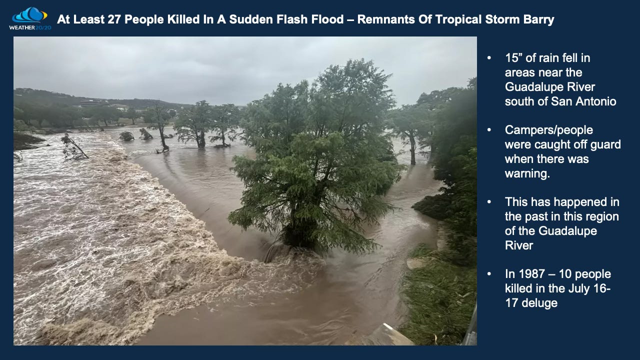
At least 27 people are killed by a raging flash flood in Texas

Welcome to the Weather 20/20 Tropical Update.
Our next full Weather 20/20 Intelligence Report will be posted Tuesday afternoon.
We are tracking a heartbreaking weather disaster that just unfolded in Texas. Moisture from the remnants of a tropical system, enhanced by the monsoon flow and guided precisely by this year’s LRC, contributed to catastrophic flash flooding along the Guadalupe River. Tragically, at least 27 lives have been lost—18 adults and 9 children—with more than 20 children still missing. Rescue teams have reported scenes of children clinging to trees. The magnitude of this devastation is both terrifying and profoundly saddening. Could it have been prevented?
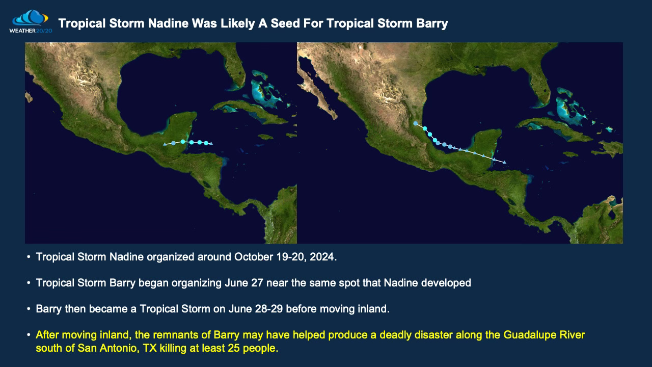
One of the key atmospheric “seeds” that set this weather disaster into motion was Tropical Storm Nadine, which formed last fall on October 19–20, 2024. At the time, we identified Nadine as an early-season signature in the newly developing LRC pattern. Based on our analysis, we projected that this feature would cycle back in mid to late June—with the potential to organize again as a potential named storm during hurricane season, and Tropical Storm Barry was born. That prediction verified right on target.
As the pattern returned, moisture associated with this cycling segment emerged once again, ultimately flowing into Texas and contributing directly to this horrific flooding event. The science behind the LRC not only identified the setup months in advance—it warned of the timing and the potential consequences. So, this devastating disaster may have been mitigated by knowledge of this weekend being a target, even if we only had five days notice. This sudden flash flood was predicted on a level that could have at least provided data and information to perhaps cancel all activities near the river.
Tropical Storm Chantal Forms
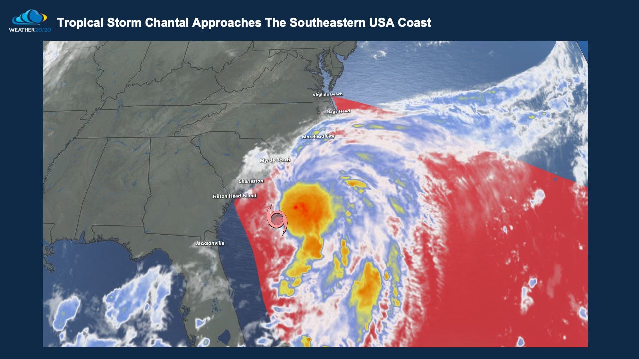
As we continue to process the devastation in Texas, the atmosphere remains active—and predictable. Tropical Storm Chantal has just formed, and this system is tied to another “weather seed” we identified in the early stages of the LRC.
Back on October 21–24, 2024, a distinct tropical signal emerged. We marked it as a feature to watch in future cycles, anticipating it would return with potential for organization in late June to early July. That forecast—issued months in advance—pinpointed this very week as a target window. Chantal has now formed right over our predicted zone, verifying yet another long-range LRC projection.