


The 45-Day Prediction Of This California Storm
We will go in-depth and look into another accurate long range prediction

It’s Groundhog Day! People from around the country waited to see what the famous groundhog would see when he emerged from his hole. And good news: for the first time in two years Punxsutawney Phil didn't see his shadow, meaning that he predicts spring will come early. Fortunately, we have a much more accurate way of predicting the weather by using the LRC.

Welcome to the Weather 20/20 Intelligence Report! A major storm is developing off the west coast as I am writing this updated Weather Intelligence Report. The Northern Hemisphere is currently in the third cycle of this year’s LRC, and California is about to get bombarded by this storm system with potential major catostrophic flooding, high mountain snow, and wind.
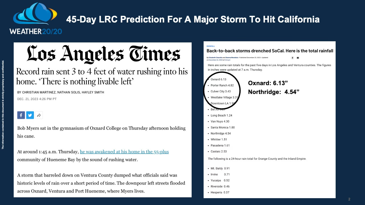
The headlines in a few days may be similar to what they were in the last cycle. Here are some headlines I took screenshots of showing what happened 45-days ago:
Most of the southwest has been near to below average on precipitation this season, and this storm will likely boost the totals to above average for the year. Spend a few minutes watching this video for a discussion of how this part of the LRC is right on schedule and predicted a month and a half ago:
Here is today’s Video:
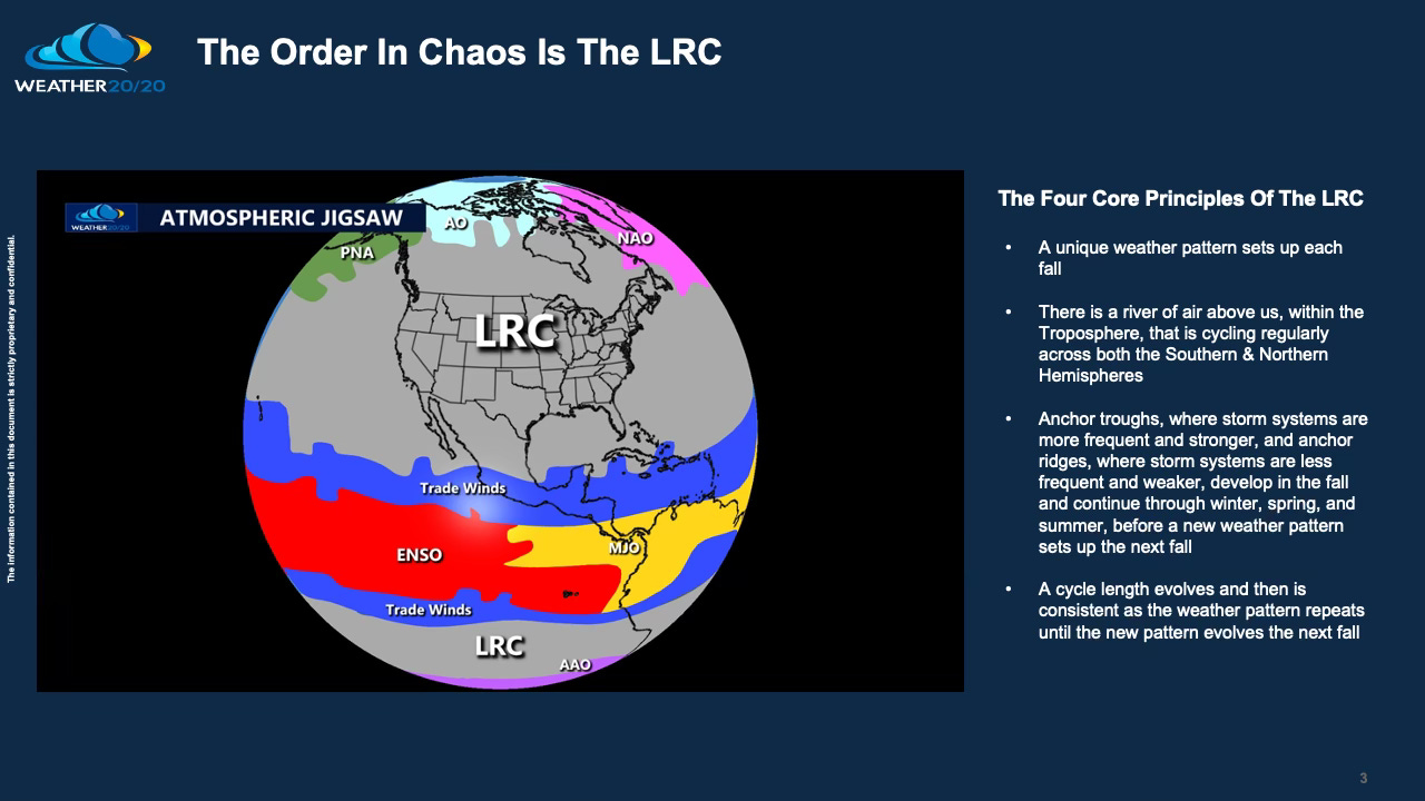
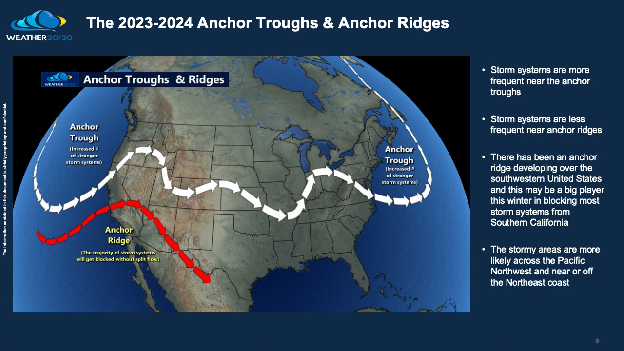
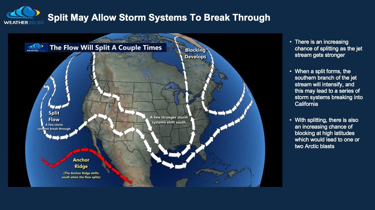
The LRC is the centerpiece of the big atmospheric jigsaw, and this series of storm systems coming in is being influenced by El Niño, the warming of the tropical Pacific Ocean.
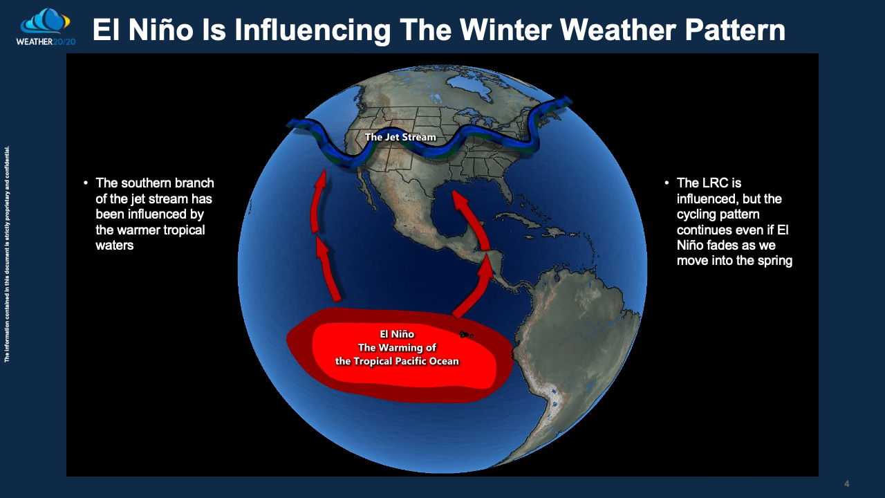
The El Niño Southern Oscillation (ENSO) is just one influence on the overall cycling weather pattern. When El Niño fades by this summer and possibly becomes neutral or even flips to La Niña later this summer, the LRC will not change. The cycling pattern continues regardless of a phase shift in ENSO.
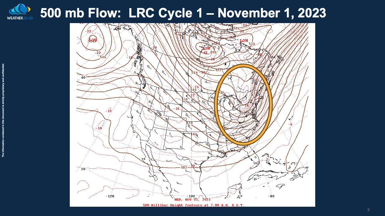
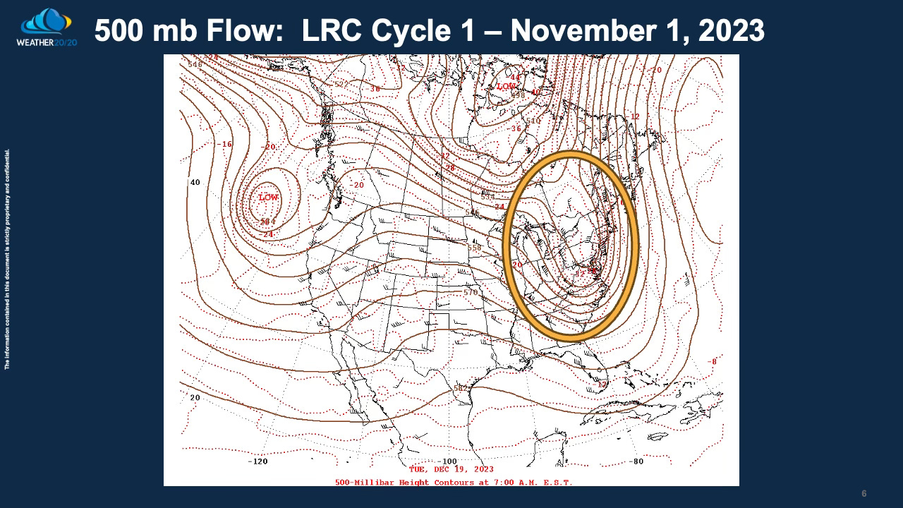
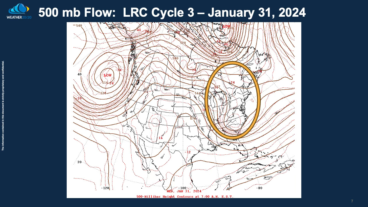
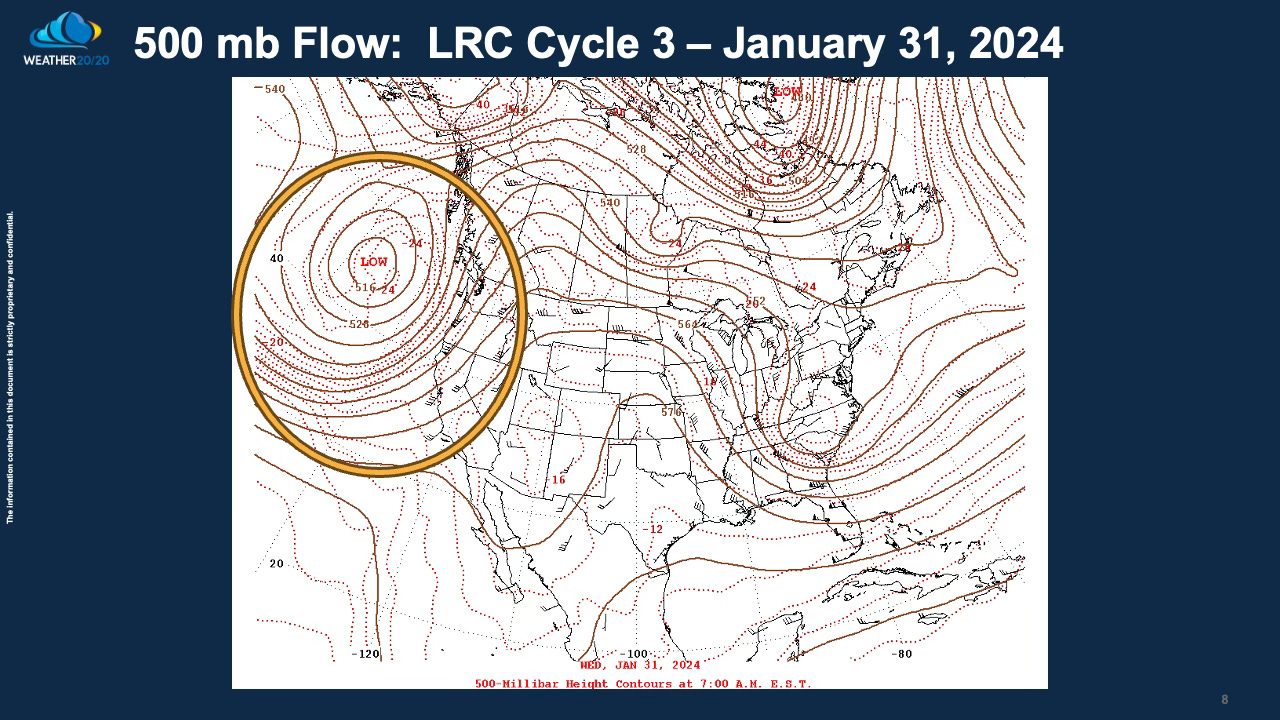
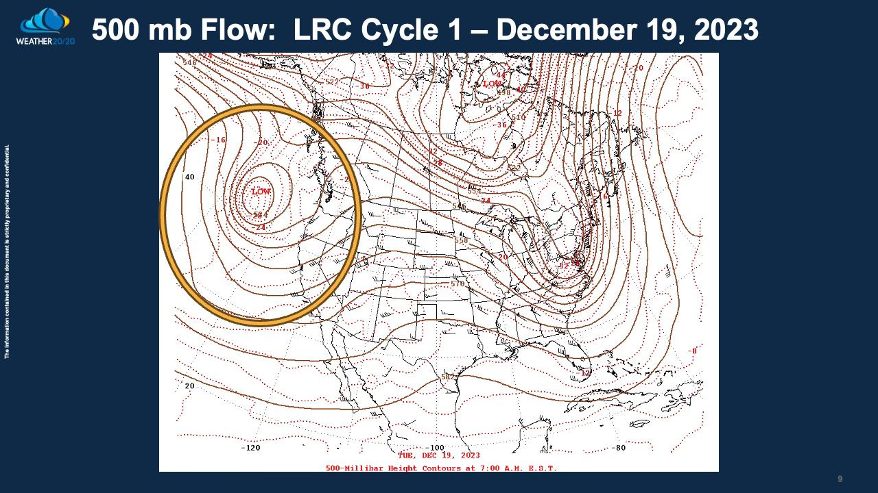
Let’s take a look at the first three cycles of this year’s weather pattern. On this next series of charts, we are looking at the 500 mb (milibar) flow, which is half way through the atmosphere in weight. The top of the atmosphere has no weight at all, or 0 mb, while the average pressure near the surface is 1013.25 mb (29.92” of mercury). So, the 500 mb level is half way through the atmosphere in weight. This is a great level to see the LRC as there is no influence from surface friction. The flow, the river of air above us within the Troposphere, is shown by looking at those lines. The wind blows parallel to these lines from west to east.
I am circling the areas to notice on these charts. Look over the northeastern United States; do you see the trough? This first map shows the trough on November 1, 2023, and then the next two charts show the flow on December 19, 2023, and January 31, 2023; cycles 1, 2, and 3 in this part of the overall LRC. Look closely at how similar the features are in each chart:
Now, look at the storm approaching the west coast in the previous two cycles:
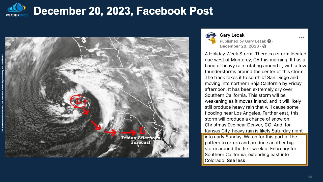
Now that I have established the cycling pattern, take a look at my Facebook post from cycle 2 on December 20, 2023:
The satellite picture that comes in around Sunday is likely going to show a storm very similar to this one. In our winter forecast, we showcased this as a likely development a couple times this winter, and it is happening now:
This is likely an example of how El Niño is influencing the overall pattern, and this pattern has been a bazaar one.
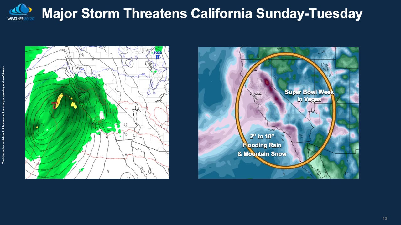
The storm coming in, shown above, has a strong surface low that may form which will increase the pressure gradient, shown by all of the black lines, or isobars bunched together. This will lead to some strong winds with the flooding rains from this second storm system in the series of storm systems.
The Super Bowl is a week from Sunday, and it will likely be a wet start to the week in Las Vegas with 2” of rain or more possible. They have been dry most of this season until right now; great timing for the big game?
California will see the snow levels rise, which could lead to a foot of rain below 6,000 feet and heavy snow up much higher.
Along the coast, 2 - 6 inches of rain are likely again, just like the storm in December.
Two more storm systems in the series:
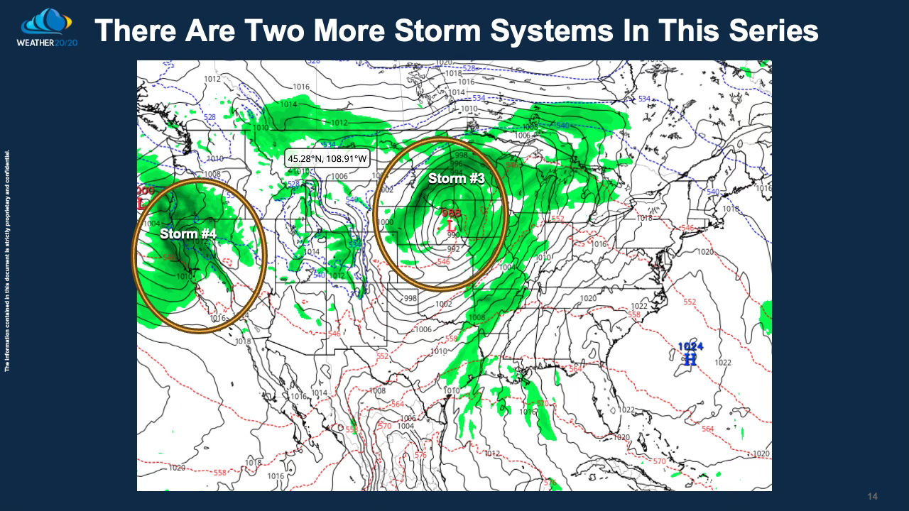
After the passage of this current storm system, our attention turns to two more systems that are predicted to line up. In LRC cycle 2, we experienced a blizzard unfold in northeastern Colorado, extending into Nebraska and South Dakota, accompanied by an uncommon ice storm further north. As we move into the third cycle of the Lezak Recurring Cycle (LRC), we'll closely monitor the development and impacts of these upcoming storms.
Additionally, a final storm in this series is will likely be weaker and track into Northern California in the coming week.
Despite the frequent disturbances, Arctic air remains stubbornly situated to the north, way up over northern Canada. However, there's a notable possibility that it might make one last push southward before the arrival of spring. Our predictions indicate a 60% chance of a robust cold blast, potentially bringing Arctic air into the picture around February 20-29.
We sincerely appreciate you taking the time to peruse this Weather 20/20 Intelligence Report. For our premium customers, we'll be examining the updated patent-pending LRC Model data in our usual Tuesday updated report.
Wishing you a fantastic weekend ahead!
Gary Lezak
Harold, Every time we post, you will get an email to open it up to watch the video and read the post. Thank you for signing up and becoming a premium member. We will keep you informed with the LRC methodology/technology as we move through this unique weather pattern.
Gary. what I really want to know is this. A grain marketing guy I subcribe to is saying with warm weather winter wheat will emerge and then freeze the last part of February. He also saying April will be perfect planting weather during April - but then in the first half of May there is a chance of a major freeze/frost. My neighbor here in in northwest minnesota says we will have a frost during the full moon at the end of may. Also my guru grain guy says the nation will be hot and dry from july into the fall. Do you concur with all this??? Is there any hope for a crop this year? No crop but great prices??