


Welcome to the Weather 20/20 Weather Intelligence Report. Thank you for being members. As summer approaches, the same pattern continues to cycle. Let’s take a look. This is going out to all of our customers, for the premium paid version, it is discounted at just $300/year, or $50/month. After you join, let me know what county you are in, and I will provide a more specific forecast for your county, and you will see the reports each week.

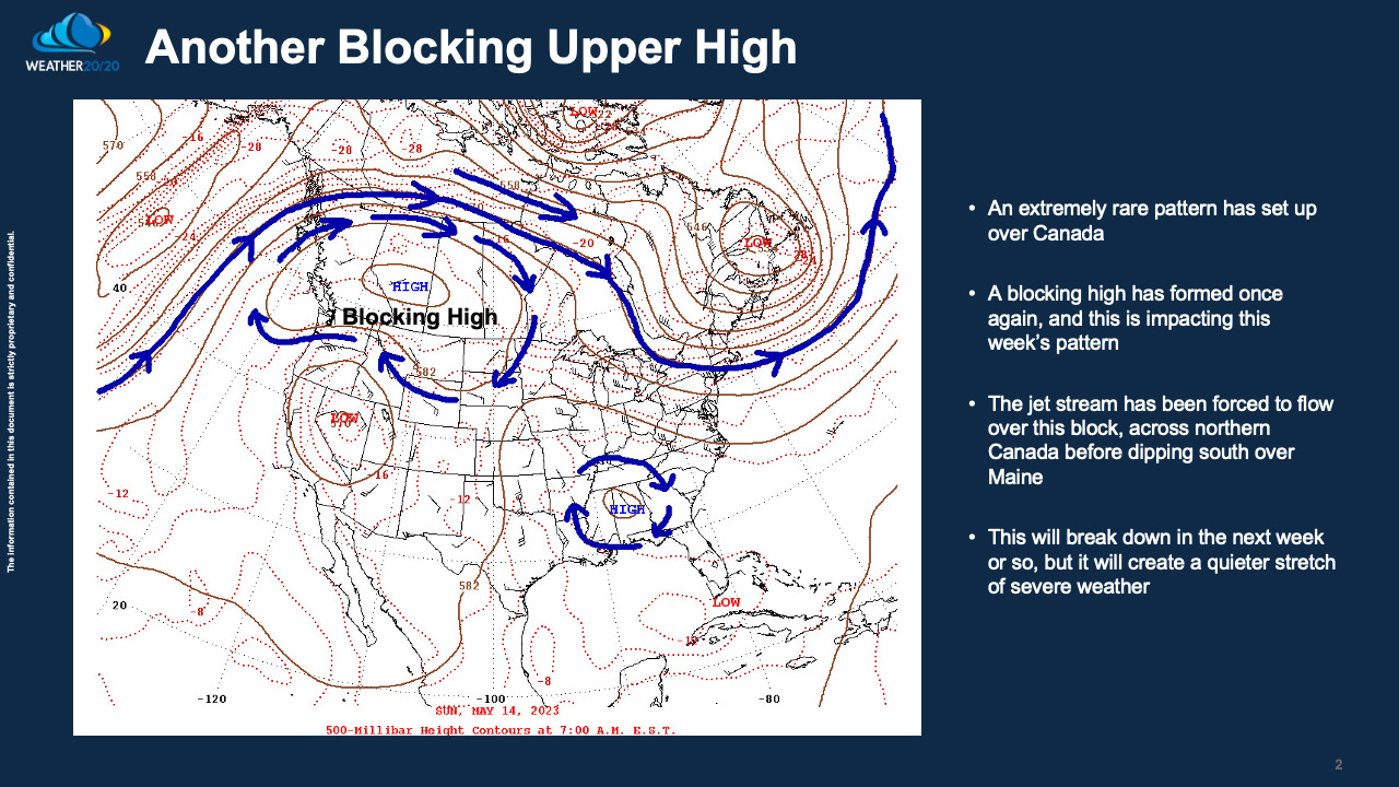
Look closely at that first map posted above. The upper level high over southwestern Canada is rather powerful for any time of the year up there. It is a 591 decameter high. For those of you interested in meteorology, you may or may not realize how anomalous this is. It is so strong that it has forced the jet stream to move out of most of the United States. It does dip southeast over New England, but this is impacting the weather pattern significantly.
The good news is that it will reduce any severe weather risks for a while. It will also impact the rainfall patterns for the next week, and maybe that is good or bad news depending on where you live.
El Niño Watch
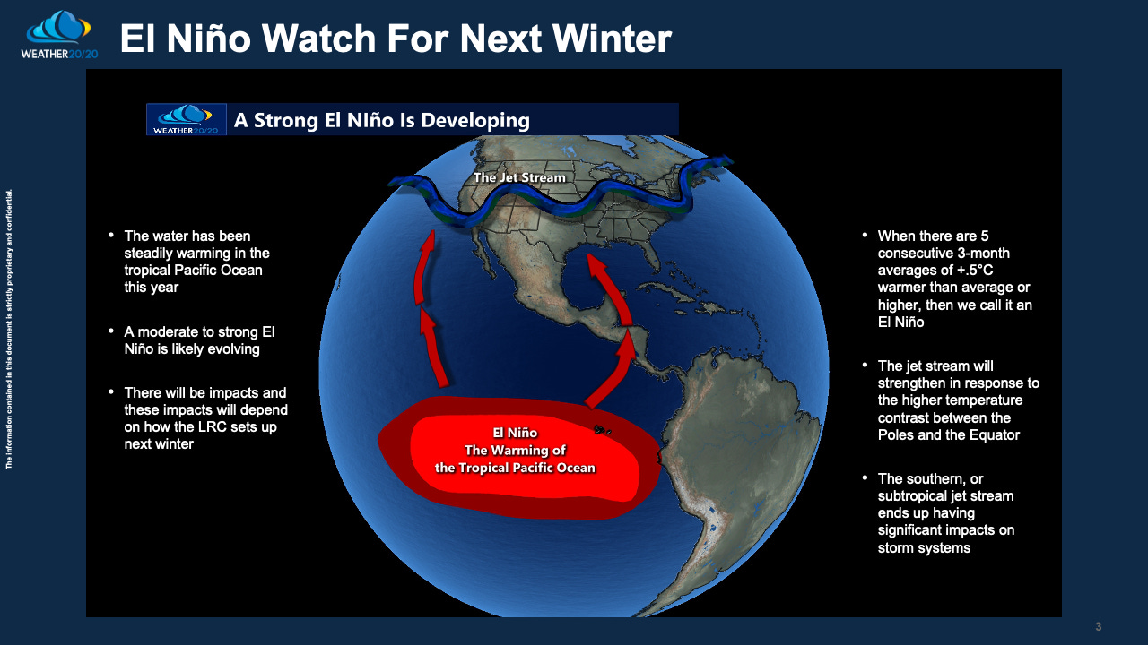
El Niño is the warming of the Tropical Pacific Ocean. This phenomenon is now forecast to become quite strong this winter. What will the impacts be? We will discuss this more in the coming months.
The LRC
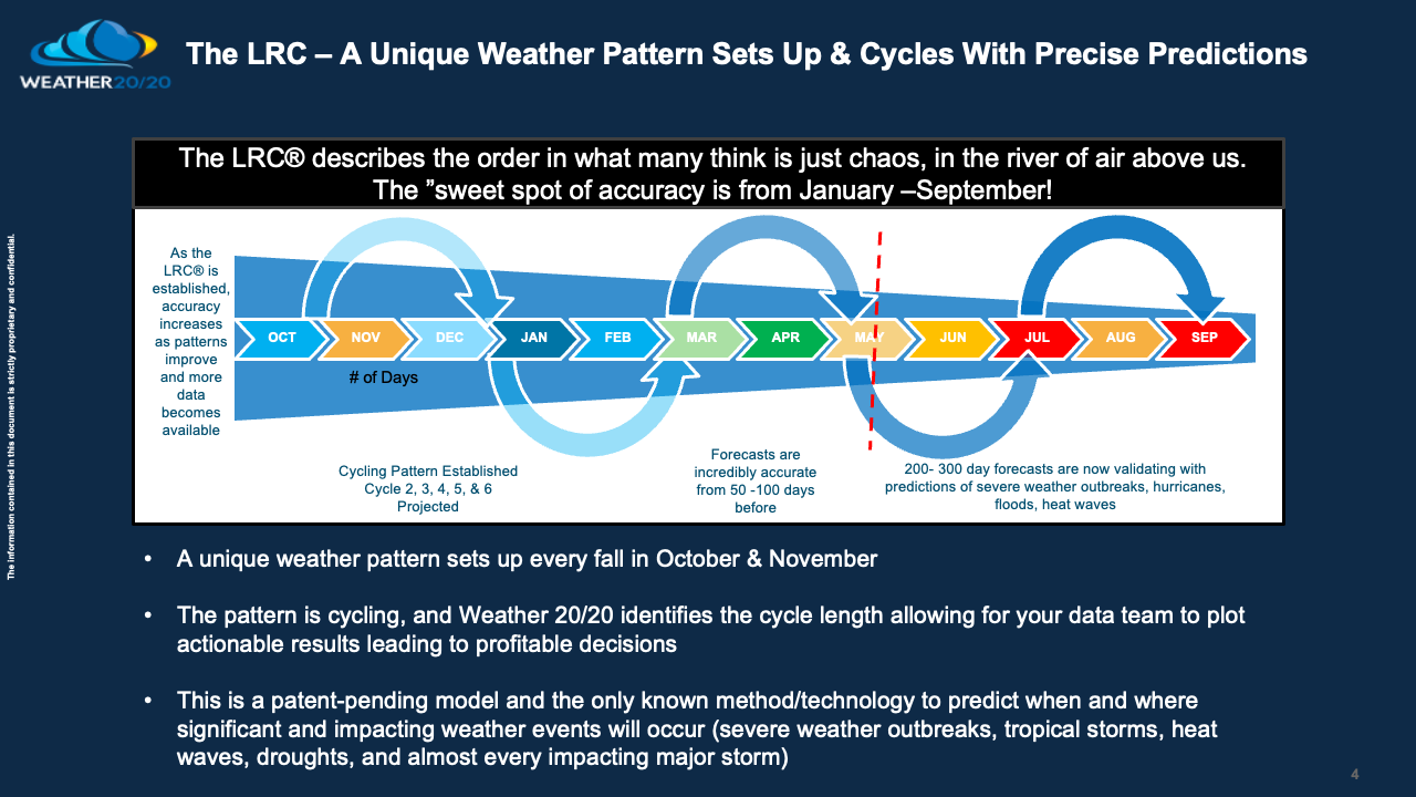
We are currently in the fifth cycle of this year’s pattern. A new and unique pattern won’t begin setting up until late September. For now, we get to experience the rest of this year’s unique weather pattern.

The potential for a major heat wave is pretty high as we go towards the end of July. Between now and then there will begin to be the evidence of this heat.
On this next map, we can see the below average temperatures are still predicted by the patent pending LRC® model over North Dakota this summer, while the heat builds in from the east across Indiana and Illinois, and really near the east coast and spreads west.


The week-by-week forecast shows the dry and wet weeks forecast for the entire corn belt. Minnesota and Wisconsin are still forecast to be in the wet region with above to much above average rainfall later this spring into the summer, with the drought conditions not getting much of a break over southern and southwestern Kansas.
LRC Successful Predictions
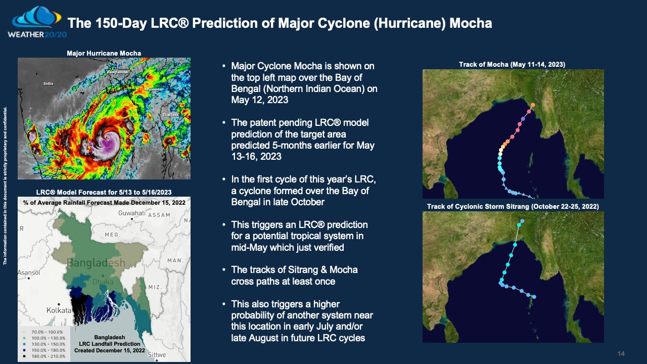
A major Cyclone just moved inland near Bangladesh. We did an analysis, and you can see there was another storm system in that same region that tracked near the same spot from October 22-25, 2022.
This shows that the pattern is cycling in the same range over in that part of the world, as it is predicted to based on the LRC and the peer reviewed paper, The Cycling Patterns of the Northern Hemisphere.
While that was going on over there, look at what just happened here:
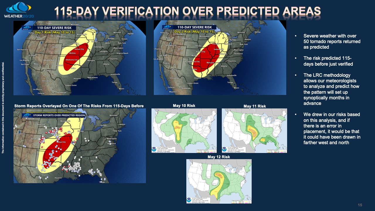
This is the latest verification, which is now 9 for the first 9 predictions of severe weather to have verified, from our January 16, 2023 severe weather predictions we put out there. There are two more risks in the next month, and this block may or may not have an impact on next week’s risk. It may be the first one we miss on the forecast, but hang on, we will have to see how it sets up.
Next week I will dive deeper into some of your counties again as June approaches. Have a great week.
Gary

Share this post