As we move through the first week of spring I welcome you to the Weather 20/20 Intelligence Report. In this late March update we will take a look at the LRC and why it will likely get wetter across the Corn Belt in the next two months, so watch the video as I will go through an in-depth explanation, and then showcase it in this report below.
We just had a wet storm move across the plains, and it missed a few key locations, especially around Kansas and Missouri. Let’s take a look.
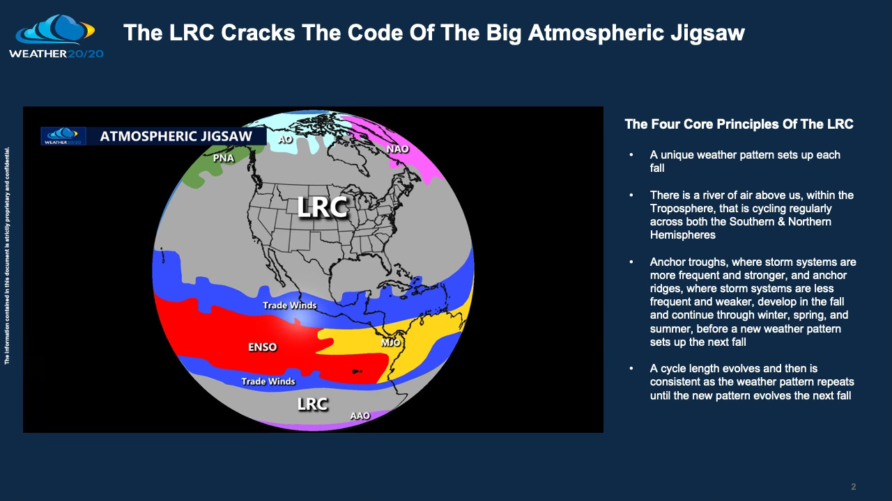
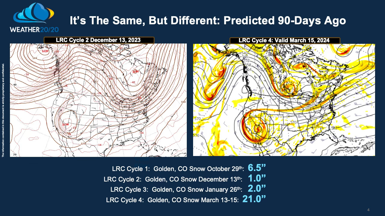
There are four core principles of the LRC. They are shown above in the Atmospheric Jigsaw slide. One example of the LRC is shown below from a couple weeks ago when I personally experienced the cycling weather pattern. It snowed in each of the four LRC cycles in Golden, CO. In this slide you can see a strong exhibit of the cycling weather pattern, shown at the 500 mb level.
Every passing day reaffirms the consistent cycling of the weather pattern. Whether it's Golden, CO, as highlighted in this report, or Savannah, GA, where Jeremy Nelson, an early adopter of the LRC methodology and Chief Meteorologist at WJCL, accurately predicted St. Patrick’s Day weather 3 months in advance, the LRC's influence spans across the Northern Hemisphere. Even my brother, Scott, recently shared satellite images of the current California storm, drawing parallels to patterns observed 45 days prior, and he has been sharing these with me all season. This cyclical phenomenon manifests wherever you reside, and if you've been following our Weather 20/20 Intelligence report, you've likely encountered similar instances.
It can be disheartening when storm systems consistently bypass your region. Engaging in discussions about droughts, heat waves, and other less sensational meteorological phenomena can be challenging due to their relatively subdued nature. Nevertheless, they are essential topics of discussion. Today's discussion will steer in this direction, although I anticipate concluding that these drought-influenced areas will contract rather than expand in the upcoming weeks as we transition through spring. Either they are contracting or shrinking, and we will notice the trend in the next three weeks.
Join me as I try to showcase all four cycles (we are currently in the fourth cycle of this years pattern) in today's video to uncover the Lezak Recurring Cycle (LRC) and decipher why it paints a forecast of increased storm activity and precipitation for April, with potential implications extending into May. Let's explore the insights offered by the LRC and understand its implications for the coming months.


