
The LRC Strikes Again!
A Strong Late-May Storm Cycles Back Into California Right On Schedule

Welcome to the Weather 20/20 Intelligence Report!
I just returned from a two-week road trip to California and back, and of course I have been meticulously tracking the cycling weather pattern along the entire route. Over the past couple of weeks, I have literally been following the blueprint of the atmosphere — the heartbeat of the cycling weather pattern — day by day. And what is happening right now is one of those moments that becomes an undeniable showcase of the big weather secret that you are now in on.
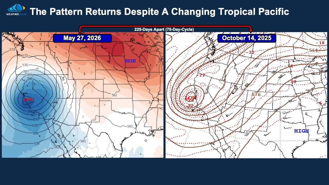
As we move firmly into Cycle 4 of this year’s LRC, the atmosphere is once again doing exactly what the Lezak Recurring Cycle hypothesis says it should do: the same upper-air structure is cycling back through right on schedule. This is not just a vague similarity. The placement of the upper-level low, the orientation of the jet stream, and the overall 500 mb flow pattern are remarkably close to what occurred back in October.
Take a look at this snapshot of the LRC comparing what is developing right now to what happened exactly 225 days earlier, or almost perfectly on cycle. The similarities are extraordinary:
A deep upper-level low near the California coast
Strong ridging extending across the central United States
Nearly identical jet stream structure
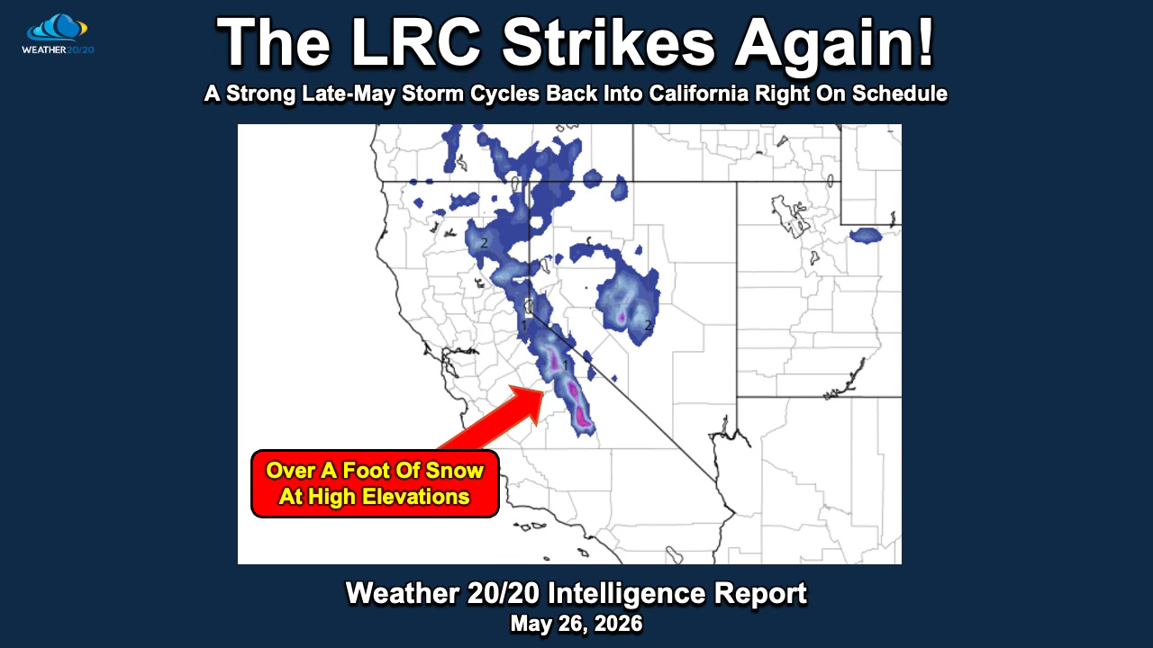
A powerful late-May storm developing over California with Sierra Nevada snow
What makes this even more fascinating is that the October version of this pattern occurred during a La Niña phase, while the current version is developing as El Niño begins to emerge. In other words, one of the largest climate oscillations on Earth has shifted phases, yet the atmosphere is still cycling the same core pattern back through. This is exactly why we continue to preach that the LRC is the centerpiece of the atmospheric jigsaw, while teleconnections such as ENSO act as important surrounding pieces that help influence how the pattern expresses itself.
One of the most fascinating — and admittedly difficult — concepts to fully grasp with the LRC is that the same upper-air pattern can produce very different weather impacts depending on the season. This is where many meteorologists get tripped up when first trying to understand the cycling atmosphere. They may expect the exact same weather to occur each time the pattern returns, but that is not how the atmosphere works.
For example, when this part of the pattern cycled through in October, December, and March, the atmosphere was colder, the jet stream was stronger, and the Pacific storm track was more energized. Those versions of the pattern produced flooding rains, strong storms, and feet of snow in the mountains. Now, here we are in late May with nearly the same 500 mb structure returning right on cycle, but the seasonal environment is completely different.
The sun angle is higher, the atmosphere is warmer, the jet stream is weaker, and the Pacific Ocean and land masses have evolved thermally since fall and winter. So while this storm is still strong enough to produce impressive late-season snow in the Sierra Nevada, the lower elevations and coastal valleys may only see clouds, showers, or a few sprinkles and pretty clouds, instead of the major storm impacts that occurred earlier in the season.
Here is today’s Video, and then we will continue this discussion: