The Major Southern Snowstorm & The LRC
We show scientific evidence of the cycling weather pattern & look ahead for the next 8-months
Welcome to the Weather 20/20 Intelligence Report!
As I began writing this report an extraordinary weather event unfolds—a rare snowstorm blankets the Gulf Coast, including New Orleans. In this report you'll discover how Weather 20/20’s pioneering scientific technology not only predicts such significant weather events but also provides you and your team with the insights needed to plan effectively for the months ahead. I would like to wish a warm welcome to all of our new customers on this cold day!
It is such a rare weather event that is in progress. The LRC model did predict that a major storm system would develop near the Gulf coast, but the model also did say it would be too warm for snow, so it was far from perfect. As you can see on the slide above, New Orleans is having such a rare winter event. It is so cold that all the streets are covered during the day and this picture is from when it had just started. They will likely have a record setting snowfall today.
This year’s LRC is cycling close to every 6-weeks. What happened in New Orleans 41 days ago? They had a storm system with rain and temperatures dropped into the 30s. What happened in Savannah, GA? They had rain followed by a rare freeze. While this storm and cold is right on schedule, the dry weather continues out west:
Los Angeles hasn’t had a drop of rain since our last report. They are in the heart of their rainy season right now. By April, Los Angeles averages around 12 to 14 inches of rain, so let’s see how long this lasts.
What is going on? In a few minutes I will be sharing some strong scientific evidence of the LRC and this part of the cycling pattern. The Arctic Oscillation is one of the big influences and it dipped deeper negative around the first week of January as you can see below:
When the AO dips negative the potential for Arctic air blasting south is increased substantially. Once the Arctic air gets down into the United States it is difficult to move out. Now, look at the AO index forecast over the next week. It is forecast to go positive again, and this almost for sure will mean an exit of the Arctic air, which we can see on the next two slides:
The latest data shows a likely response to the AO going higher into positive territory, and this means a warm up during the next week.
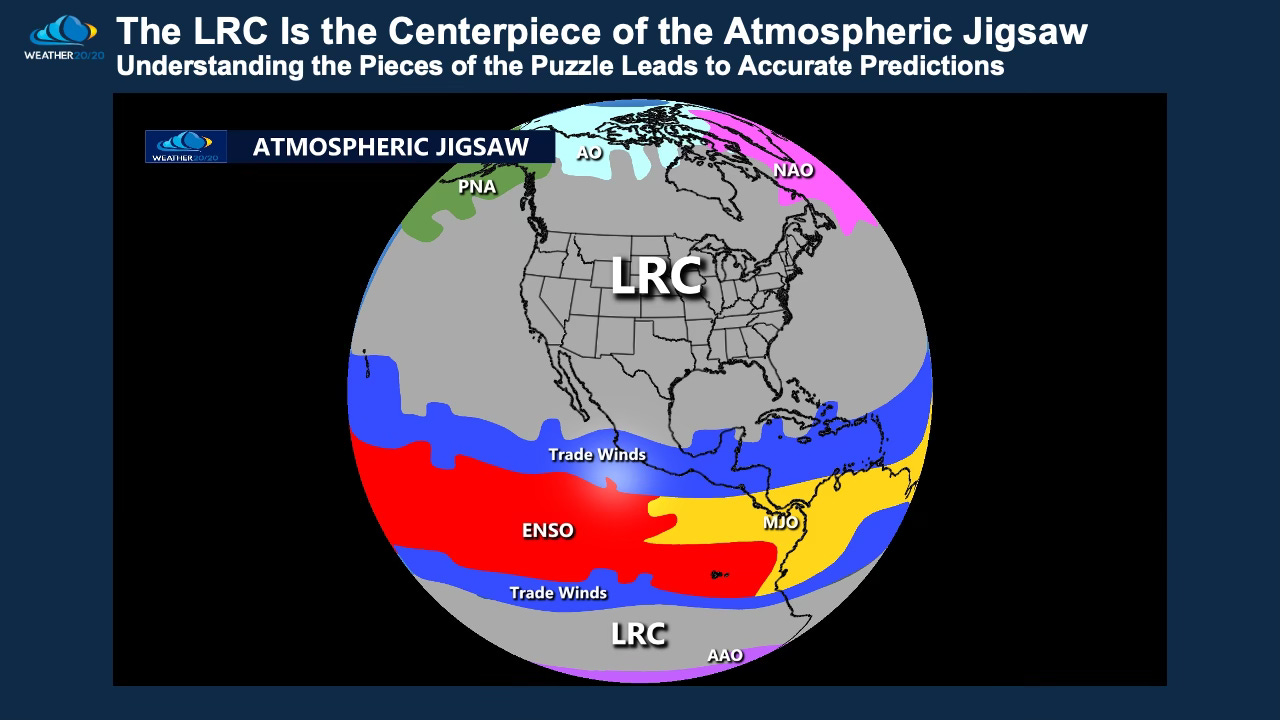
The LRC is the centerpiece of the big atmospheric jigsaw. Let’s take a look at a couple examples of this year’s cycling pattern.


