


The Weather Outlook Through September
The peak of summer arrives as the jet stream weakens further

Welcome to the Weather 20/20 Intelligence Report! We will be sharing some crucial updates and provide a detailed weather outlook as we approach the harvest season.

Heat Building - Tropics Remain Quiet
As Bob Seger brilliantly captured in his 1978 hit, "the pattern is still the same." This echoes true for our weather pattern, which established itself last October and November. We are now cycling through the seventh cycle of this year's consistent weather pattern.
In today's report, I am excited to share fresh data from our patent-pending LRC model. We'll not only cover state-wide forecasts for three different states but also zoom into specific counties in northwest Iowa, providing localized insights that are critical as we edge closer to the harvest season.
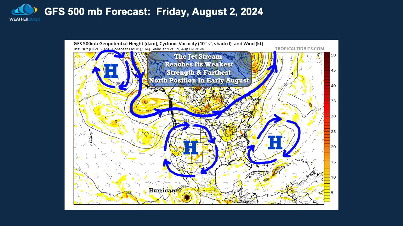
In our last report, we explored how the jet stream reaches its weakest intensity and northernmost position during the late July to early August period. As we transition into mid-August, colder air masses begin to develop in northern Canada, prompting the jet stream to regain strength, but hang on, that is still a few weeks away.
The slide above illustrates the current position of the jet stream, projected for August 2, 2024, positioned far north, influencing the precipitation patterns that we have been experiencing. As the jet stream intensifies in the coming weeks, expect the weather dynamics we've been experiencing to escalate once more. This shift signifies the onset of bigger changes ahead, and again, that is still really weeks away.