Exciting News: Weather 20/20 to Shine on The World's Greatest TV Show!
We are thrilled to announce that Weather 20/20 will be showcased on The World's Greatest TV Show, airing on the Bloomberg Network on November 25th. This feature highlights Weather 20/20 as the 'World's Greatest' in the field of meteorology, underscoring our commitment to excellence and innovation in weather forecasting.
Additionally, we are eagerly anticipating the debut of our new website in the coming weeks. Our revamped website will provide users with an interactive map that can display a forecast for an entire month, up to three months in advance, for any location around the world. Stay tuned for more details as we get ready to launch this exciting new tool.
Now, let's delve into the evolving weather pattern as we prepare to issue our winter forecast during the first week of December."
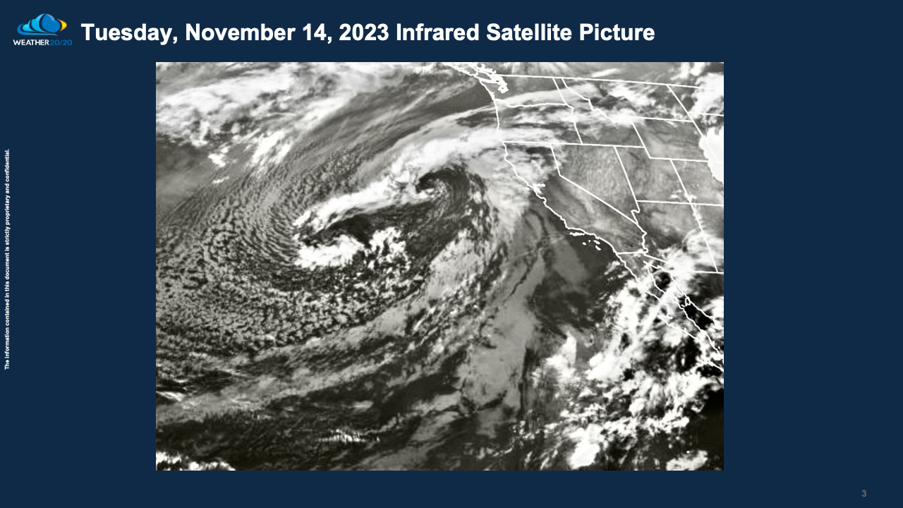
Let's start with this satellite image featuring a storm situated approximately 1,000 miles west of Monterey, California. This storm brings both favorable and unfavorable news for California.
On the positive side, its current location positions it favorably for future LRC cycles, increasing the likelihood of its persistence and impact.
However, on the downside, the storm is currently experiencing significant weakening as it spins cyclonically over the Pacific. This development raises concerns that the anticipated wet winter, as suggested by other sources citing El Niño, may not come to fruition, but I am not 100% going there at this moment.
As depicted in the video presented below, we'll be examining the storm off the west coast and the one in the early stages of formation along the Gulf of Mexico coastline, specifically in the regions of Louisiana and Texas. These weather events are of particular interest as we closely monitor their evolution within this year's LRC cycles. We will also explain the LRC model predictions for North Dakota in this video.


