


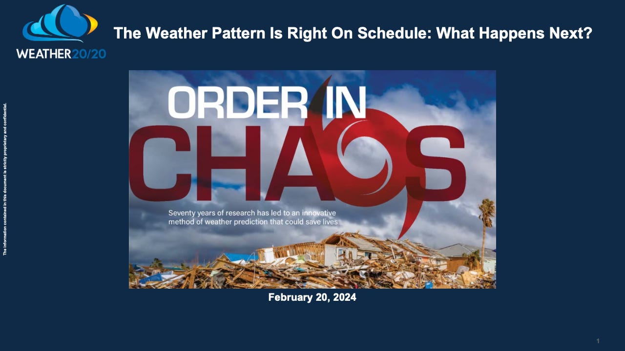
The Weather Pattern Is Right On Schedule: What Happens Next?
We will look at the first four cycles of this year's pattern

Welcome to the Weather 20/20 Intelligence Report! This is going out to all of our customers. We will be showcasing more of the LRC model for our premium customers in March, so join now for less than $1/day to get this valuable information and insight.
I do my best to explain the following charts in-depth in today’s video:
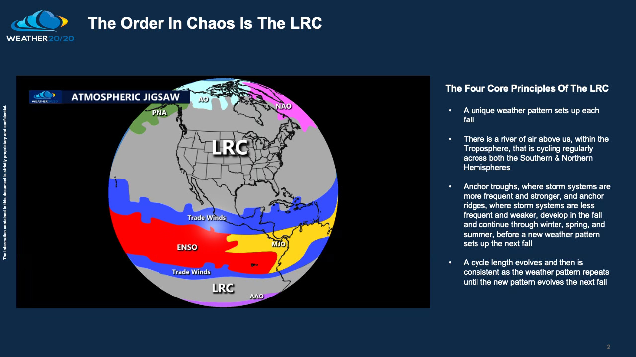
The LRC is the centerpiece of the big atmospheric Jigsaw. Right now, the pattern is cycling into the beginning of the fourth cycle of this year’s weather pattern. As a storm moves into Southern California today, and weakens, a huge warm-up is in progress ahead of it over the USA, and it may even reach 80 degrees next week in Kansas City. The big question; will it also snow later next week in Kansas City? Let’s take a look.

El Niño, the warming of the tropical Pacific Ocean waters continues to influence the overall pattern. El Niño is forecast to weaken steadily between now and summer, and the impacts on the LRC will be interesting to track.
The Arctic Oscillation (AO) is another influence on the weather pattern, and it was surging positive in the past few days:
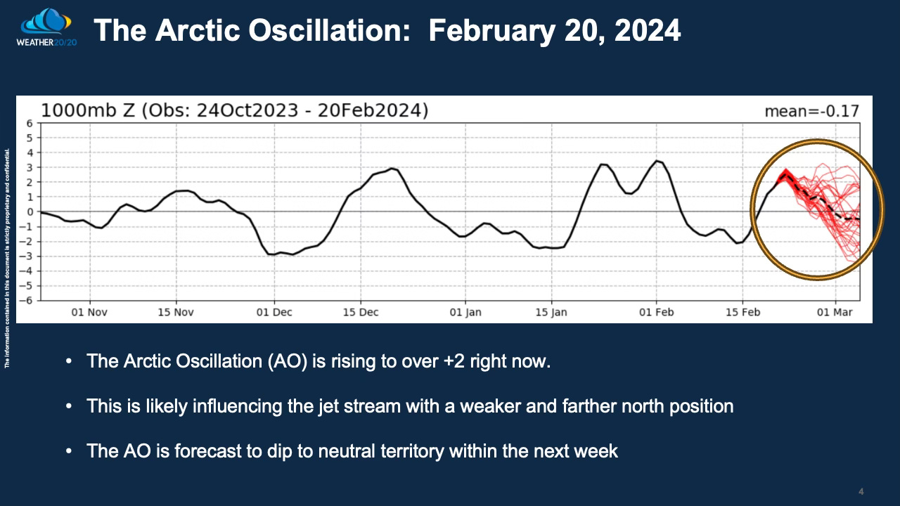
The forecast from the models is for the AO to drift back towards neutral in the next ten days. How will it impact the pattern? Let me try my best to explain:
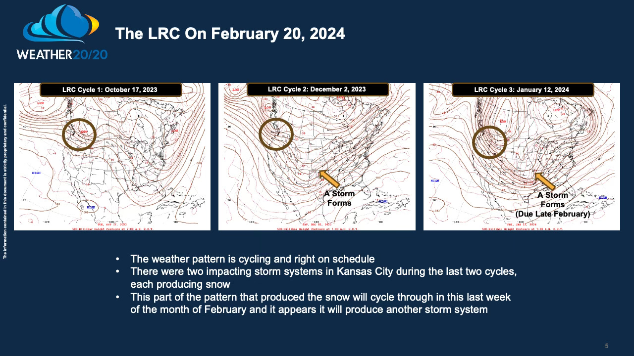
This chart, above, shows the weather pattern at 500 mb (around 18,000 feet above sea level) where only Mount Everest and a few other very high mountains disrupt the flow. This is the level of the atmosphere, within the lowest layer known as the Troposphere, that the LRC is tracked the best.
Look closely at cycles 1, 2, and 3 on this chart. I circled a wave of energy coming into the Pacific Northwest in each cycle, and it is forecast to do so again next week. In the past two LRC cycles, a storm dipped down into the southern Rocky Mountain states, and produced a storm. This did not happen in the first cycle, however, and on these next two maps, you will see a first cycle version and a second/third cycle version of the pattern forecast for next week.
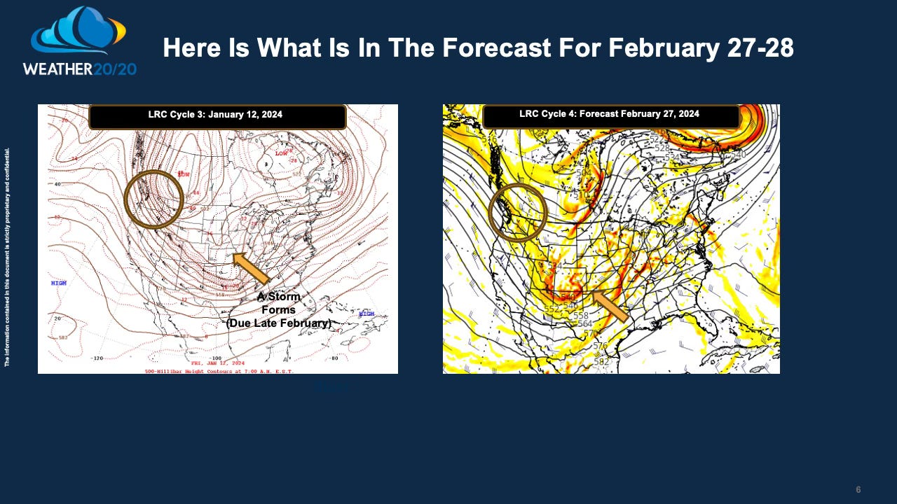
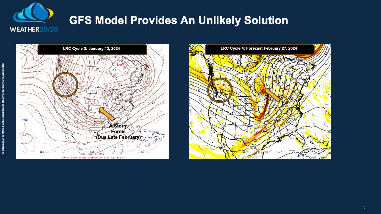
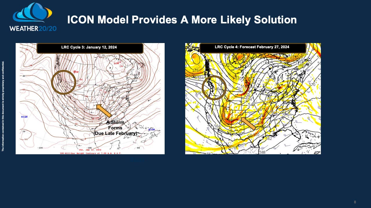
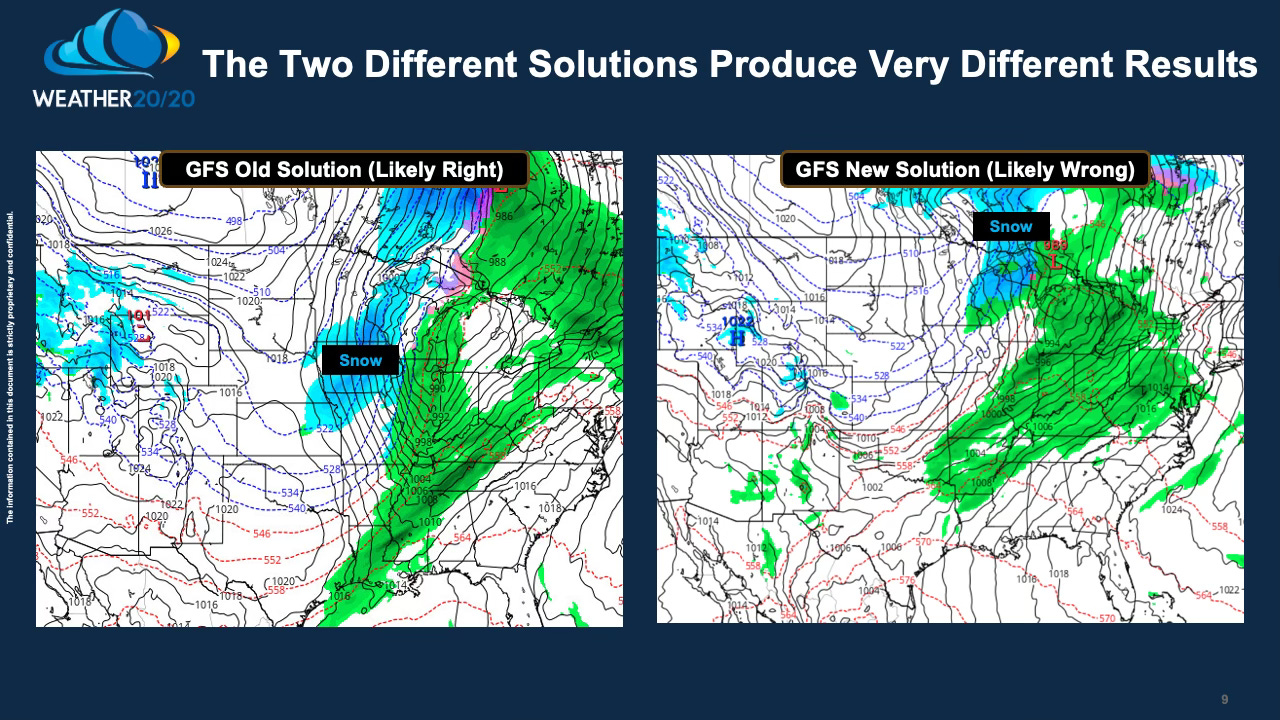
So, if you stare at the maps long enough it may give you a headache. I stared for hours this morning and the LRC comes into focus. The pattern is “the same, but different” as Gary England (retired Oklahoma weather icon) once said around 15 years ago. Will it look more like cycle 1, or will it look more like cycles 2 and 3? The difference is huge for places like Kansas City. One solution this morning implies a weaker cold front and no chance of snow, and the other solution produces a much stronger cold front and the potential for some snow. I lean slightly in favor of the stronger cold front from cycles 2 and 3. We will look at this in next week’s report.
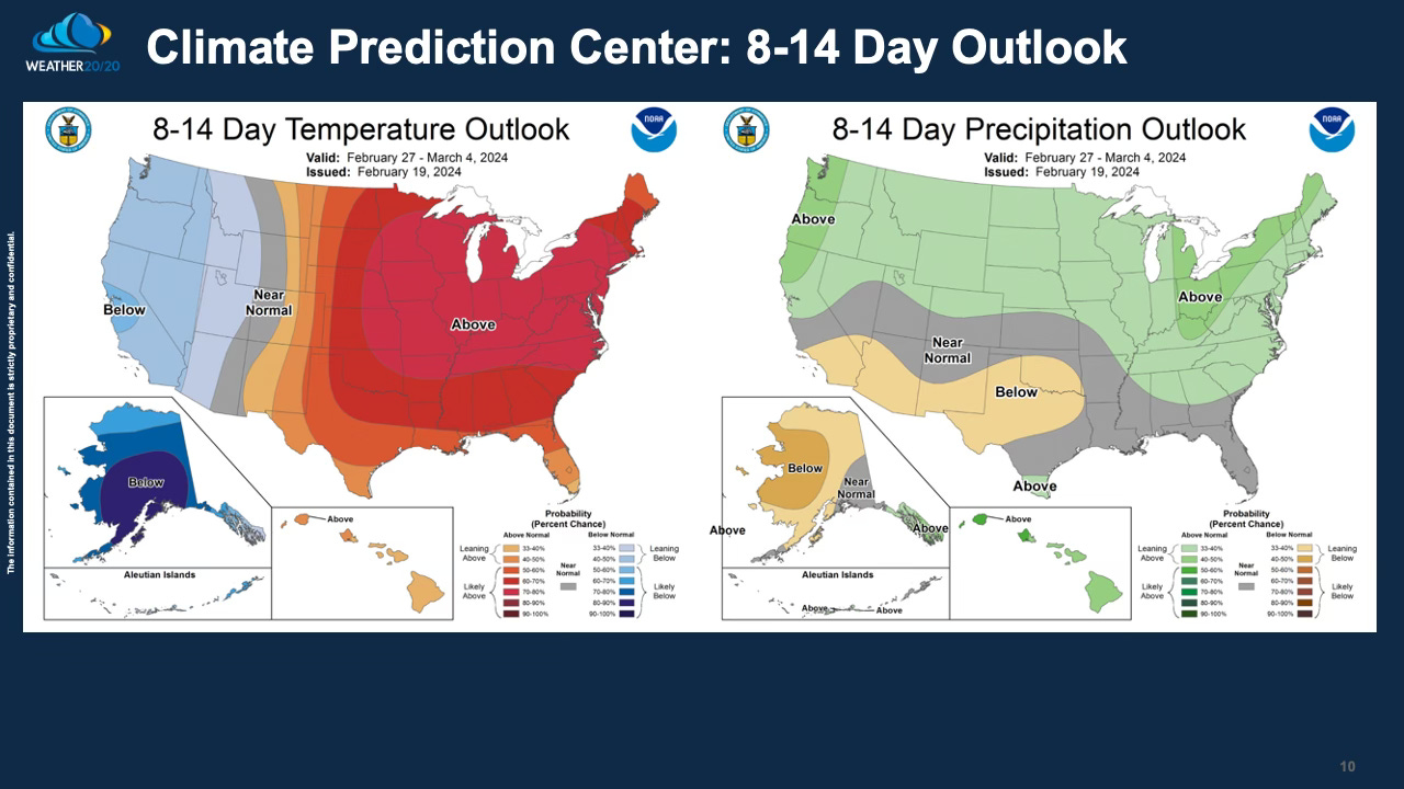
The Climate Prediction center just issued the updated 8-14 day outlook, so they are obviously favoring the farther north and weaker solution as shown below:
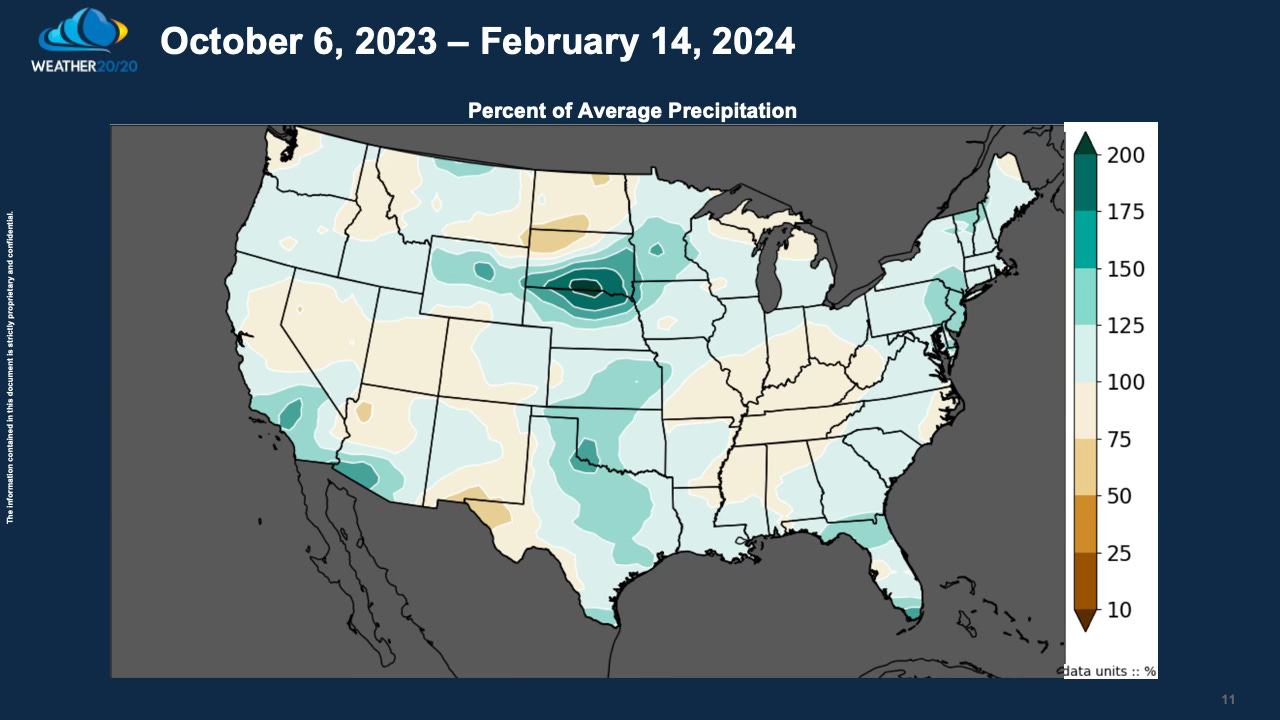
Here is what has happened since this LRC began:
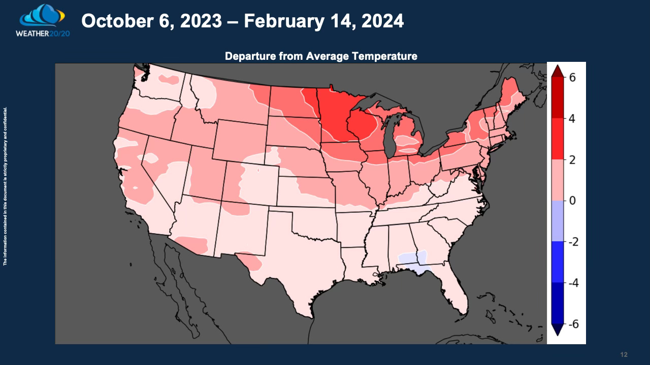
The warmer than average temperatures are in our LRC model forecasts as you look back at the previous Weather 20/20 Intelligence Reports. We are currently analyzing the spring and summer patterns and will update you in the coming weeks for premium customers
I hope everyone has a great week.
Gary Lezak