
This Cold Outbreak & Developing Western Storm Will Return - It’s Part Of The New LRC
The Roulette Wheel Ball Is Slowing Down & About To Drop Into One Of The Slots

Welcome to the Weather 20/20 Intelligence Report!
A warm welcome to all of our new premium subscribers, and a sincere thank you to those who have been with us for many years — some of you for more than two decades. We are on this journey together, studying one of the most important discoveries in modern meteorology: the weather pattern cycles.
Over the past week we’ve seen a powerful early-season cold outbreak, snow down to northern Georgia, and a sharp cold plunge into the Great Lakes. This is not random. This is a signature of the developing 2025–2026 LRC — the cycling weather pattern that will shape our winter, blizzards, severe weather season outbreaks, and next year’s hurricane season.
This is also where many forecasts diverge - Other meteorologists are making long-range claims based on analogs and single-year comparisons — methods that have repeatedly fallen short because they lack the why and the when.
The LRC is different.
It identifies the pattern itself, its cycle, and when it will return.
Today, we’ll look at:
The cold outbreak and how it developed
The deep trough and the weak blocking near northeast Canada that helped set it up
The AO, NAO, and ENSO — and how they influence but do not create the pattern
And most importantly, how this cold signal will cycle back later this winter
The Roulette Wheel of Weather is still spinning — but the ball is slowing.
We’re getting close to seeing where key features of this year’s pattern will land.
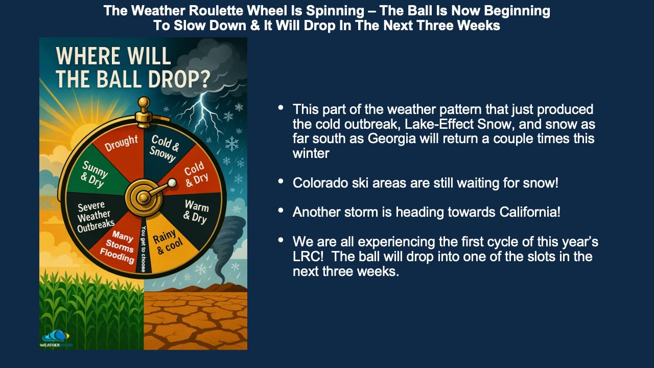
Yes, as you can see on this slide above, Colorado ski areas are literally starting the season entirely on man made snow. Now, there could be 2 to 4 inches of snow at the base, but this is a rough start to the season. If the ski areas can get hit by a significant storm by Thanksgiving, then this early season will still be a success, but will they?
Comparing the Start of This Year’s Pattern to Last Year
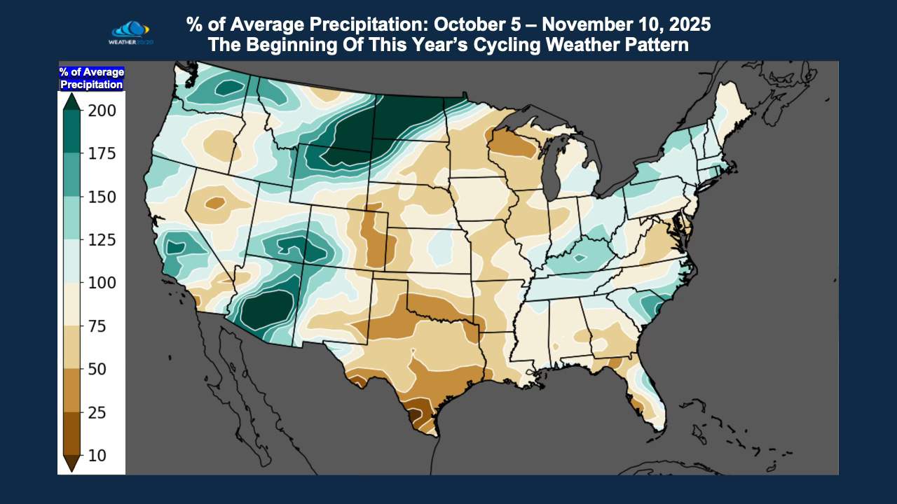
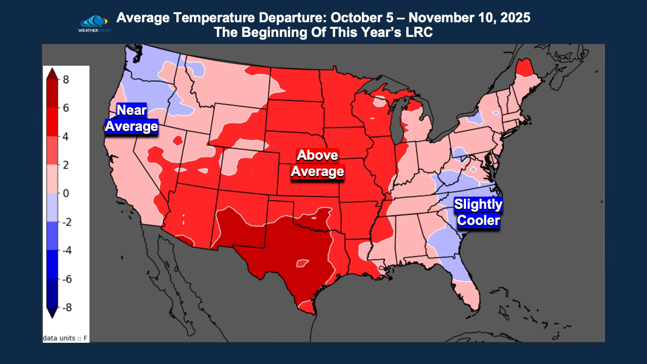
We have identified October 5th as the beginning of this year’s cycling weather pattern. So our analysis begins from Day 1 of the new LRC through yesterday.
When we look at the precipitation trends so far, a clear signal is emerging:
A region from eastern Colorado northeast to the Canadian border, then curving southwest into Texas, has been getting progressively drier.
The Great Lakes region shows a slight exception due to the localized Lake-Effect snow that just occurred.
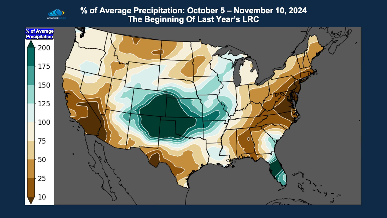
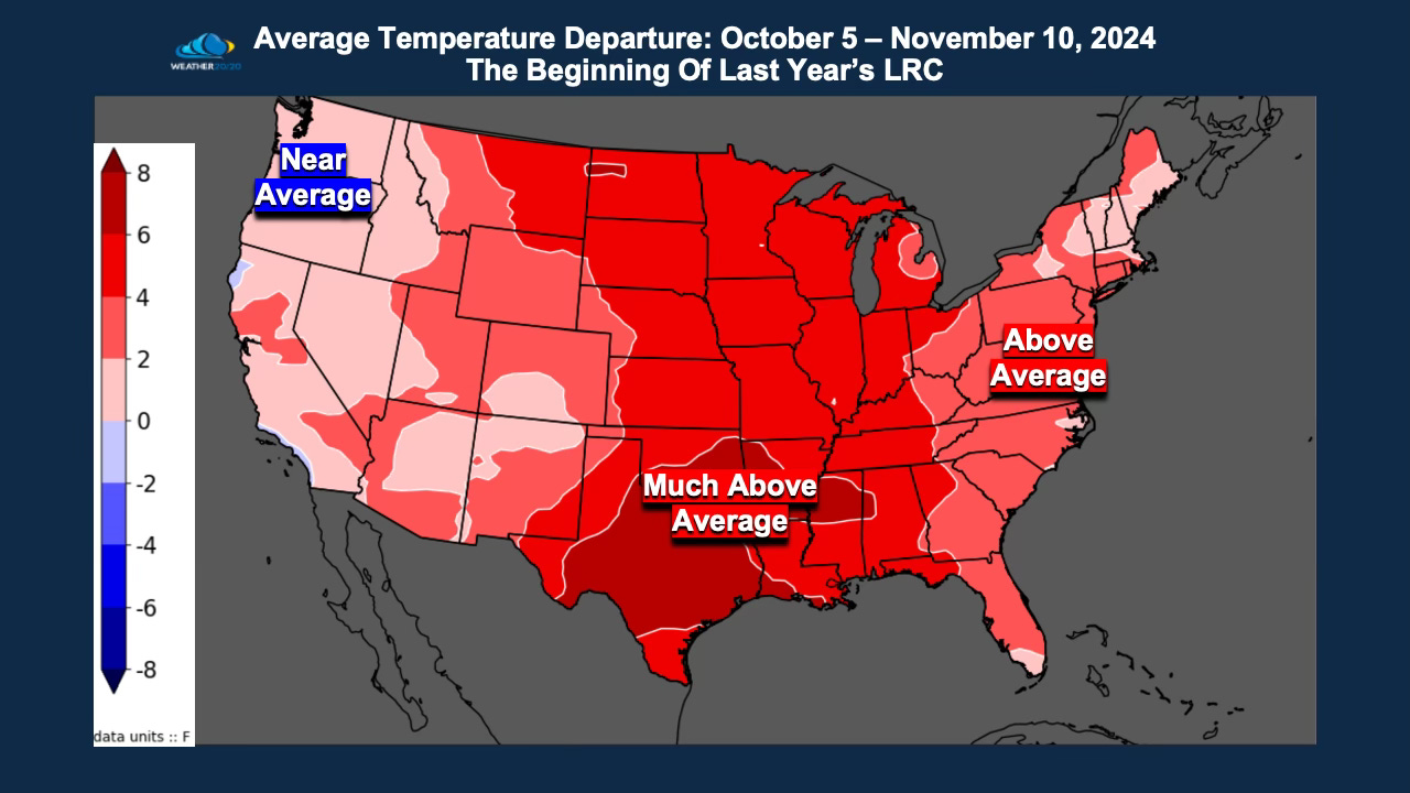
Now, compare this to where we were one year ago. At this same point in last year’s pattern, we were seeing increasing rainfall from Colorado south into Texas — almost the opposite of what we are seeing now.
When we compare the temperature profiles, both years have started out warmer than average, even when we include this week’s cold outbreak. These early trends are important, and we will watch how they evolve as the cycle repeats in late November and again in January.
A Critical Distinction: Pattern-Based Forecasting vs. Reactive Forecasting
Every day on social media we see forecasts reacting to whatever is happening right now.
This past week, we saw headlines calling the cold surge an “Arctic Blast”.
I like to reserve that term for when:
The cold air originates in the deep Arctic
The upper-level pattern supports multiple reinforcing surges
This was a strong early season cold outbreak, and what caused it will return, and then we may be truly looking at an Arctic invasion!
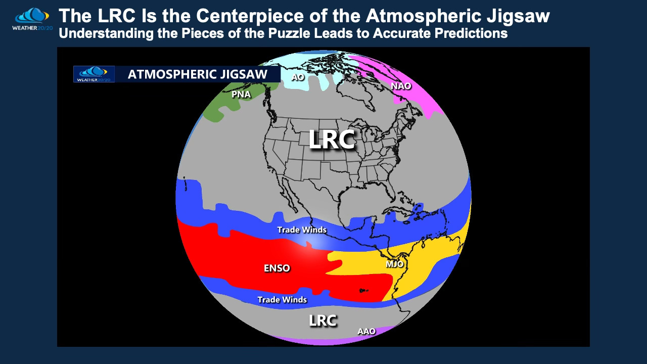
The LRC is the centerpiece of the big atmospheric jigsaw, and there are other influences, so let’s take a look at the latest trends:
Most forecasters are still using:
Analog years
ENSO alone
Pattern-matching on a few days of data
But those are pieces of the atmospheric puzzle. They do not explain the structure of the pattern.
The LRC is the missing piece that organizes:
The blocking over Canada
The jet stream shifts
The variability in ENSO
The temperature anomalies
The timing of major storms
And yes — even the return of this cold outbreak
Until you understand the cycling pattern, the atmosphere appears chaotic. And this cold outbreak will return — because it is part of the structure of this year’s cycling pattern. When will it return? It will be shown in our Weather 20/20 Vision Dashboard as the patent pending LRC model in the coming weeks and months, just not yet.
The full analysis continues below for our premium members.
But first, here is today’s video walking through this evolving weather pattern: