


This Week's Pattern Is Right On Schedule - What's Next In Line?
We are now moving into phase 1 of this year's LRC

Welcome to the Weather 20/20 Intelligence Report!
Greetings to all our dedicated readers, and a special welcome to our new premium customers who have joined us in tracking the fascinating complexities of weather forecasting. We are now in the third cycle of this year’s weather pattern, and this edition of our report is designed to showcase the incredible reliability of the Lezak Recurring Cycle (LRC) through three exhibits of the past few weeks showing the cycling weather pattern. These examples not only highlight the precision of our forecasts but also shed light on the complexities involved in making long-term predictions, which are crucial for your agricultural and planning needs.
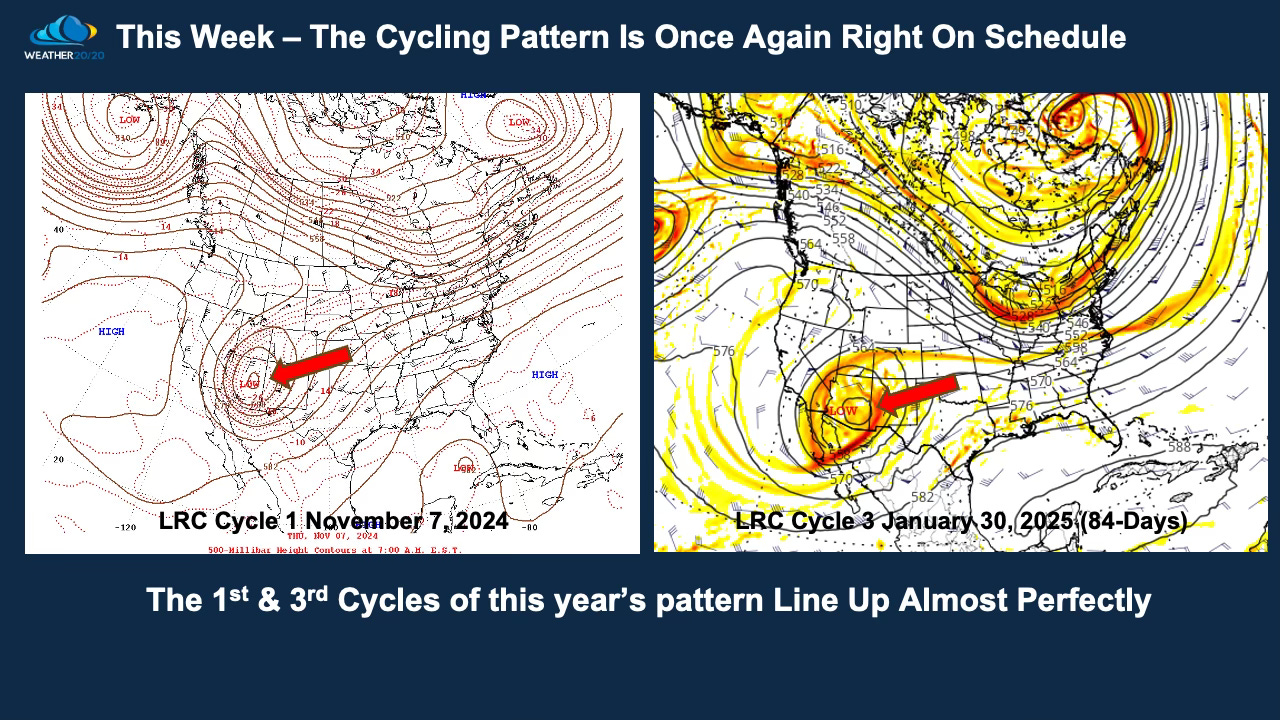
In our first exhibit, we invite you to examine the comparison displayed on the slide above. The left image captures the actual conditions over North America and surrounding areas at the 500 mb level on November 7, 2024. To the right, you’ll see the forecast for the same atmospheric level on January 30, 2025. These dates, 84 days apart, align perfectly with a 42-day cycle, demonstrating how this year’s weather pattern is cycling within the 38-45 day range, centered around 40-42 days.
Notice how nearly every major and minor atmospheric feature aligns in this map-to-map comparison. This precise alignment is a testament to the predictive strength of the LRC model, which successfully forecasted the position of a significant storm system over the southwest near the end of January, that is developing right now.
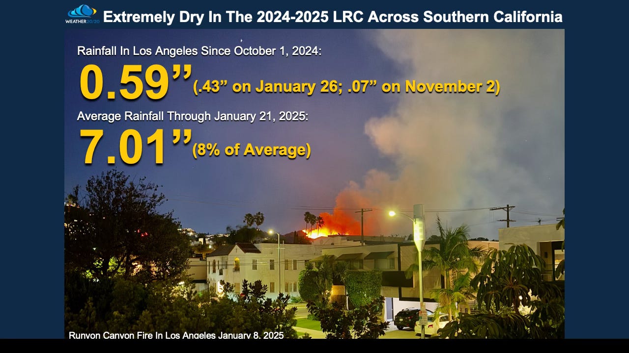
Southern California finally got rain Sunday into Monday from this developing storm and they needed it as you can see the lack of rain as of January 25th:
This next picture below is just incredible. A major snowstorm hit New Orleans, a once in a lifetime occurrence, and in many spots the largest recorded snowfall across the south.

Both the recent rain in Los Angeles and the southern storm system were predicted weeks ago. Now, we did not say New Orleans would have up to 10” of snow. The LRC model predicted that it would be a cold rain with temperatures dropping to near freezing.