


Tropical & LRC Update - What Does This New Pattern Mean For The Tropics?
A massive change is in progress

There is a massive change in the weather pattern as the new LRC evolves right before our eyes. There is a unique weather pattern setting up right now and bigger changes are beginning to show up. This is our tropical update. The videos will go more in-depth!
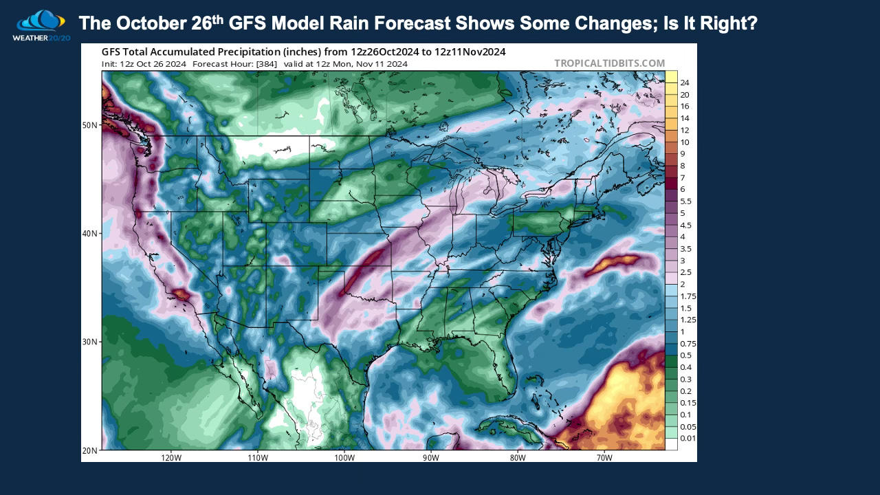
Does the rainfall forecast shown above, the precipitation forecast (rain and melted down snow), have a chance of verifying? Look at those bands of 2” of rain or more near Kansas City, in Oklahoma, and out west. We don’t know enough about this year’s LRC yet, so confidence is shaky as we experience this first cycle of the 2024-2025 weather pattern. We will have a much deeper discussion of these potential changes in Tuesday’s report.
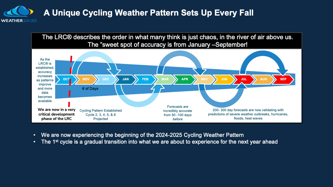
We are likely just in the first half of the first cycle of this year’s pattern. We will discuss this further in Tuesday’s report. Let’s move onto the tropics: