


Tropical Update: A Quiet Start to What We Are Forecasting to be an Active 2025 Season
We will look at some LRC analysis of an important part of the cycling pattern for hurricane season

Welcome to the Weather 20/20 Intelligence Report – Our Second Tropical Update of the Season!
Welcome to all of our subscribers—and a special thank you to our premium members for your continued support and trust in the LRC-based forecasting we provide.
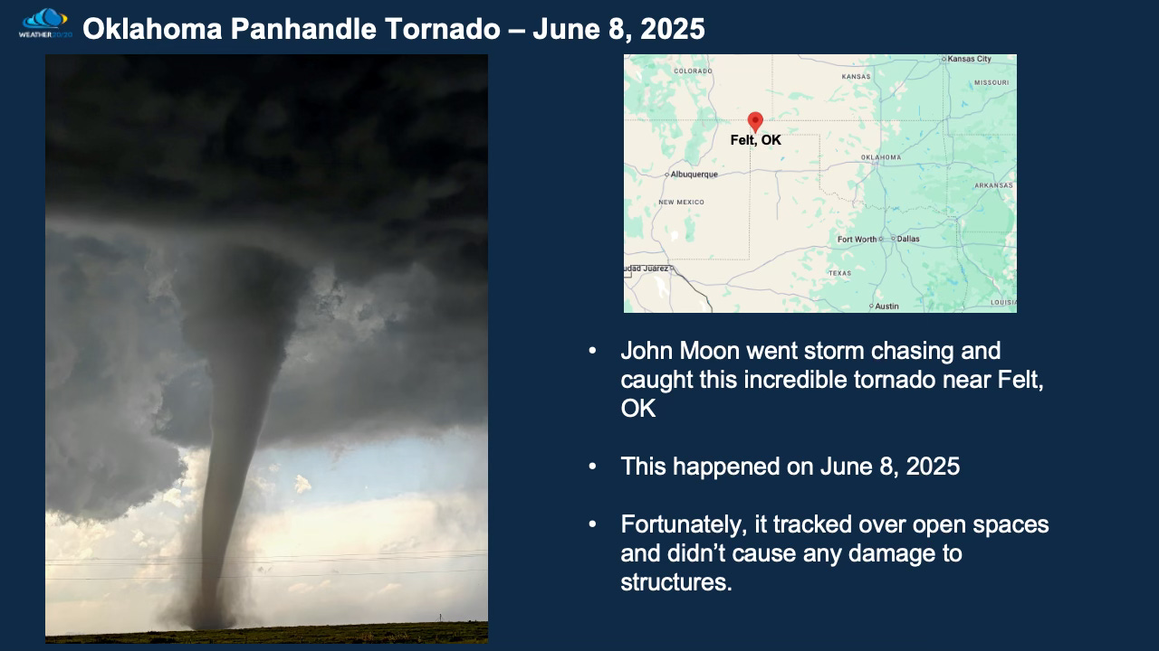
The first slide I am presenting is that incredible picture taken and experienced by John Moon. Thank you for sharing it with us John:
The weather pattern is right on schedule. In Tuesday’s main Weather 20/20 Intelligence Report, we highlighted how this
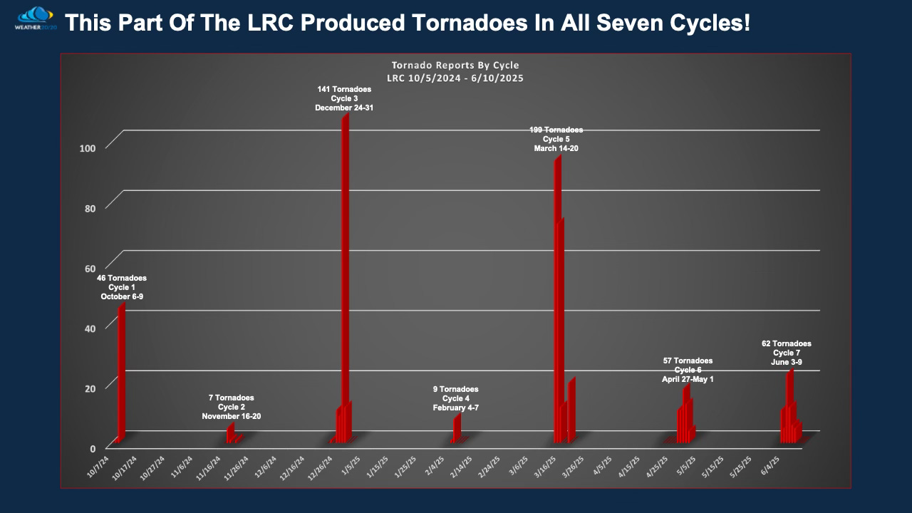
”deadly severe weather outbreak” segment of the cycling pattern has produced tornadoes in all seven cycles—a remarkable and consistent signature, which is illustrated on the second slide below. The deadly outbreak happened in March, and there was also a major winter outbreak on December 28th.
So, what’s next in line?
As you know, the LRC provides the DNA of the atmosphere, and what’s cycling through this week is one of the most recognizable parts of this year’s pattern—what we’ve called the “Blizzard” segment. This is the same segment that produced the January 5th snowstorm and blizzard in Kansas City, which dropped 11" of snow and brought near whiteout conditions. That exact pattern is cycling through again this week, and we’ll take a closer look at it in just a second.
Meanwhile, while the tropics appear to be sleeping, this lull is a trend we’re watching very closely. If there isn’t a named storm by July 1, history tells us the odds of reaching the high levels of activity forecasted for this season drop significantly. That said, we’ve seen delayed starts before—even in active years—and we’ll continue monitoring this carefully in context with the pattern.
Now, let’s pivot to this week’s tropical analysis:
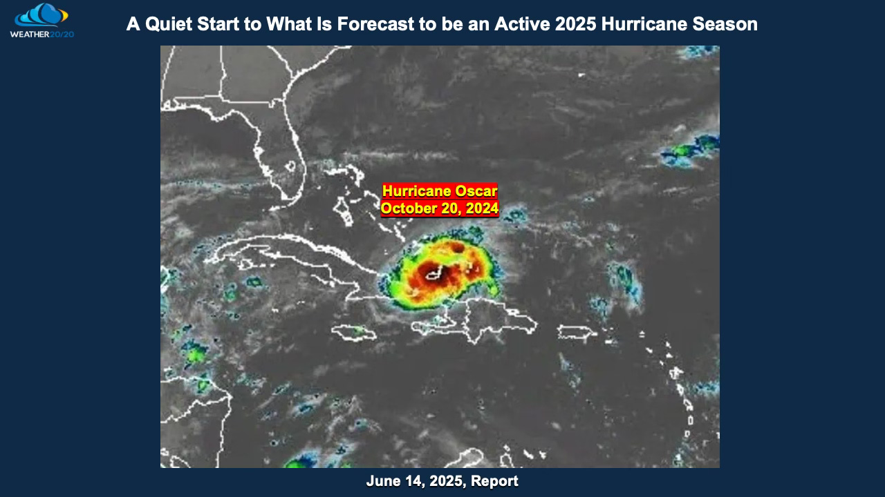
We’re focusing on the “Hurricane Oscar” segment of the LRC.
This part of the pattern dates back to October 20, 2024, when Oscar rapidly strengthened near the coast of Cuba, becoming a hurricane and beginning a track we’ve studied across every cycle since. That evolution provides key insight into when and where the pattern may support tropical development next.
Here’s a look at Oscar from its early stages as it gained strength off the Cuban coast...
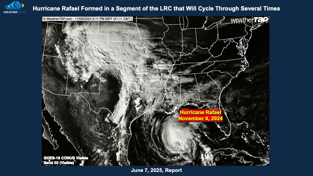
Next, let’s revisit the “Hurricane Rafael” segment of the LRC.
This segment cycled through in November and was the focus of our analysis last week. Together, the Oscar and Rafael segments form two of the most prominent tropical triggers within this year's LRC—and based on how they’ve evolved in previous cycles, both are likely to support the development of organized tropical systems in the coming months.
These aren’t random guesses—these are recurring atmospheric signatures that have returned on schedule with hints to other “weather seeds” indentified in the past few cycles. And as we approach the heart of hurricane season, these segments will play a major role in determining when and where the next named storms will form.