


Tropical Update: Northeast Gulf of Mexico Threat
The 8th named storm of the season will form in the next few days

As we welcomed the first day of fall this morning, it looks like we're on the verge of validating another extraordinary forecast from Weather 20/20. Hurricane Hermine is poised to form, tracking closely along the path we predicted 6 1/2 months ago in our early March forecast guide. I've included a video explanation at the end of this update to walk you through the latest developments.
This Sunday morning's model runs are zeroing in on a trajectory that leads into the northeast Gulf of Mexico by Thursday, with the potential for landfall by Thursday night. Take a look at the projections from the American GFS model for Thursday evening:
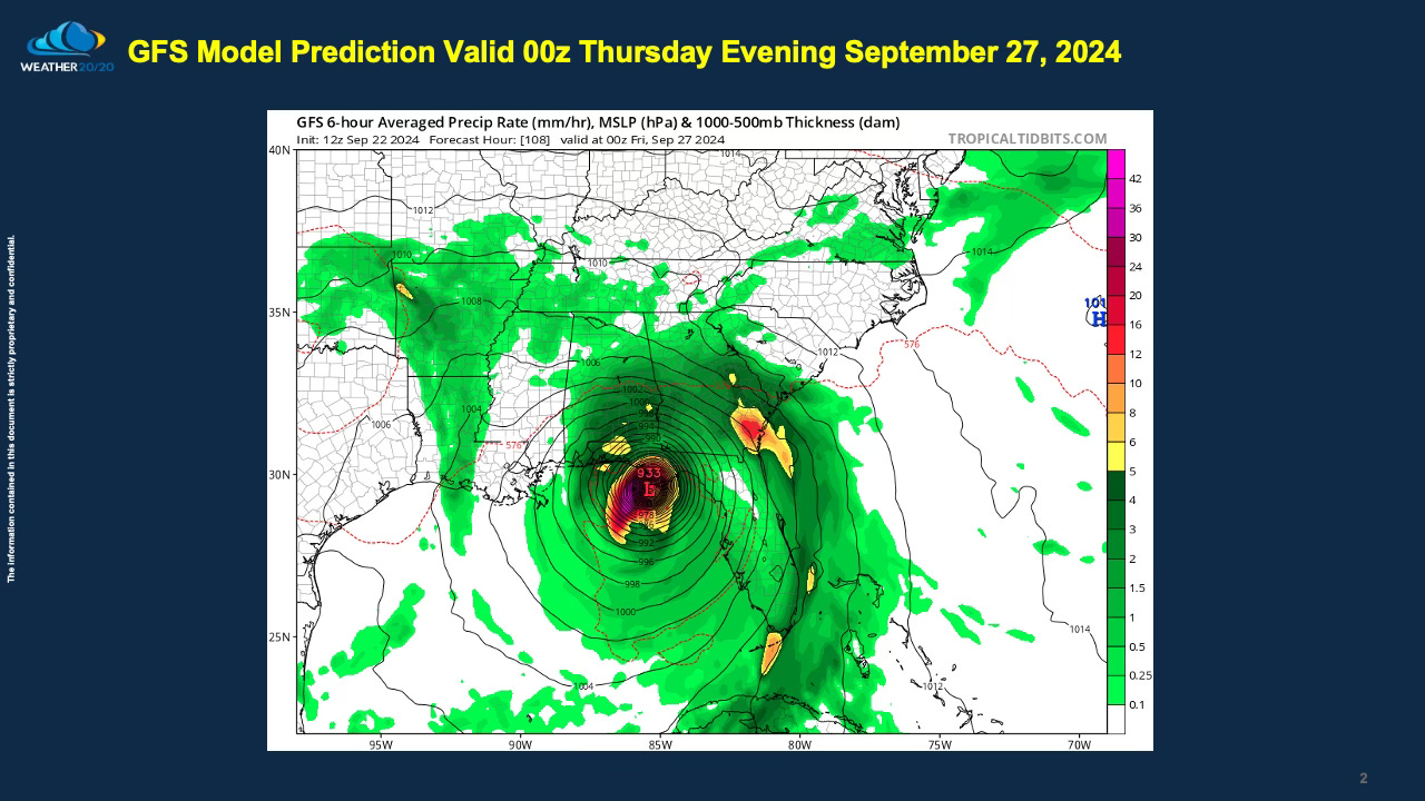
Weather 20/20 has been closely monitoring this region since releasing our Hurricane Prediction Guide in early March. The focus is now converging on Apalachicola, with all indications pointing towards this area as a potential landfall site. It’s crucial to keep a vigilant watch as the storm has yet to form, and dynamics could still shift as it develops. As you can see on this next slide, the Florida Panhandle is the target right now for Thursday night: