


We Answer Some Questions On This Extremely Dry Start To The 2024-2025 LRC
We will go in-depth into this evolving first cycle of the Lezak Recurring Cycle

Welcome to the Weather 20/20 Intelligence Report. This dry weather pattern seems unbreakable, but is it? We will answer this question and others in this update. If you have any questions, just let me know in the comments.
The Developing Weather Pattern Right Now
Let’s begin with a discussion of the Arctic Oscillation (AO). The AO is continuing its surge to +5. It is the last thing I expected or wanted to see. Why?
When the AO is higher positive:
Arctic air is more likely to be weak and held far to the north
The upper level winds spread out and are weaker; the jet stream is usually weaker, especially when the AO is above +3, and it is nearly +5
Storm systems are weaker
When the AO is deeper negative:
Arctic air is more likely to blast south
The jet stream gets energized and storm systems are stronger, especially with an AO negative lower than -3
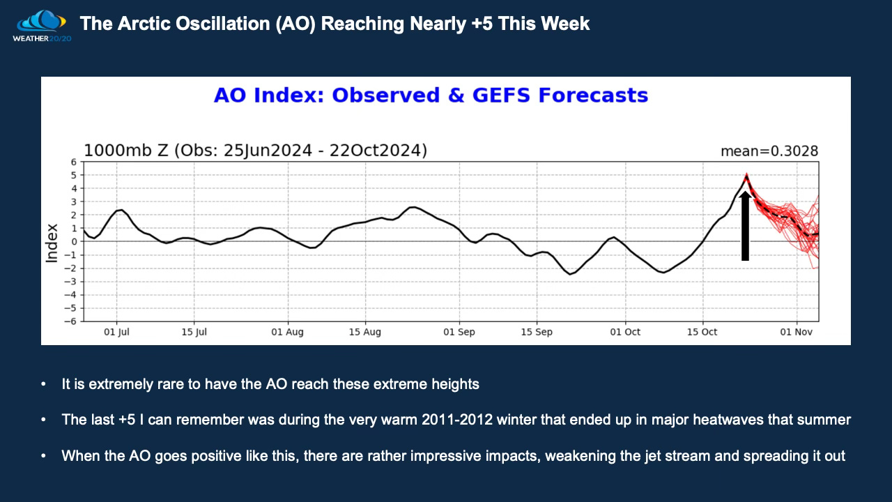
Look at that surge on the latest update from the Climate Prediction Center. The AO is forecast to be +5 by Wednesday or Thursday of this week, but then it begins a steady fall. This is impacting the weather pattern, let’s take a look.