


Weather 20/20 Tropical Update: North Dakota Slammed by Hurricane-Force Winds
An Active End to Spring — Now What’s Next as Summer Begins?

Welcome to the Weather 20/20 Intelligence Report – Tropical Update
As we are still weeks away from the heart of tropical season, our weekly update brings you cutting-edge insights powered by the Lezak Recurring Cycle (LRC) – the only technology capable of predicting tropical development and impacts weeks to months in advance.
This week, we’re tracking extraordinary wind events in the Northern Plains — including hurricane-force winds in North Dakota, an extremely rare occurrence tied to the active end of this year's spring cycle. As summer begins, we’re already seeing signals in the pattern that hint at what’s next.
In this report, we’ll examine:
The quiet start across the Atlantic, Caribbean, and Gulf of Mexico
LRC-driven forecast windows for potential tropical activity
Ground truth validation from this past week’s high-impact events
What you need to know heading into the final days of June and early July
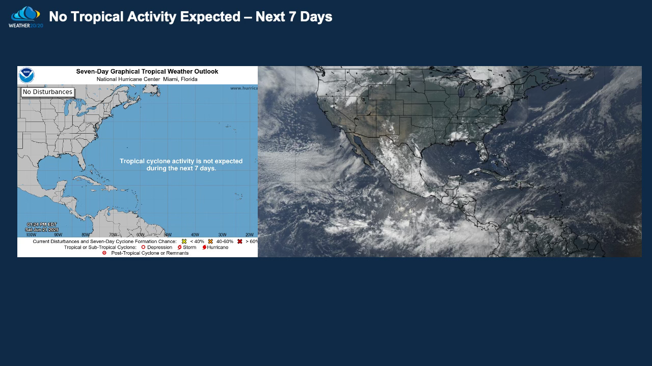
Tropical Season Off to a Quiet Start — But the Atmosphere Is Anything But Calm
We’re now approaching the end of June, and so far, not a single organized tropical disturbance has developed in the Atlantic Basin. Historically, the basin averages one named storm by June 30, but with just nine days remaining, it’s looking increasingly likely that we’ll fall below average to start the season.
At this time, there are no credible signs of tropical development in the near term — but as you’ll see later in this report, the LRC tells us this calm is unlikely to last.
Meanwhile... What Just Happened in North Dakota?
While the tropics remain quiet, the central U.S. just experienced a truly extraordinary early summer event.
Take a look at this jaw-dropping photo captured by Laura Hoffman in Jamestown, North Dakota:
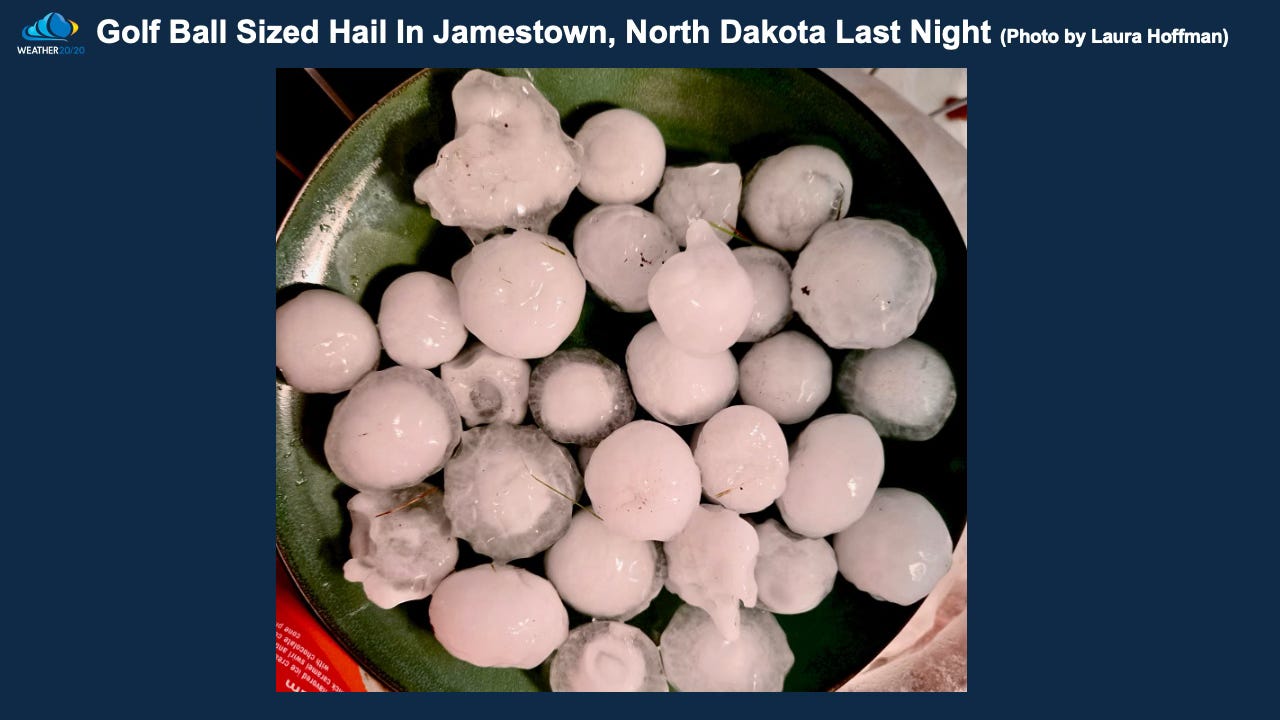
What looks like a bowl of golf balls is, in fact, golf ball-sized hail — the result of a powerful line of severe thunderstorms that raced across North Dakota overnight, producing hurricane-force wind gusts and widespread damage. This was a derecho with a few tornadoes.
This high-impact event was no fluke. It fits perfectly into the current LRC cycle, confirming yet again how this year’s pattern continues to drive extremes in areas where they are least expected — and providing clues for what may be coming next. Let’s take a look at these radar images: