Welcome to the second week of August! The jet stream is now beginning to strengthen as fall is just six weeks away. Can you believe it? Let’s take a look:
The LRC Model Forecast For September
Here is today’s video:
The jet stream is caused by a huge contrast in temperature from north to south.
During the summer it may be 75 degrees in central Canada and 110 in the deserts. This is a 35 degree contrast.
During the winter it may be 40 below zero across central Canada and near 100 near Mexico. This is a 140 degree contrast.
So, as it begins turning colder in Canada, the jet stream will get stronger and shift south.
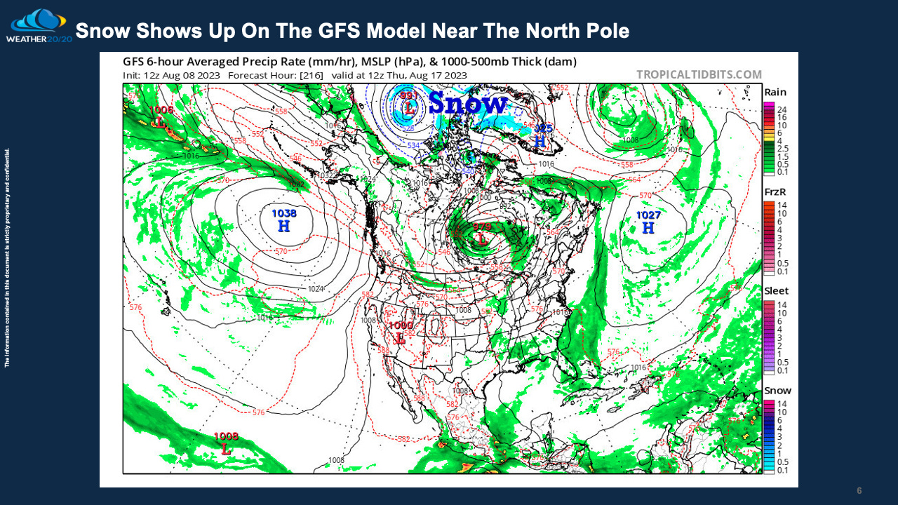
This map above shows the “heat wave creating machines”, or anticyclones, over the Pacific and Atlantic Oceans. So, the extreme heat of summer will take a break in mid-August. Now, these anticyclones are not done with the United States yet, and it will likely build once again later in the month and in parts of September.
Look closely, and you will see the blue up there. Yes, that is snow showing up. This is a sign of the colder air masses forming up to the north.
Rainfall Forecast From The GFS Model: Next 15-Days
With a couple of stronger cold fronts moving across, it will be drier over the Dakota’s as a result. We will see how the moisture recovers later this month.
We are now in the seventh LRC cycle and it will likely be the last cycle of this year’s pattern. Just as the 8th cycle begins, the new pattern will also be evolving. The New LRC will begin during the first week of October.
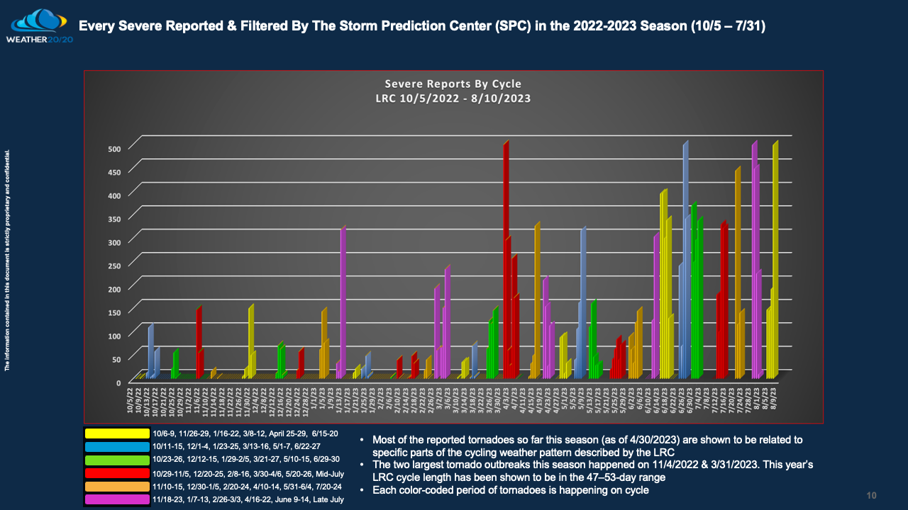
Severe weather just struck the eastern USA and it was right on schedule. This part of the pattern has produced severe weather and tornadoes in each LRC cycle:
This map above shows the tornado in just this part of the cycling pattern. One of the bigger tornado outbreaks happened in late November, and then again in mid-June when Perryton, TX was hit by a deadly tornado. That part of the pattern just cycled through and it produced again.
You can see the other five parts of this year’s pattern that have been severe weather generating machines.
Thank you for being premium members. Let us know if you have any questions. We are analyzing he cycling pattern for clues on any early frosts, and any other subtle changes. We will discuss in the coming weeks.
This post is going out to everyone, so the premium subscribers can ignore the subscriber button. It is less than $1/day, or $300/year to be a member. Next week’s post will be for only the premium members.
Gary


It is this year's LRC. It is just producing that type of severe weather event. The new pattern is still two months away.
Frost risk on sept 20 for western Nebraska , or western corn belt in general?